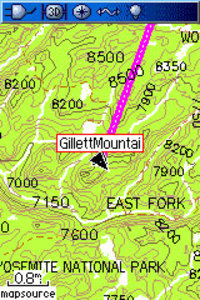
Garmin has announced an updated version of its backcountry maps for the U.S. – Garmin TOPO U.S. 2008. There’s not a huge amount of information available yet.
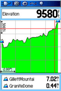
What’s known now is that the maps use 1:100,000 scale data, not 1:24,000 – a disappointment. The maps do include some new features, including the ability to generate elevation profiles on your PC or compatible Garmin receivers (shown below, after the jump), though that will be of little use if they are generated from straight lines rather than along trails. No word yet on whether there is auto-routing for trails or roads, nor do we know if this map product will be locked.
TOPO U.S. 2008 will be available on DVD or micro SD cards. Garmin has not posted an availability date.
There is a discussion thread on Groundspeak, Geocaching.com’s message board.
Via Allory.
 Related posts:
- Garmin US TOPO 24K review
- Choosing the best mapping software
- How to load Garmin TOPO maps to your hard drive
- 1:24K Colorado maps for Garmin receivers

I have seen this information and lots more at http://newfileengine.com/
It is one of the best searches of the internet! very useful!