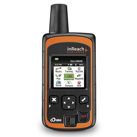
 DeLorme has finally done it, announcing an all-in-one two-way satellite communicator plus GPS navigator, the DeLorme inReach Explorer.
Basically, the unit is a GPS navigator married with the inReach SE. In addition to the latter’s two-way satellite communication capabilities, you’ll get many of the features you expect from a handheld GPS navigator — waypoints, routes, a map screen, etc. The specs include a digital compass and barometric altimeter.
Trade offs
Yet they may not have quite brought us the holy grail. The only mention of topo maps is that they can be used on a paired mobile phone:
When paired with a mobile device, inReach owners get exclusive, unlimited access to DeLorme’s topographic maps and U.S. NOAA charts, which can be downloaded via an Internet connection prior to departure and remain available in the Earthmate app, even when beyond cellular coverage.
You can see an example Explorer map screen at right.
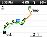 Which brings us to another issue — the company appears to have kept the same interface and form factor, which would mean a tiny 1.8″ display — one reason to avoid adding detailed maps to it.
And that decision was probably also impacted by power usage, since the diminutive screen size is partly responsible for the long battery life (100 hours sending a track point every ten minutes).
Pricing, plans and availability
One note on the ability to send and receive texts, etc. — while a subscription is required for satellite messaging, the company’s new Freedom Plans offer the flexibility of month-by-month options, starting at $14.95 per month.
The list price is $379, with the units slated to ship in mid-May.
Your turn
What do you think? Are you interested in the inReach Explorer? Do you prefer longer battery life or a larger screen with built in topo maps?


I’ve considered one of these for a remote backpack emergency kit. So if you’re in an area where there is no cell service and come upon a situation (someone fell off of a mountain side) requiring emergency assistance, what type of real world response time is there? Can a text be sent directly to emergency responders for immediate reply or does it sit in queu(sp?) for a while? Is this service geared more toward general info usage (Hi.) than emergency (Help!)?
Depends on how far back you are and where SAR is based. I believe it goes to some sort of response center first but I would expect a response from the local SAR team within a few minutes. Both.
And can the emergency assistance request be much more specific than a general SOS, more information being much better?
I believe there is a 150 character limit per text.
Thank you. I’ll be reading your reviews and when I decide will use your links. Chris
Thank you. I’ll be reading your reviews and when I decide will use your links. Chris.
Thanks for sharing the press release Rich, and for helping answer Christopher’s questions. Let me add a little more detail. Declaring an emergency with the inReach sends an SOS message via the Iridium satellites to GEOS Worldwide, our emergency response partner’s headquarters. An SOS message carries a higher priority than a casual message on the inReach so it is sent out before any casual text or tracking messages are sent. The user has the option to type up to 160 characters of detail into each message they send to GEOS during an emergency. We find that many of the rescues that take place using the send and receive capabilities of the inReach involve sharing details between the user and the search and rescue responders. Details about medical emergencies or equipment failures help the SAR team know what to bring with them when they respond. Sending messages from an inReach in the field to GEOS only takes a handful of seconds to complete when the user has a clear view of the sky and the satellites overhead.
Feel free to send me any additional questions you might have. I’d be happy to help answer them.
Take care,
Chip Noble
[email protected]
Product Manager
DeLorme
Thanks Chip!
I have the first inreach and just love it. I do not even do long road trips with out it. With that said, I am really waiting for one with maps so I can ditch the GPS and stop carrying 2 devices. Maybe soon?