Sunday, March 18, 2012

Garmin Debuts Two New inReach Devices

Whether you’re out backpacking through the wilderness by yourself or headed out on the trail with a group of friends for an afternoon, communication and the ability to call for help is extremely important for not only your safety, but the peace of mind of your loved ones. One of the more popular devices for this has always been DeLorme’s inReach devices. As one of DeLorme’s bestsellers, inReach provides the ability to not only call for help, but also communicate with others, track your location, and provide peace of mind.

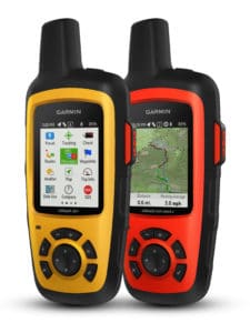
Early last year, Garmin purchased the faltering DeLorme and folded it into Garmin’s expansive GPS empire. And, as with any business acquisition, it shed some doubt on what would happen with DeLorme’s product line. However, fans of DeLorme’s inReach devices will be pleased to hear that Garmin recently introduced two new devices at the 2017 CES. The inReach SE+ and inReach Explorer+ are the first Garmin devices with satellite communication technology, courtesy of DeLorme. read more
Garmin Acquires DeLorme

Delorme_Garmin_Logo_Large

DeLorme, previously a private company, has been acquired by Garmin Ltd. This was completed in April of this year. DeLorme designs satellite tracking devices with two-way communication and navigation features. The company’s most well know products are its inReach series, which are GPS-enabled devices that allow users to send and receive texts, or an emergency SOS signal, via satellite from anywhere in the world.

“Our inReach technology is invaluable to hikers, hunters, boaters, and pilots who often find themselves in remote areas – Garmin’s core customers. We are looking forward to completing the acquisition and are excited to help leverage our expertise into enhancing their already outstanding products,” said Michael Heffron, CEO of DeLorme. Heffron went on to say the acquisition will expand DeLorme’s consumer base to more markets than they are used to, since Garmin has a global distribution network. read more

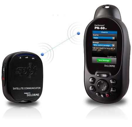
DeLorme PN-60w with SPOT Satellite Communicator

DeLorme PN-60w SPOT
UPDATE: I’ve posted reviews of the DeLorme Earthmate PN-60w and the PN-60w / SPOT Communicator combo.

UPDATE 2DeLorme has discontinued the SPOT Satellite Communicator in favor of their own product, the DeLorme inReach, which offers two-way communication and works as a standalone device or can connect with the PN-60w or with the iPhone or Android smartphones.

We’ve got some big news for backcountry types today. DeLorme and Spot have jointly unveiled the first combination ruggedized GPS navigator and satellite communicator. The DeLorme Earthmate PN-60w with SPOT Satellite Communicator can send customized text messages to individuals or groups. While emergency messaging or personal locator beacon capability is something I’ve been wanting to see in a handheld GPS receiver for awhile, plans are for the PN-60w to offer even more.

read more

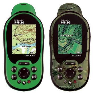
DeLorme Earthmate PN-30

DeLorme PN-30 review The DeLorme Earthmate PN-30 is a stripped down version of the PN-40, bringing all the features of that popular model, except for the electronic compass and barometric altimeter. It includes the PN-40’s dual-core processor for fast map redraws and speedy menu navigation. You’ll find the two colors above available, as it comes in both green and “realtree” for a camouflage appearance.

read more

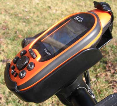
DeLorme PN-40 RAM mount

PN-40-RAM-mount

UPDATE: Check out my hands-on review of the DeLorme PN-40.

While working on my DeLorme PN-40 review, I've also been testing a RAM mount for it on my bike. Bottom line — like most RAM mounts, it's rock solid. I tried a couple of different setups, including a new type of rail mount. Read on for the details…

read more

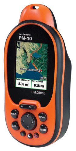
First looks at DeLorme PN-40

DeLorme PN-40 L

UPDATE: Check out my hands-on DeLorme PN-40 review

I'm fortunate to have a DeLorme Earthmate PN-40 in for testing, and I thought I'd share some initial impressions since this unit is due to become available in the next week or two.

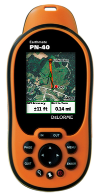
Like the PN-20, this new model lets you view your position on aerial imagery. But a number of upgrades promise to make this an even more popular handheld than the original:

  • A dual-core processor makes map redraws and menu navigation very fast, and I can already attest to this; even at 60 MPH, map redraws were nearly instantaneous — I saw only brief flashes of blank areas on the screen
  • Tri-axial compass (meaning there is no need to hold it dead level)
  • Barometric altimeter
  • SDHC high-capacity SD card support
  • A more detailed base map

read more

DeLorme PN-40 and new low cost plan for aerial imagery

Delorme_pn40

We heard about the DeLorme PN-40 earlier this summer, so today’s announcement of its pending release this fall comes as no surprise. One new piece of info though — they’ve scheduled a September shipping date.

Low cost aerial imagery and USGS quads

The other new piece of information is that you’ll be able to download all the aerial imagery, USGS topo quads and NOAA charts that you want for an annual fee of $29.95. I’ve been merciless in my criticism of DeLorme pricing; prior to this thirty bucks would have only bought you two 7.5′ quads worth of imagery. So here’s a big thank you to DeLorme for giving us this deal. I can’t imagine owning a DeLorme handheld and not ponying up the extra bucks for imagery.

read more

DeLorme PN-40 boasts impressive specs

Delorme_pn40

DeLorme is announcing the PN-40 handheld GPS today. Scheduled for release this fall, the PN-40 appears to be something akin to the PN-20 on steroids. Slow map redraws on the PN-20 were a common complaint, which has been addressed somewhat with new firmware, but the PN-40 is slated to have a dual-core processor for rapid screen re-draws. Here’s what Chip Noble, who manages DeLorme’s User Interface Design department, has to say about it:

read more

DeLorme Earthmate GPS PN-20 review

Hands on with the DeLorme Earthmate PN-20

UPDATE: There are now two newer models in this series, the DeLorme PN-30 and PN-40.

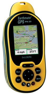
Finally, a GPS that displays aerial photos. The DeLorme Earthmate GPS PN-20 does just that, and displays USGS topo maps too. It is incredibly cool to be carrying a GPS that shows your position on an aerial photo. Having said that, DeLorme clearly has some improvements they need to make, and I hope they do, because this is one nifty device. Before we get into the details, let’s get up to speed on aerial photos, and why other GPS receivers lack this capability.

Aerial photos on the DeLorme Earthmate PN-20

Most GPS receivers utilize vector files — basically data files consisting of lines and points. The DeLorme PN-20 differs in that it can also accommodate images, such as aerial photos and USGS topo maps. The technical term is raster imagery, and they eat up much more memory than vector files. For a more detailed explanation of raster versus vector imagery, see What kind of maps can I put on my GPS (and what do you mean by raster and vector)?

Vector lines are redrawn, and therefore appear sharp, at every zoom
level. Aerial photos and USGS topo maps, on the other hand, will only
appear clear at one zoom level. DeLorme probably uses aerial photos
supplied by USGS which are available at multiple resolutions – 1
meter/pixel, 4 meters/pixel, 16 meters/pixel and 64 meters/pixel.
DeLorme appears to be utilizing the one meter/pixel imagery.

read more

Interview: DeLorme introduces handheld GPS

Continuing our series of interviews with mapping software companies, we turn today to DeLorme’s Caleb Mason, for the scoop on some exciting new proucts. Pay particular attention to the answer to the first question, for it holds two major announcements — not only is DeLorme introducing a handheld GPS, it will also accept raster imagery!

Caleb, can you tell us about any new products or features that you are working on, and when we might see them available?

DeLorme announced at this year’s Consumer Electronics Show our first-ever handheld GPS receiver, the Earthmate GPS PN-20. This device will sell for around $200 and include a color screen for displaying DeLorme vector maps as well as raster imagery.

For years we have heard from customers that what they really want to do is load our vector color topographic maps on a handheld GPS receiver. This has not been possible as the major GPS suppliers use closed systems designed to sell their own mapping software. Now, customers will have an affordable, high-quality solution for use with our maps and software to make the outdoor experience that much better. More competition and choices within the GPS market will help expand awareness and sales for all providers.

Many of the most popular features of DeLorme software will be carried over to the new GPS. For instance, it will be possible to create automatic trail or road routes on the desktop software and transfer these to the GPS. This automatic route generation feature is very powerful and limits the time it takes to hand-draw routing information. Waypoints and Draw objects will be easily transferred between the desktop software, the GPS, and back to the desktop.

A new version of DeLorme Topo USA is planned for release in conjunction with the Earthmate GPS PN-20, tentatively scheduled for the first half of 2006. The software will work seamlessly with the new GPS and also contain a new 3-D mapping engine that will be far superior to the current one.  Updated trails and BLM data are planned along with much more.

read more