Sunday, March 18, 2012

Is MSN Direct the best traffic service?

Nuvi_680_2_delays_map

Is MSN Direct superior to TMC / TTN for live traffic info? Jack Yeazel of the well-respected site GPSInformation.net thinks it may be. He recently posted on the sci.geo.satellite-nav UseNet group:

"For a couple of months I’ve been comparing these two traffic sources in the Atlanta area with a nuvi 660 (TTN) and a 680 (MSN Direct)…

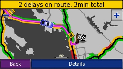
Well here, MSN Direct obviously uses more of the traffic monitoring stations than TTN, resulting in a more-detailed display of changing traffic conditions…  As for "reality", MSN Direct also seems superior…

(Not to mention that you also get Gasoline Prices, Weather  Forecasts, and Movie Schedules (not available with TTN) for $50 a year as compared to $60 for TTN)… And pardon for "beating this dead horse", you get one year trial subscription with MSN Direct as compared to three months with TTN."
read more

Garmin opens up

Garmin_logo_pms_rgb_3
Garmin has published an API and taken several steps to open Garmin devices to third-party generated content.

The Garmin Communicator Plugin API beta "allows developers to transfer location data – such as waypoints, track logs, maps and points of interest (POIs) – to and from a website and Garmin device." I find it especially interesting that maps are included in that statement. Perhaps we’ll start seeing more third-party map providers now that Garmin has given them tacit approval. Geocaching.com and Motionbased.com are both using the technology behind this, though users may have to download a plugin to ensure that it works with their browser. Currently IE 6+ and Firefox 1.5+ are supported. Mac support is "coming soon."

Many of the other tools announced today move Garmin farther into the location-based services game:

read more

Location, location, location

Weather3dayforecast
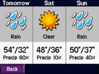
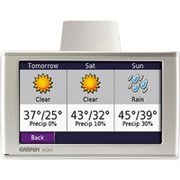
This is beginning to look like the year in which location based services (LBS) will break out big time. In the past week, we’ve heard that the Dash Express will feature Yahoo! Local search, and that the Garmin StreetPilot c580 and Garmin nuvi 680 will both feature MSN Direct, giving access to traffic, weather, gas prices and movie times (see accompanying screen shots).

Other announcements are coming fast and furious. Garmin, which has used XM Radio’s weather service and and now MSN Direct’s, yesterday announced the acquisition of LBS provider Digital Cyclone. This gives them a developed weather product for cell phones and aviation, more options in personal navigation devices, and additional distribution channels in the wireless telecommunications industry.

read more

Garmin nuvi 680

Nuvi680weather
Garmin today announced the Garmin nuvi 680, a new flagship GPS navigation device in the nuvi line. As expected, this new nuvi (couldn’t resist) offers dynamic content from MSN Direct, including traffic, weather, gas prices and movie times. Offering content in 100 U.S. markets, 12 months of MSN Direct service will be included with the nuvi 680. After that it will cost $49.95 a year or $129.95 for the lifetime of the device. MSN Direct service is delivered via an FM signal, and the 680 comes with a receiver for it.

Otherwise, the nuvi 680 seems to be identical to the nuvi 660. Here’s the press release announcing the Garmin nuvi 680 and Garmin’s other new MSN Direct connected device, the  Garmin StreetPilot c580. The nuvi 680 is expected to be available in the first quarter of 2007, at a sure to be discounted suggested retail price of $999.99. I’m including a few screenshots as we get our first look at the nuvi 680.

read more

GPS in the competitive marketplace

Strategy Analytics has released a report entitled "Portable Navigation:  Vendors Face Consolidation and Automotive Fightback." Electronic News has an article on this report about the GPS marketplace that says:

"The firm concludes that investment and competitive pressures are also expected to drive consolidation among portable navigation vendors in the next 12 months."

All Points Blog’s read on the report is that cell phones are going to eat into market share for portable/personal navigation device (PND) manufacturers.

read more

Can my GPS be used to track me?

This has got to be one of the most frequently asked questions about GPS. The short, simple answer is no, your GPS cannot be used to track you. That is because most GPS devices are receivers; they transmit nothing. There are rare exceptions, such as the Garmin Rino series, designed to transmit your location to a friend.

Having said that, there is a more complex answer. First of all, if you have the tracklog enabled on your GPS receiver, someone with access to your GPS can physically connect it to a computer, download the track and see where you’ve been and when. Of course, that is all very different than real-time tracking. Just don’t use a GPS to guide you to a bank heist!

Many companies do make real-time GPS tracking devices, which have transmitting capabilities built into them. These can be used to track everything from lost pets to teenagers to commercial vehicle fleets. We’re not talking about your typical GPS receiver here; these are specialized devices.

And then there are cell phones with A-GPS. Many cell phones have options allowing you set it to "location on" or "911 only." You would need to have it set to "location on" to utilize GPS-assisted location based services. The legal issues surrounding access to this information by law enforcement agencies have yet to be fully sorted out.

Then there are other places a GPS may lurk, many times unknown to a person driving a car with GPS. Got Onstar? You’ve got GPS. Ever rent a car? Better check the fine print in the contract.

A couple of other references:

  • Wikipedia entry for GPS tracking, which hypothesizes "The consumer electronics market was quick to offer remedies (radar detectors) to radar guns; a similar market may exist for devices to counter satellite tracking devices. Radio jamming of the relevant GPS or cell phone frequencies would be an option, as would a device which could detect the RF emissions of the GPS receiver circuitry."
  • An article from Pocket GPS World on privacy concerns and the future of GPS.

Technorati tags: GPS

Interview: DeLorme introduces handheld GPS

Continuing our series of interviews with mapping software companies, we turn today to DeLorme’s Caleb Mason, for the scoop on some exciting new proucts. Pay particular attention to the answer to the first question, for it holds two major announcements — not only is DeLorme introducing a handheld GPS, it will also accept raster imagery!

Caleb, can you tell us about any new products or features that you are working on, and when we might see them available?

DeLorme announced at this year’s Consumer Electronics Show our first-ever handheld GPS receiver, the Earthmate GPS PN-20. This device will sell for around $200 and include a color screen for displaying DeLorme vector maps as well as raster imagery.

For years we have heard from customers that what they really want to do is load our vector color topographic maps on a handheld GPS receiver. This has not been possible as the major GPS suppliers use closed systems designed to sell their own mapping software. Now, customers will have an affordable, high-quality solution for use with our maps and software to make the outdoor experience that much better. More competition and choices within the GPS market will help expand awareness and sales for all providers.

Many of the most popular features of DeLorme software will be carried over to the new GPS. For instance, it will be possible to create automatic trail or road routes on the desktop software and transfer these to the GPS. This automatic route generation feature is very powerful and limits the time it takes to hand-draw routing information. Waypoints and Draw objects will be easily transferred between the desktop software, the GPS, and back to the desktop.

A new version of DeLorme Topo USA is planned for release in conjunction with the Earthmate GPS PN-20, tentatively scheduled for the first half of 2006. The software will work seamlessly with the new GPS and also contain a new 3-D mapping engine that will be far superior to the current one.  Updated trails and BLM data are planned along with much more.

read more