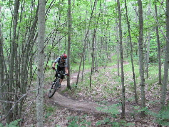
Moutain biking the VASA singletrack; image courtesy SteveF
I’ve been on the road for the past week, testing the Garmin nuvi 2495LMT 2497LMT and Oregon 650t, while visiting my wife’s family in Michigan. We got in a brief side trip to Sleeping Bear Dunes National Lakeshore, and next year I want to do an extended hike there, so that may be a forthcoming trip report. For today though, I want to share our mountain biking experience on the VASA singletrack trail, just outside Traverse City. read more
 It was a little over a year ago when I learned about a new 10,000 acre public land acquisition located between Asheville, NC and Johnson City, TN. Described as remote, isolated and unmapped (as far as trails go), I knew right away where I’d be spending my play time for the foreseeable future. I’ve now completed most of the routes that can be mountain biked in Rocky Fork, and I’m happy to present my first


 The trail we rode, Manly Gulch, is as challenging as it sounds — narrow and technical, with steep dropoffs. The photo at left is of me coming around a tight curve between two redwoods. The trail section pictured is a narrow perched run set between a cut redwood stump on the upper side and a retaining wall on the lower side.

 I just returned from vacation, during which time I tested a
  To see visual evidence of the difference between reception in the two units, check out the tracks on the aerial photo to the left. The Garmin track is in red, the Magellan in blue. I have one caveat here…It appears that the Garmin collected much more detail, but the Magellan is my wife’s GPSr, and I’m not as familiar with it. Once I saw this image, I checked and discovered that the Magellan was not set to acquire as detailed of a tracklog as possible. Apart from that, the most interesting thing I see is that both units recorded at least one stray track point, far away from our position. On the basis of this, I’d rate their performance as comparable.
 You can see a fire road going off to the north from the waypoint and, while the online image isn’t as sharp as the original, you can actually make out single-track going off to the northeast! The single-track leaves the image near the top of the right-side.