UPDATE: Read our hands on review of the Garmin Monterra.
It’s been a few months since we first heard the rumors, but today the Garmin Monterra has finally been announced. Boasting an Android operating system, the Monterra can utilize apps from the Google Play Store. It even has WiFi to allow for direct downloading of apps.
Apps
Garmin appears to be making a push for developers to create apps for the Monterra, saying “Developers are also free to create new apps that are ideally suited for the rugged, waterproof, and sensor-loaded handheld device.” The news release mentions Peak Finder as an example of a useful app and also cites professional apps such as ArcGIS.
Monterra specs
The Monterra offers a 4″ (same size as the Montana) multi-touch display and includes a headphone jack and built-in FM and NOAA radios with SAME alert capabilities. It is their new top-of-the-line model, with GPS+GLONASS support, a triaxial compass and barometric altimeter, and something else new — a UV sensor. It also features a built-in 8MP geotagging camera and (in another feature new to Garmin) a 1080p HD video camera with LED flash. Internal memory is 8GB with a microSD slot for expansion.
Like the Oregon 600, the Monterra features a hardened mineralized glass display, and dual battery capabilities allowing you to use the included rechargeable li-ion battery packs or AAs.
In addition to WiFi, other wireless capabilities include ANT+™, Bluetooth 3.0 and NFC.
3D MapMerge
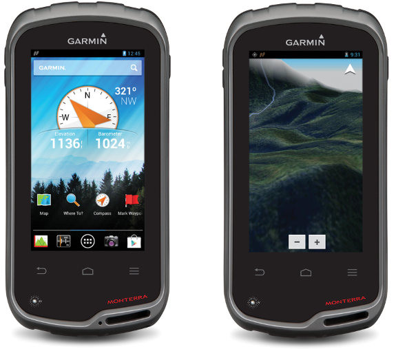
Another new feature is 3D MapMerge, which appears to be what we’re seeing in the image above, on the right. It’s described this way in the news release:
New to the Monterra, is a unique mapping feature: 3D MapMerge. With this feature, users can combine two maps-like TOPO, basemap, or BirdsEye Satellite Imagery- then view the new unique map in three dimensions. Hills, valleys, lakes, roads, and points of interest combine to give Monterra’s maps unequaled detail and richness. Combine BirdsEye with TOPO US 24K, or a GIS-based water table map with a shaded relief basemap, then zoom in, pan out, and rotate the 3D map using multi-touch.
Availability
The Monterra is slated to be available in the third quarter of 2013 with an MSRP of of $649.99 (Worldwide with preloaded worldwide basemap), and $699.99 (U.S. with preloaded TOPO U.S. 100K with Navteq® roads). That price point will likely keep quite a few folks away. Too bad — it sure looks interesting.
I’ll update this post with product links, more images and other info as they become available.

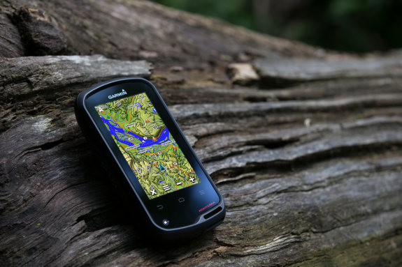
The Garmin Monterra in its natural habitat
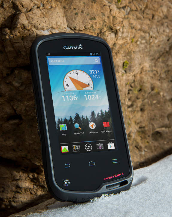
UPDATE: Here’s the full news release and another pic…

UPDATE 2: Here’s the Garmin Monterra product page.
UPDATE 3: GPS City is showing an estimated availability date of September 1.


Pretty cool! The mapmerge feature isn’t completely new, if I understand what they are saying. Their multi-touch Nuvi’s (34xx, 35xx and 37xx) support realistic 3d views and include DEM data in a separate map (gmapdem.img) that can be combined with other vector maps. Looks like they are building on this technology and adding the ability to combine DEM with raster data. Will be interesting to see if the hardware is strong enough to handle this smoothly.
It appears they have added a touch sensitive area below the screen with the most frequently used buttons, like return and menu. Nice idea, frees up some pixels on the screen for the map.
I like it, but don’t really want one for myself – especially not for $650. Still very happy with my Montana and just got a Nuvi 3550 and am having fun hacking the software on it. 🙂
Will look forward to learning more about the Monterra in the coming months. Garmin is certainly keeping the lead in the outdoor field. Nobody else has anything like this!
Just got my Oregon 650 just two weeks ago. While I really like the 650 features and performance, I probably should have waited. The ability to run 3rd party code on the Monterra unit is going to be the real game changer for me.
Wow, seems to be morphing into an android device. I like it. Seems Garmin is doing everything they can to keep the pnd relevant. Now, if it just has phone capability……
I think you’re more likely to see a future one with satellite messaging.
Something similar to In Reach ala Delorme?
Yes, but hopefully as an all-in-one unit, i.e., a GPS navigator + satellite communicator.
How rugged is the device for outdoor trail use? Gorilla glass would be a nice idea.
Well, if it’s anything like the glass on the Oregon 600, it should be quite rugged. http://www.youtube.com/watch?v=C0Ab2lr4WVI
Sounds the same. They say it’s a “highly durable mineral glass display.”
Is anyone else disappointed that it doesn’t have a cellular radio? I thought that was one of the most interesting prospects. I guess you could use a personal hotspot on your phone, but that’s kind of a kludge and requires you to bring two devices along.
Also, i’m not so happy to see the screen is only 480 x 272 like the Montana. Maybe they couldn’t make a transreflective panel with the desired characteristics at a higher resolution?
Higher resolution would mean less space between the pixels on the screen, thus limiting the available space for sunlight to reflect and illuminate the screen.
Yeah, I do understand the brightness issue with transreflective screens. But that seems like a very low resolution for what this device aspires to be and leads to rather clunky looking graphics in today’s age of “retina” screens. 🙂
Same resolution as the Montana, which looks absolutely fabulous. I have no issue with the screen resolution. More pixels means more battery consumption, and I prefer longer run times over pixels I cant see 🙂
I also like my Montana screen. But it doesn’t run third party Android apps that expect higher resolution screens. Look at the location services menu in the photo gallery of the review link I posted. That just can’t be a 480×272 screen with text that small. My guess is 800×480. Garmin has just done a sloppy cut/paste job on the web page based on the Montana 650. 🙂
Only $650!
I read all over the internets that Android is free.
$650 is almost enough to buy an iPad?
It will be interesting to see how/if the third party android apps scale to the 272 x 480 pixels screen,
when even 480 x 800 pixels is now considered standard/low among middle range android units over 3 inches.
If presented with the possibility of having the Garmin navigation program, which might come with the Monterra, in other Android units, some people might choose in favor of a unit such as the Samsung Galaxy S4 Active (http://www.gsmarena.com/samsung_i9295_galaxy_s4_active-5446.php) which is dust and water resistant, with GLONASS, FM, wifi, camera, and higher screen resolution.
Some years ago it was very convenient having the Garmin Mobile XT application on Palm OS, Microsoft Pocket PC, and Nokia Symbian devices.
Surely they will try to tie their software to the Monterra hardware. But that is not likely to prevent certain people from trying to “present the possibility” you describe. 😉
Regarding the screen… look closely at Garmin’s product page. It appears to be a sloppy cut and paste job based on the Montana. Garmin has been guilty of this frequently with the Nuvi series. If you click the link for the manual it takes you to the Montana manual. If you click the link for software, it takes you to the Montana 650t software page. The screen specs are identical to the Montana.
There is now a review at
http://www.pocket-lint.com/news/122006-garmin-monterra-outdoor-gps-pictures-and-hands-on
See the photo of the main menu page. That looks like higher resolution than 480×272 to me, based on the size of the text and icons. The review slams the screen BTW, calling it “horrid”. 😉
Rich, is there some way that you can find out the correct specs are for this screen?
I could ask, but I don’t see any reason to believe its not 272×480.
You’re probably right Rich. I’m just struck by the screenshots of the Android user interface. All the icons and text are quite small compared to the Montana and other Garmin units. Seems like that would look bad on a 480×272 screen, but I guess we’ll just have to wait for some full res screenshots to find out.
Still pondering this… 🙂 I was just looking at the software license screen my Montana. That is pretty small text actually. So now I just don’t know, it’s hard to tell whether the fine print in that review photo is any smaller than the software license text on my Montana.
That little text sure looks ragged on the Montana screen though, so I hope they are doing something a little better on the Monterra. 🙂
It looks like this will be in competition to those who use the Trimble Juno T41. Can’t see it being aimed at the hiking/backpacking crowd, not at $650
It seems to me that this is a test unit for Garmin. Price notwithstanding, it won’t get widespread adoption due to size. After the Montana, they are bound to know that. Personally, I’m looking forward to an Android-based oregon unit.
The Google Earth style 3D map merge is what I consider the holy grail. My hope is that it’s implemented nicely without the anticipated Garmin restrictions and clunkiness. With all of the new features included, the $699 price point doesn’t seem to be too bad. Pre-order here I come!
Interesting side note, the Monterra comes boxed with, what appears to be, a pliable Zagg-like screen protector. I guess for $700 bucks it’s the least Garmin could do.
You can get a good Google Earth 3D style map view with Android programs such as
OruxMaps
https://play.google.com/store/apps/details?id=com.orux.oruxmaps&hl=en
and
TwoNav
https://play.google.com/store/apps/details?id=com.compegps.twonav
Orux Maps even reads garmin img maps for display, but with no routing, and both programs support formats for offline multilevel custom/raster maps.
That would be an interesting use case, using Orux, etc. on the Monterra!
The screen resolution is a big disappointment (if true) – one reason for the low resolution may be battery life? Smartphones only have to last a day between charges, while I’d target something much longer with a GPS! It’s also disappointing that it is actually heavier than a Montana (so it’s REALLY pushing weight limits on what you might want to take hiking). Could this really be more of a low-end GIS device to compete with the Trimble Juno series? The Junos are even (a bit) more expensive, and about the same weight, although Windows Mobile seems to be a significant advantage over Android for field GIS use (ESRI’s Android apps will display GIS maps but not edit them, while their WinMobile apps can edit). Android is a big advantage over Trimble’s old version of WinMobile for consumer use, but this seems to be a bit big, expensive and low-res for a true consumer device!
Battery life may be a factor, but I think a bigger one is screen visibility. The denser the pixels, the less light that can be reflected back to the user.
It sort of comes down to the same thing, doesn’t it? With more battery power a transreflective screen wouldn’t be needed and the Monterra could have the kind of high resolution screen we expect in a modern handheld device.
But Garmin knows their audience, and they want to get through a long day without changing batteries. The Montana is already pushing the limit for the size of a handheld, so I’m not sure how many batteries you could cram into that space. There’s also the expectation that an outdoor handheld be able to use standard AA batteries.
Maybe they could fit some kind of larger, high capacity battery inside there if it didn’t also have to work with AA’s? Looking at my Montana, it almost looks like a battery twice the size of the included Li-ion could fit in a similarly sized case if it didn’t also need to accomodate AA’s.
Some may, but I personally don’t think many users will be overly bothered with the resolution of the screen, especially if they’ve used Garmin’s before. The screen readability in bright light will be amazing and could be the best android device on the market as far as sunlight readability goes. My gazillion megapixel smart-phone screen is quite often a challenge to read in direct sunlight even with the backlight on 100%. I mean it’s ok but not even close to the brightness of a highly transflective screen.
I think the battery life question will be a difficult one for Garmin and Monterra users alike to pin down. I know Garmin says 16 to 20 hours but it’s hard to assess just what the battery life is on an android device because it all depends on usage. Will the 16 hours be based on sleep mode? How fast will redraws and 3D image processing run the battery down?
Another concern I have are the functions that have, in the past, been run while the unit is powered down. I’m betting you’ll have to keep it in sleep mode to use the alarm clock and Barometer “Save Always” feature. As far as I know, nothing runs on an android if it’s truly powered down. If that is the case then if your not connected to a charger you may not want to use them.
I also noticed on Garmins Monterra page that the unit appears, at least in part, targeted at “outdoor professionals”. You can see test tubes, and field data collection box in the main photo. It makes the competing with Juno theory a bit more plausible. All facets of a feature class (point, line, polygon) have been possible on devices for a long time (with third party software). Field techs in natural resources and researchers are primarily collecting rather than editing spatial data anyway so a Juno like editing of feature classes isn’t really a primary concern.
I read the article and I stared wondering if we are looking at a Garmin with Andoid or if we are looking at Android with Garmin.
Not to sure of what to make of this device. The price tag is a bit steep though.
Great Post! If you’re looking for the best in class repair services for your Gaming PC you can visit our website and find the best and affordable solutions.