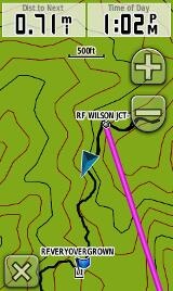
 I often go through a fairly involved process when I’m prepping my GPS for a backcountry trip, and I thought I’d share what that looks like. I’ll start off with a few caveats…
- I like to explore remote areas, and my process will be overkill if you’re just getting ready for a quick hike on a well-trodden trail
- I tend to use multiple programs, as each has its own strengths and weaknesses
- Finally, this is geared a bit towards Garmin users, but I expect others may be interested in seeing the workflow and what data I use
Now that we’re done with that, let’s take it step by step:
Tracks and trails
If at all possible, I prefer to have a track displaying the trail I plan to take. You can check the maps on your GPS first, but you’ll probably find that the trail isn’t there. That seems to be the rule more than the exception.
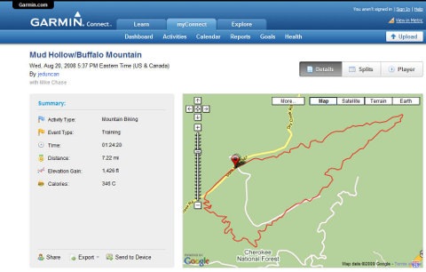
I’ve posted before about online sources of .gpx files and even put together a custom search engine for them. Both desperately need to be updated to reflect newer sources such as everytrail.com and Garmin Connect (screenshot below), but one of my favorite ways to find tracks is to just search for “place name” plus GPS or GPX.
 If I can’t find a track online, I will sometimes trace the trail or 4WD road using aerial photos (this is much easier in open landscapes such as the American Southwest). My favorite program for this is TopoFusion, which allows you to toggle back and forth between topos, aerial photos and blended imagery. Alternatively, USAPhotoMaps is a shareware program that offers aerial imagery.
Creating waypoints
Now that I (hopefully) have all the tracks I need, I can start creating waypoints. In general, I’ll try to create waypoints for the trailhead, trail junctions, peaks or other interesting features nearby. I’ll also create waypoints for any benchmarks I may pass, so that I can use them to calibrate my altimeter. I prefer to do all this in TopoFusion, which allows me to check aerials, etc., should the need arise.
Creating routes
As long as I’m using a Garmin, I prefer MapSource for this task. It has the best route creation tools I’ve seen. Simply click the route tool and then click from waypoint to waypoint.
Maps and data to your GPS
The next step in the process is to find some good maps and load them along with waypoints, tracks and routes to your GPS. I prefer the detail found in 1:24,000 scale topo maps. For Garmin units, you can use their TOPO U.S. 24K maps, or some of the many free maps out there. If you have a Colorado, Dakota or Oregon, you can also create a custom map using a USGS topo or aerial photo.
I tend to use MapSource to transfer everything (except custom maps) to the unit in one fell swoop. If you don’t have a copy, you can get it for free by following these simple steps.
Printed maps
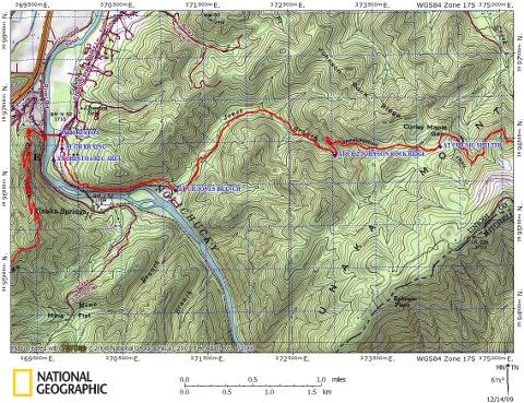
The final step in my prep is to create a printed map. National Geographic TOPO! is my favorite for this. I import my waypoints and tracks, and typically set up a 500 meter UTM grid, to aid in finding my position in the field using GPS coordinates. You can see what the end result looks like below.

Hit the trail!
And now I’m ready to go. Like I say, it may be overkill for many outings, but I hope you have gained some new insights or ideas from this. Happy exploring!
Related posts:


My approach is easier:
I use Google earth to mark the points. First I create a new folder and make all points in it. To name the points, I use abbreviations like 20L (means: at point 20, turn left).
Then I save the folder as a single kml file.
Next, I use GPSU (GPS utility software; the free version is quite adequate) to convert the file into gpx. It can also convert to gdb, but I prefer gpx.
Finally, I open the gpx in Mapsource, make the route, and load it on my GPS. That’s it!
If I need a print, I print the Google earth image with all waypoints.
A lot of people prefer to work in Google Earth. Thanks for sharing!
A lot of people prefer to work in Google Earth.(2)
Nice post, Rich. I’d just add that for cross-country backpacking in the Sierra, creating some well-planned tracks ahead of time, as you describe, can make the difference between looking down an impassible ledge and an easy saunter. I’ve seen places where the track points to a less obvious route that ultimately proves better. Not always, but enough to pay attention. To paraphrase Richard Pryor: “Who are you going to believe–the GPS or your lying eyes?”
Thanks! That’s an excellent point. Pre-GPS, I did an off trail exit from Darwin Canyon in the Sierra and missed Lamarck Col. Sheesh! Sure could have used a GPS and track that day!