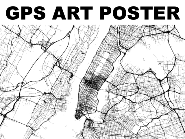
An image of the GPS tracks of Manhattan
There is nothing cooler than seeing technology and art combine. Being at opposite ends of the spectrum, the two can pair beautifully and create some really interesting and fantastic pieces. Although, that might just be me—I am a huge fan of both art and technology. If you are too, then you’ll definitely want to check out Steve Coast’s GPS Art Poster project.
These beautiful pieces are created by overlaying GPS track data from a specific area on a blank canvas. Each individual line is a separate route made by a real person, with the thick lines representing more traffic. The result is a unique piece that captures the movement and pulse of a city. I’ve seen things kind of similar to this before, but nothing quite so detailed or artistic.
Created by OpenStreetMap founder Steve Coast and originally funded on Kickstarter, the idea for this project goes back to 2005, when Coast and Tom Carden took GPS traces of London and overlapped them to create an image of the city. As GPS has become more and more prevalent and available, Coast has been able to make images of many cities in the United States and Europe.
While the Kickstarter has long since finished, these beautiful prints available via the website. Prints can be purchased for $60 – $200 in small (24″ x 20″), medium or large (up to 44″) format. Desktop wallpapers are also available for $10. All of the prints are signed and a specific location can be specified when you check out. There isn’t a list that I could find of the specific locations that are available, but I expect there are plenty as the Kickstarter page features a map of the whole US.
