UPDATE: Read my hands on review of the Garmin fenix.
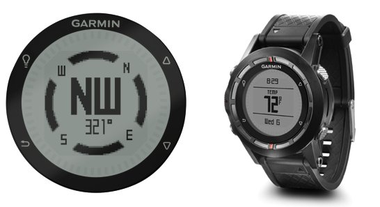
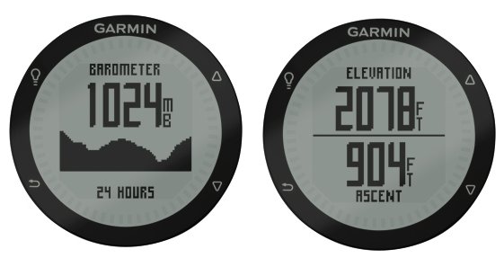
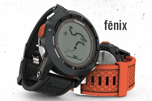
The Garmin fenix (pronounced Phoenix) was announced by the company this morning. It appears to update the rather clunky Foretrex line with a slimmer form factor built on the Forerunner sportswatch platform. The fenix is a full-fledged navigator with the ability to store and navigate waypoints, tracks and routes; and get this – it is even setup for paperless geocaching! A barometric altimeter and tri-axial compass are also squeezed in. It seems to have just about everything except the ability to add maps.
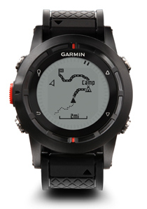 The fenix carries a $399.99 MSRP and is slated to be released in the third quarter (one report is saying they are shooting for late August). You can bet that I’ll be trying to get one of these ASAP and report back to you about it.
In addition to the backcountry capability, the device also includes many fitness functions such as user profiles for running and cycling, auto pause, auto lap, alerts, and customizable data fields such as heart rate, distance, pace, calories, laps, etc.
Garmin mentions off-trail use quite a bit in talking about this device, and that indeed appears to be a prime use for this device – a situation where you need both hands free without a carabiner-clipped GPS swinging around on your pack. They also cite it as appropriate for mountaineers, hikers, cyclists, hunters and backpackers.
Quotes of note
Some tidbits from the news release (shown a bit further down the page):
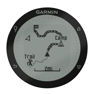
- “Sporting a classic round watch design in a high-strength housing with a scratch-resisting display…”
- “fēnix is equipped with both ANT capabilities and Bluetooth to wirelessly share tracks, waypoints, routes and geocaches with other compatible Garmin devices”
- “For an extremely accurate temperature reading, fēnix can be paired with tempeTM, Garmin’s new external temperature sensor”
- “Garmin’s outdoor watch is waterproof to 50 meters and has a battery life of up to 50 hours in GPS mode (depends on settings) and up to 6 weeks in watch mode”
- “The polyurethane wristband will be available in olive or orange and an optional leather wristband can be added”
 There is a fenix mini-site up. Engadget managed to score one for a hands-on, though there’s not much of interest there other than a photo gallery.
 So what do you think? What interests you about this device? Sound off in the comments below…
Here’s the full news release.


” A BaseCamp mobile app allows users to transfer waypoints and tracklogs to view them on a more detailed map and larger screen of select smartphones”
Whats up with a basecamp mobile app? I would love Basecamp on my phone
Can’t believe I missed that. Thanks for the tip!…
http://gpstracklog.com/2012/07/garmin-basecamp-app-coming-to-smartphones.html
In addition to BaseCamp mobile, it seems Garmin also plans to create a new site adventures.garmin.com for outdoors users, per BaseCamp 4.0.0.4 beta. Pretty cool.
https://forums.garmin.com/showthread.php?p=139828
Yeah, I got a tip on that yesterday. I should have a post up on it sometime between today and Monday. Looks interesting.
I’m also wondering whether Garmin fenix can serve as an external bluetooth GPS receiver like GLO does? It would be great if it can do that.
Looks like maps to me Rich, http://uncrate.com/stuff/garmin-fenix-gps-watch/
Awesome!!!
Yeah, I should have been more clear. It does include a worldwide basemap, but the detail will be pretty sparse.
@gpshiker – I doubt that they have built in that capability, but we shall see.
Hi Rich,
Je can download a gmapsupp.img to the fenix. (max 20mb) . But most maps have to much detail. The fenix becomes very slow.
I made a Benelux map from osm data with less detail. This is working fine.
http://www.gps-info.nl/wordpress/wp-content/uploads/2012/09/garmin_mapinstall.jpg
I will make a europa map later.
Regards Guido
Interesting!
Hello Guido,
Can’t wait to know how your map-making is going.
Check this out… http://gpstracklog.com/2012/10/garmin-fenix-review.html#maps
I have a dutch tutorial on how to create your own custom maps. (http://bit.ly/XTVfqO , link is pointing to translated site)
I have made a dutch map from osm data.
just take a osm map, filter out all extra roads. Keep only highways and interstates. (mapedit)
then use cgpsmapper to create a img file.
If you need more info or help, use the contact button on my site.
guido