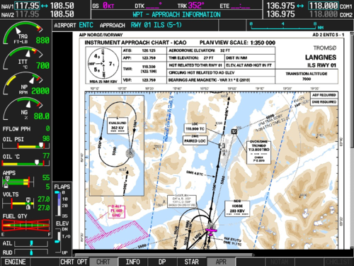
Garmin announced last week that they have expanded their global aviation charts to include several additional European countries. This expansion has added instrument approach charts, SIDs, STARs, ground movement charts and airport diagrams. The European FliteCharts expansion is designed to increase pilot awareness and help with approaches by conveniently overlaying the aircraft position onto the chart and providing easy to read charts and information.
Countries included in this newest update are:
- Czech Republic
- Denmark
- Finland
- Hungary
- Ireland
- Norway
- Poland
- Portugal
- Romania
- Spain
- Sweden
- Turkey
- Ukraine
This expansion is available in the form of an update and will be compatible with Garmin products capable of displaying terminal charts including the GPSMAP 695/696, aera 795/796, G3X, G3X Touch and select certified avionics including the GTN series, G500, G600, G1000, G2000, G3000 and G5000.
Pilots may download the European FliteCharts from flyGarmin.com without purchasing additional software updates to their garmin products. Garmin Pilot for iOS mobile devices also will carry this update. To see which approaches are included, the FliteCharts Lookup Tool has a searchable database.
If your unit does not qualify for the free update, you can purchase the European FliteCharts for $125 or as part of a Bundle or PilotPak database subscription from flyGarmin.com.
