If you are one of those people who enjoys a daily run or bike ride, then it can sometimes be easy to get caught in a rut and simply take the same path you always do. After all, it can be hard to find good trails and routes sometimes, and it can be tempting to just stick with what you already know.
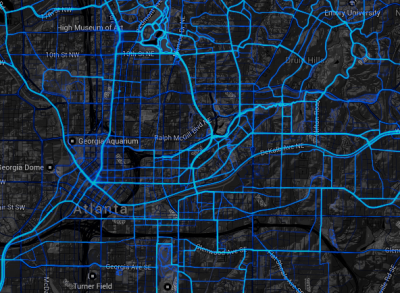
Well, the popular fitness tracking company Strava recently introduced a new interactive map that is designed to help you explore new trails and areas and find popular routes you might not otherwise know about. Called the Strava Heatmap, this pretty nifty-looking interactive map uses GPS track data from around 160 million rides and runs to determine the most popular areas.
It looks pretty cool too.
This project has actually been underway since November 3, 2014 and currently includes more than 375 billion data points to map out locations and routes and such. The map isn’t perfect, but it is global and certainly is something interesting to take a look at. I could see this being incredibly useful if you’re in a new location on vacation or a trip and still want to get your daily run in.
As a side note, Strava is also working on another similar project that will also map out routes of runners and cyclists using a slightly different method. Called Strava Metro, this project is still underway, whereas the heatmap is active right now.
I’m not much of a runner, but it looks pretty useful to me. What do you say? Would you use it?

