GPS is arguably one of the most important technologies developed in the last 50 years and has been used for a shockingly wide variety of things including defense, contracting, sports, recreation, innovation and more. Several other countries are following in the footsteps of (and even improving upon) the GPS constellation, and the United States is working on upgrading the satellites.
However, I would be willing to wager that most people have probably never really stopped to think too much about how GPS actually works. It just does. Well, today I’m going to try and explain some of the basics of how and why GPS works.
What is GPS?
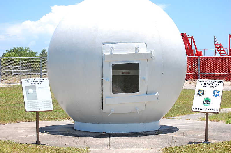
GPS Ground Station | Image Courtesy Jud McCranie via creative commons
GPS, as you likely know, stands for Global Positioning System. This system is managed and run by the United States Air Force but is available to everyone for free. The basic GPS system is comprised of three parts: GPS satellites, GPS receivers and ground stations.
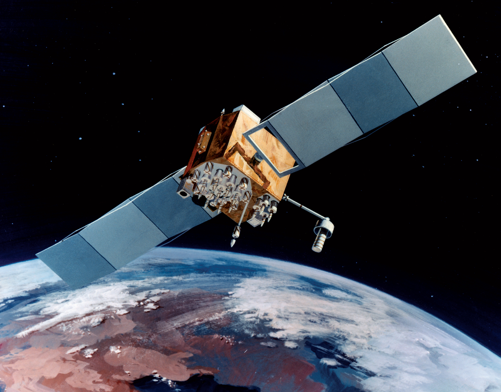
GPS Satellites – a satellite navigational system like GPS generally requires 24 – 32 satellites which are orbiting around 20,000 km (12,000 miles) above the Earth. These satellites make roughly 2 revolutions per day and are constantly transmitting a pseudo-random code to the earth using electromagnetic radio waves.
GPS receivers – the GPS receivers are used by civilians and professionals alike and can be handheld or mounted in a vehicle. These receivers use the satellite signal to calculate your location using an algorithm. They can then use maps to help plot out routes, track where you’ve been and a myriad of other tasks.
Ground stations – ground stations are placed at known locations around the globe. Like the GPS receivers, these stations also receive the signals sent from the satellites. Because the stations already know their location, they are able to spot and calculate inaccuracies in the GPS signal and then transmit that to the GPS receivers to ensure more accurate locations.
How are locations calculated?
So, how do these three parts translate to a little blue arrow on a map screen showing you the way to get to the theme park on vacation? Well, the short answer is: math. The long answer involves a lot of physics and math, but bear with me!
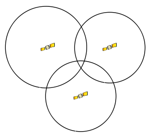
Trilateration using three spheres: your location would be in the middle where all three intersect.
In order to figure our your location, GPS receivers uses a method called trilateration which requires signals from at least three satellites (However, just like with chocolate, more is always better). The receiver uses the GPS signal, an almanac of where each satellite is located, and the speed of light to calculate a radius in which the GPS receiver is likely located on Earth. With each additional sphere, the location is narrowed down. Most GPS constellations are set up in such a way that the GPS receiver will have access to at least four satellites at all times: three to calculate location and a fourth to confirm.
GPS Relativity
Because the GPS receiver figures location by the time it took the GPS signal to reach Earth (calculated by knowing what the speed of light is and where the satellites should be), time becomes incredibly important in the GPS algorithm. However, the theory of Relativity states that different gravitational pulls will effect time ever so slightly. Therefore, the super-accurate clocks on satellites (which are in space and therefore under different amounts of gravity) will be slightly different from the clocks in the GPS receivers. This is referred to as GPS Relativity.
In order to calculate precise location, the clocks on the satellites and the clocks on the GPS receivers must be accurate to the nanosecond. For satellites, this means that atomic clocks need to be used, but because atomic clocks are too expensive for civilian devices, your GPS receiver instead uses yet more math to calculate how inaccurate it is and figure out what the atomic clock time reads.
This is one of many issues that GPS devices have to overcome in order to be as accurate as they currently are. Others include inaccurate location information from the satellites (solved by ground stations calculating and tracking location) and signal interference from buildings and other obstructions.
Read more
These are just some of the super basics to give you an idea of how GPS signals function. For more information on GPS signals, inaccuracies and Differential GPS, check out this article.
