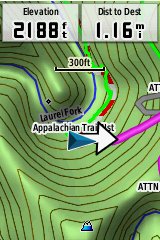
I started using the Garmin Trailhead Series Appalachian Trail map soon after it came out last year, so it’s high time I posted a review. It includes a routable, 1:24,000 scale topo map of the entire AT, complete with a searchable points of interest (POI) database.
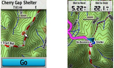
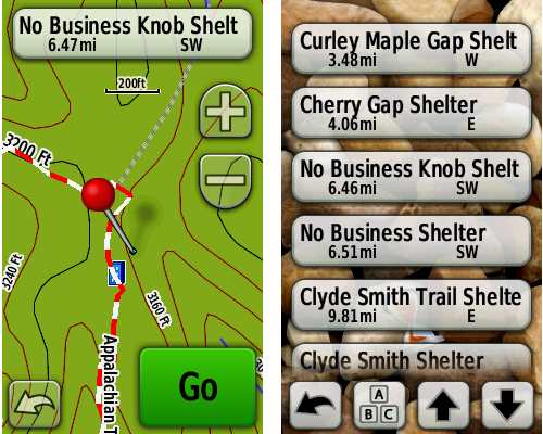
 POIs include shelters (as seen above) and helpful geographic features such as springs and mountains. Since it is routable, you’ll get actual trail distance in the distance to next and distance to destination fields, rather than “as the crow flies” mileage to a destination.
The Trailhead series is available on a microSD card or as a download. In the case of the latter, it is locked to a single device. If you connect a device with a Trailhead Series map to your computer, the map is available in Garmin’s free BaseCamp program for trip planning.
The map coverage extends 10 miles to each side of the trail, and uses a digital elevation model (DEM) for shaded relief and 3-D views.
Trail placement was very accurate in tests along several sections of the AT; I never saw an error of more than 60 feet.
The screenshots above and at left were taken using a Garmin GPSMAP 62s. The ones below are from a Garmin Oregon 450. The image sizes reflect resolution differences more than they do screen size. Oh, and my take on the maps? Highly recommended. I doubt that many thru-hikers carry a GPS, but these maps are great for day hikers and section hikers.
Garmin Trailhead Series Appalachian Trail map sources
- Get the Garmin Trailhead Series for the Appalachian Trail
from Amazon
- Get a great deal on the Garmin Trailhead Series AT maps from GPS City
- Buy the Garmin Trailhead Series Appalachian Trail map
direct from Garmin


Mr. Owings,
Thanks for the review. As a thru future hiker, I wanted to know what you thought would be a good GPS brand/make to view the AT Trailhead Maps. I am looking for something that is lightweight, water resistant, rugged and easily viewable day and night. Any thoughts on your experience?
Thanks,
Don Moore
Thru hikes are tough, due to battery life. You may want to investigate solar chargers. Otherwise, the Garmin eTrex 20 or 30 are good choices, with a rated battery life of 25 hours. The Garmin fenix sportswatch has limited mapping capabilities but has a low power mode that is rated at 50 hours.
I’m currently working on building very detailed GPS maps of all of our nations National Scenic Trails and had a few questions for you. Is there anything in addition to the shelters, springs, and parking areas you would have found useful to have on your GPS? Is the 10 mile buffer enough? I was going to extend a bit beyond that and include public lands. I was also going to provide more info on the shelters, like, condition, structure type, amenities, and usage. So anything you can think of that Garmin version was missing or lacking on would be very useful to me. Thanks
Possible things to add could be Privies, shelter max capacities, unmarked but good campsite locations not considered shelters, and maybe even a check in feature for shelters. What i mean by that is when looking on your GPS at the next shelter coming up, itll tell you how many people are checked in on their GPS’s at that location. I realize this may not be possible and only people with GPS’s would benefit but its just an idea i thought of. Nice to see you are taking the time to get feedback.