 Alright intrepid trekkers, the travel and backpacking season has arrived and at least a few of our readers are heading to Europe with backpacks in tow. The good news is that Garmin has topo maps available for most of the continent. What you need to know is how to get them for $30 instead of $300.
Two different types of maps
The key is to understand that there are two different types of maps available. If you go to Garmin’s European topo maps page, you’ll see BirdsEye Select maps near the top, followed by a wide range of topo maps below them.
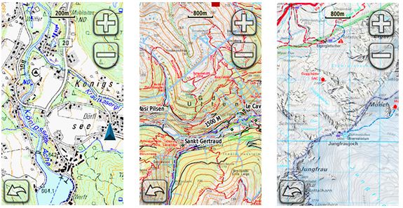
The BirdsEye Select maps, currently available for Austria, France, Germany, Great Britain, Ireland, Switzerland, and a small slice of the Italian Alps, are image maps, similar to USGS topos. Since they are comprised of image (raster) files, the file sizes can get quite large. Depending on the country, you can download anywhere from 600 to 5,000 square kilometers for $29.99. One other thing to keep in mind – these maps only work with the newer Garmin handhelds, such as the Dakota, Oregon, Montana and eTrex x0 series.
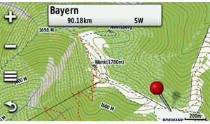
Further down the page, you’ll see a wide range of maps compiled by third-party map developers. Unfortunately some are priced as high as $450! These are mostly vector maps, comprised of lines and points (see image below). While less memory intensive than raster imagery, they won’t look exactly like traditional topos, although you will have contour lines and points of interest (POIs) on them.
Jet lagged GPS?
If you’re travelling, please remember that your GPS will take a solid half an hour to regain satellites after you fly off to another continent. It’s best to leave it on and motionless, under open sky, while it tries to recover from its own version of jet lag! For a more complete explanation, see my post on GPS reception problems.


Thanks for being here! I’m going hiking in the Pyrenees and would like a topo map for my Etrex 20. What do you recommend??
Hello, I am hiking the Camino de Santiago Compostela this coming April. Can I get topographic maps of the Pyrenees and Northern Spain on my Garmin Montana?