I went to Atlanta this past weekend, armed with a nuvi 1490T and the Atlanta edition of Garmin’s new CityXplorer maps. And I have to say, I was quite impressed. I’m blessed with a good sense of direction (though I find it much easier to lose N, S, E and W in the city), but I’m not a real urbanite. I can probably count the number of times I’ve ridden a subway / light rail on one hand. So I had some nervousness about leaving my car behind and venturing into the city via MARTA, with only a nuvi to guide me. It turns out that my fears were misplaced. Quite simply, CityXplorer rocks. Read on for the details…
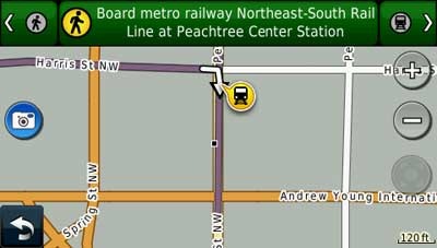
CityXplorer is very easy to use. Rather than drag my wife and 21 month old on too long of an excursion, we drove the mile from our hotel to the Lindbergh MARTA station, with the nuvi 1490T guiding the way. I left the parking garage to be confronted with an image similar to the one below (I screwed up this screenshot, so this one is from a simulation; the rest are real).
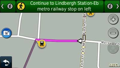
There is no compass to point your way, though you can see a direction arrow in the next image. I quickly realized how helpful it would be to turn on the tracklog – that’s the blue line trailing the position cursor.
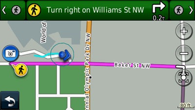
Doing so allows you to see where you’ve been and which way you are moving, which is a huge help in getting you properly oriented. It took less than a minute to figure this out each time I had to do it – once at the parking garage and once when exiting the MARTA station downtown.
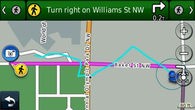
I did see an urban canyon effect, causing reception problems as shown in the next image.
Once, when walking between two large buildings with connecting overhead walkways, I lost reception completely. But it only happened once, and the turn by turn directions were more than adequate to keep me on route.
Here are a few more details on the interface and options:
- You can view your upcoming (or preceding) turns by tapping the icons in the left and right corners of the top information bar
- The icon below the zoom in and zoom out buttons lets you re-center the map on your position should you decide to pan the map
- You can select what transit types are included in calculations – bus, train and/or metrorail
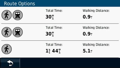
Since our destination, the Georgia Aquarium, was an equal distance from two MARTA stations, I was given two options that included light rail. Oh, one other thing, the time estimates of 30 minutes were spot on.
I was very impressed with how well CityXplorer worked, and I expect that I will use it in the future, on trips to other cities.
CityXplorer maps, available for download directly from Garmin, run from $9.99 to $14.99 per city. They are compatible with a wide range of Garmin products, but the pedestrian / mass transit features only work with the forthcoming nuvi 12xx, 13xx and 14xx series.

Can my Nuvii 255 track log? I have been useing an Etrex Legend on my bike for 5 years. Usually I map out a route on the computer and down load it to the Legend. Can my Nuvii record a track for download, or to follow again later? This issue came up while planning a charity bicycle ride. The motorcycle escorts wanted a track to follow. Which car or motorcycle units can do this?
Yes, it can record your track log, but it cannot follow later like a handheld can. I think all Garmin motorcycle units can record tracklogs. Here’s a chart showing which nuvis can… http://gpstracklog.typepad.com/gps_comparisons/garmin-nuvi-comparsion-chart.html
On the Garmin zumo series, I believe it will convert a track to a route to follow.
i rec. downloaded the london xplorer map, but the download stopped at 50%. how can i tell if the download was successful? i downloaded the pub guide and found it in “extras” but do not see the london xplorer there.
thanks
You can look under map setup. It should be listed there if you have it. But I’m not sure that means that you have all of it.
map isn’t there, and garmin seems to be of no help. customer support is a joke.
thx
don
Try calling again and getting someone else. Usually they are pretty good, but sometimes it takes a couple of tries.
@ Don:
I had the same problem as you have and checked online if I could find the solution. Fortunately, I did. You can find it here:
http://forums.gpsreview.net/viewtopic.php?t=14083
Let me know if this worked for you. It did for me and for that other poster you see in the thread contained in the link above.
Good luck mate.
EXCELLENT INFO, thanks for it.
followed the instructions, worked great.
I AM VERY UPSET WITH THE NON EXISTANT GARMIN SUPPORT. i have never seen such poor support.
but, my thanks to you, sir
Glad I was able to help you out, Don. 🙂
I agree with you that Garmin should definitely do better with their support. I tried to contact them by phone, never could get anyone to speak to me (always a projected waiting time of more than 30 mins…) and when I got an email answer, it was a procedure that did not work! Unbelievable…
But anyway, at the end we found a solution and that’s all that matters. Enjoy your Nuvi, Don.
Take care.
Al
many thanks once again. garmin finally called me and i pointed them to the website for the answer.
@Legion681 – Thanks for helping out.
No problem, my pleasure! 🙂
I am trying to decide on the nubi 885t or the 1490t. I like the larger screen on 1490t but i like the longer battery life the voice command feature and parking your car in some crazy lot forgetting the numbers/letters able to locate it. I fail to understand why they did not include these options. also you can get a accessory travel package for 885t for a good price. the 1490t every thing is seperate and expensive. your thoughts on both mark.
I’m not a huge fan of voice command units. The nuvi is a good one but it’s often faster to use your fingers! Nevertheless, your points are sound. And the nuvi 885T has a powered mount and custom avoidances. It’s lacking the recent cities and streets folder, which is a bummer. The biggest difference though is a trial of MSN traffic vs. lifetime NAVTEQ traffic.
Thanks for your insite. I guess I am going to hold off for the nuvi 1490t. I like more info on this unit when it comes available. I hope it is a good as the 885t.
I recently downloaded cityXplorer Vancouver Whistler Edition to my new nuvi 1350 and tried their enhanced pedestrian mode on the city of vancouver. That cityXplorer version does’nt work. All it could do is make you walk no matter how far it is you’re going. It does’nt give you any public transit option. Garmin said on the software overview that it will give public transit option. So I called twice on different days and both support tech. says this version of their software does not contain any public transit option. And eventually upgrade of this will come and still have to pay for it. Vancouver winter olympic is coming pretty soon and lots of customer will be downloading this crappy software. I have chosen this gps unit instead of other brand because of this feature, I’m disappointed.
similar with the venice maps. no public transport, walking only. this map isn´t worth anything.
The Denver CityXplorer also has quality issues. It does not do bus. only light rail. for instance, I was sitting in my car at an RTD bus Park-and-Ride, put in a destination, and the instructions were to walk 15 miles to the light rail station.
I also am very disappointed in this feature, and would recommend against buying a Garmin with the enhanced pedestrian mode. The reason is the Garmin units are separated into two categories – MP3 capable versus enhanced pedestrian mode. Since the enhanced pedestrian mode is poorly done, one would be better off getting the MP3 capable, so the unit will run the tour guide, etc that do not run on the non-MP3 units.
Thanks TimO. It’s beginning to sound like these maps aren’t quite ready for prime time!
I did notice that the CityXplorer maps are a newer version than the North America Map on my 1390T. So one use for the CityXplorer maps would be to cheaply update cities without updating the whole country.
Also, I’m going to try to another use for the CityXplorer maps. I put a U.S. planimetric map by ibycus (USA2)from GPS File Depot, along with the Denver & Las Vegas CityXplorer and the CN North America map. I’m driving to Las Vegas this week from Denver, so I’m hoping (expecting) that the ibycus planimetric map shows up in the areas not covered by the CityXplorer maps, instead of the CN North America Map. My simulated run seemed to work. Unless I have the CN north america map activated, then the Garmin uses the inferior world base map for the routing, so having that activated is the only reason I have a question as to if this will work. Also, in messing with this combination of maps, I noticed that the Garmin – in car mode – does not use the CityXplorer maps for routing, but uses the underlying map – either the CN north america or the global world base map.
Interesting that it uses the underlying CN for routing. It sounds like it should work the way you want it to.
I’m surprised. They are saying specifically that the Vancouver map has those features…
http://garmin.blogs.com/my_weblog/2010/02/february-fun-with-vancouver-cityxplorer-free-winter-sports-icons.html
Make sure you try these maps out before hand.
I have just purchased the ones for Stockholm as a trail, as that is my home town.
The accuracy of the transport data is disgraceful. It has not yet once got a train/Bus suggestion even close to right and has actually become a great source of amusement.
It often suggested walking up-to 5 km past a known rail station in favour of the Tunnelbana stations and – it short – is a useless program that I wasted 10 USD on.
Thanks. You’re definitely not the only one complaining about CityXplorer maps.
I had a very interesting correspondence with Garmin about CityXplorer maps. Since the latest update, I haven’t had any issues, but the mindset of Garmin help was interesting. I hope this is not too long a post, but here is the back and forth:
1a) me to Garmin: Since I updated the Garmin software around June 13, I get very strange, and wrong, directions when the cityXplorer maps are is active ( Denver and Las Vegas). For instance, Denver to Saint Louis with the cityXplorer active sent me in a really weird out of the way route to I-70. Without cityXplorer, it went directly out I-70, the correct route. Other weird things have happened with directions in the Denver area also. I just updated the software again today, 6/24, hoping that would fix it. It just changed it. now, with cityXplorer active, the directions send me up I-80 to get to Saint Louis. Still not right. Before the update a couple weeks ago, everything worked fine together.
1b) Garmin response: Thank you for contacting Garmin International. I will be happy to assist you with this. If you are not happy with your route and wish to take a detour please see the below instructions which will explain how this can be done on your nuvi device:
1. With a route active, touch Menu
2. Touch Detour ..[they went on to explain how to do this]
[Then they said I should make sure I had fastest route and automobile mode on]
2a ) my response: Thank you for your reply. Let me restate my problem. When the cityXplore maps are active, the unit routes a different way than when the cityXplore maps are turned off. Should not the route chosen be the same regardless of if cityXplore maps are active or not?
2b) garmin response: The mapping version on your device is the City Navigator North America NT 2010.40 and the mapping version for the cityXplorer mapping is the 2011.10. They will contain different information that may result in
different ways of getting you from one place to the next. As long as you are in the city that the cityXplorer mapping covers, it will override the preloaded mapping.
3a) my response: Thanks for your reply. So my issue is when I enter directions that cross between the City Navigator North America NT 2010.40 from/to the area covered by cityXplorer 2011.10, the route given is very far out-of-the way, neither the shortest distance or fastest time. If I am in the cityXplorer 2011.10 only, directions are normal, and if I am in the City Navigator North America NT 2010.40 only, directions are normal. This situation only started occurring after I performed a software upgrade
from the Garmin ‘my dashboard’ site in early June.
3b) garmin response: Sounds like there may be conflicting information in the mapping, but I am not certain to this. I would encourage you to do a software update with the Program called WebUpdater. This will give you more control over what is downloaded to the device. Please use the information
below. If the system software update does not correct the issue, please
do a master reset as well. Let us know if this does not help. Thank
you.
[they then described how to download and use webupdater, and if instructed me to do a master reset after that.]
4 – [I deleted the last emails out of frustration, but when I told Garmin that the download and reset instructions did not work, I received a response that the CityXplorer maps are only for local use and for long distance calculations, to turn OFF the CityXplorer maps.]
I purchased the DC map for my 1350. IMHO the map was pretty much a waste of $10. Out of five times I used it, it did once help me find a place to eat, but that’s it.
Yeah, I think the best use for CityXplorer maps is for areas you don’t have map coverage. Like a trip to London where you just need the city, but not all of Europe.
On my recent trip to New York, I was standing outside Grand Central Station and wanted to get to the Met. After spending $16.99 on NY CityXplorer, it couldn’t tell me any other way than walking. It worked so-so for lower Manhatten subways, but never on the upper east side. I never did see any bus information. The restaurant info was relatively up to date, but for the restaurants we wanted to visit, we had the street address or the closest intersection, and, of course, never had a problem finding food whenever we were hungry in Manhatten. I still had to buy a pocket guide map of the city, which cost less than CityXplorer and was a lot more useful. For NY anyway, don’t waste your money on this useless software. Still love my Nuvi 1350 otherwise, though.
I want to download the alaska map how can i do that
You can’t buy a Garmin highway map just of Alaska; you would need this instead…
https://buy.garmin.com/shop/shop.do?cID=253&pID=1456
Although this is another option…
http://gpstracklog.com/2011/04/garmin-topo-alaska-enhanced.html
What Garmin device do you have?
Does someone know why my navigation for transit types is not lit up and won’t let me touch screen transit types. It shows up as enabled and won’t let me choose that button! please help someone?
Ugg, the transit type question is for my garmin nuvi 1490T if you have any suggestions on how to get it working again?
Do you have CityXplorer maps installed and enabled under map setup?
It would nice if Garmin was more upfront about the models with which the city xplorers will work in the pedestrian mode. It wasn’t until I read this site that I realized my Nuvi 50 does not support those features. Technically they are “compatible” but those maps end up being useless as city explorer aids without the right model. I wish I had my $9 back. I think Garmin has some real internal problems. Their communication with their customers is abysmal. Their website is mysteriously vague on details. I get the impression the place is over-run with inept marketing wienies who run roughshod over the designers. They as so worried that someone might steal a map without paying for it that they totally neglect real customer service and support. Good products with bad support.
I am an international traveller. Most of the time my smart phone does not work due to no connection or no wi fi. I am looking for a pedestrian GPS to guide me in different countries/cities of the world. How can Garmin help me and what device should I choose?