UPDATE: I’ve posted a Garmin Foretrex 401 resource page with links to hands on reviews
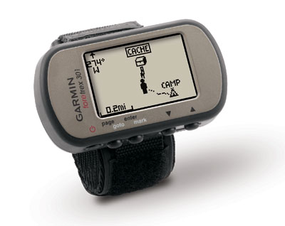
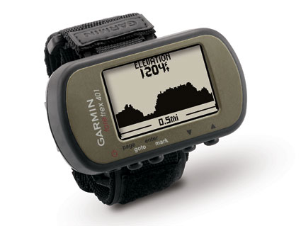
Apparently there is still money to be made in the entry-level handheld GPS market – the Garmin Foretrex 301 and 401 are being announced this morning. These two wrist-mounted units update the Foretrex 201, adding a high-sensitivity receiver and USB interface.
The Foretrex 401 ups the ante, adding an electronic compass, barometric altimeter and the ability to wirelessly share data with compatible Foretrex, Oregon and Colorado receivers. The 401 is also compatible with Garmin heart-rate monitors and cadence sensors.
Garmin is touting the new models as lightweight, waterproof devices for light hikers, skiers, campers and military personnel to wear comfortably on their wrists.
The Foretrex series has been among Garmin’s lowest priced handheld receivers. They are capable of basic backcountry navigation, and while they don’t have a basemap and you cannot add detailed maps, they can display a rudimentary sort of “map” (seen above) showing your track, waypoints and route.
The units, weighing an incredibly light 3 ounces, are powered by three AAA batteries, lasting up to 18 hours in the 301 and 17 hours in the 401. There is no word yet on availability or price.


With all the high end GPS units that have everything included, except for your favorite episode of LOST :), this is the ticket. I only want a GPS that allows me to backtrack in detail. How many times have you taken the wrong fork or turn, only to relize it later. However you then turn around and realize that you can’t recognize the trail back! That is what gets most people lost! GPS maps are not that great, and only Megellan Trition has good Topo maps, and those maps cost a bundle. carry a good Topo, a cheap compass (for backup) and this unit…its all you really need.
Has anyone ever used this for running? With a sweaty wrist? It says for light hikers wondered about running.
Hi,
I’m planning a 6-month hike through the European Alps next summer. I’ve collected based on a number of website, maps, guides,etc 6,000 waypoints that will guide me through my trek.
Now, i’ve got this 6,000 line csv file, I’m a little stuck. I converted it the csv into a gpx. Imported it in Google Earth, and it works fine. The file give me approximately 30 waypoints per day of trek, which should be fine not to get lost, and should save me from carrying 10 kg of maps.
Now come the tech part and my questions. I’ve excluded the mapped GPSs because of the high cost of European maps. I’d have to buy the maps from the 8 Alpine countries… costly.
And it looks like those colour-GPSs have lower battery lives.
I came to the conclusion that the Foretrex 301 may be a good and cost-effective solution. It doesn’t have 6,000 waypoints. But I was wondering if it’s possible to load teh 6,000 points as a “fake” tracklog and then use the track-back function?
There may be other ways much smarter to load my 6,000 points? or more suitable GPSs for this sort of trip?
Your experience will help.
Cheers,
Greg
You could probably convert it to a trackfile, but I want to address the “high cost of European maps.” There are plenty of free ones at:
http://mapcenter2.cgpsmapper.com
and
http://gpsfiledepot.com
Of course, you would need a mapping receiver. I believe that some of the eTrex units are rated at 25 hours battery life.
If you still want to convert to a trackfile, you could perhaps do it manually. Or maybe GPSBabel could do it.
Thanks for the advice. I got the same comments today from the saleman at my local outdoor shop.
On his advice and yours, I bought an eTrex legend. I’ve been playing with it all afternoon, and it seems indeed to be a nice gps. It’s well priced, and the colour screen is much easier to read than the foretrex. According to the saleman, battery life will also be better than to AAs instead of AAAs.
I also had a look at the GPX files. the xml code is pretty easy to generate with MS Excel. I tried loading a 6,000 point trackfile. That didn’t work. but by splitting the tracklog in 499-point logs, I can load my complete itinerary.
Cheers, Greg
Sounds like a Legend HCx. Nice unit!