When planning a new outdoor adventure, I usually search online for tracks that I can download to my GPS. There are two places I typically look:
- Google, using the trail name, park name, etc. + gpx
- MotionBased, soon to be completely transformed to Garmin Connect
The latter is actually my first choice, since it is (IMHO) the best trail database in the US. What continues to amaze me is that Garmin doesn’t seem to realize what they have. We still get maps with plenty of missing trails, and they seem to be based on ancient USGS data.
I see no reason Garmin can’t utilize their MotionBased data to build a better trail map. They could decide how many tracks they would need for a given trail, and how much error was allowed before throwing out a track. A little follow up by hand (and even this could be automated) could establish trail junctions and where they connect to the nearest road (i.e., trailheads).
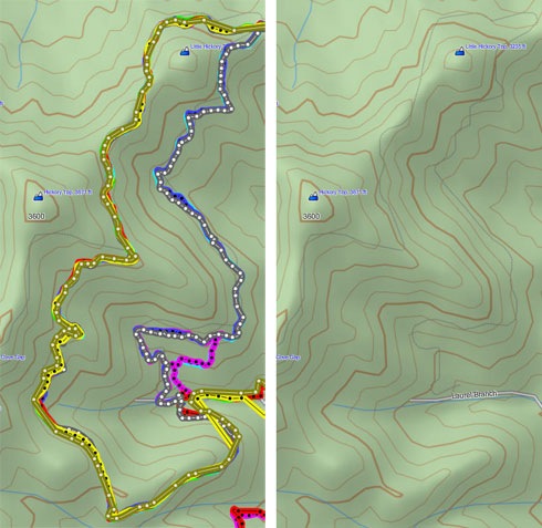
For example, I did a search on MotionBased for a mountain bike trail in my area. I downloaded eight tracks, pictured in the image below at left (MotionBased probably has 50 to 100 tracks of this trail). People take different approach and exit routes, so the trail segment I was targeting is the one on the left side of the image, showing mostly yellow and olive track lines. If you’ll compare this to the Garmin Topo US 2008 image at right, you’ll notice that they only have the upper half of the trail on their map.

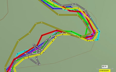
I’ve zoomed in on a section with some of the worst track “noise” below. We can see aberrations that might lead you to toss one or two tracks.

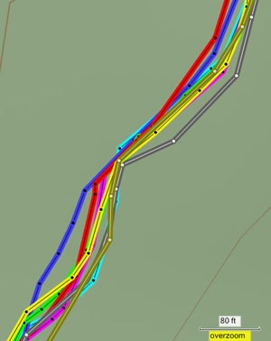
The next image is a more typical section, where we can see that most tracklogs are coming within about 60’ of each other, with an even tighter cluster falling within 30-40’.
 Garmin has recently ramped up their topo mapping with the new 1:24,000 scale series, but they are getting a lot of criticism for missing trails, with some reports that it’s worse than Topo US 2008. But here they have this database that may have 90% of US trails in it. Why not utilize it?
They may not even realize what they have. The MotionBased team appears to be significantly underfunded, if the speed of conversion to Garmin Connect is any indication.
I don’t imagine for a moment that this would be an easy thing to do; it would require quite a bit of effort. But Garmin is the US leader in outdoor navigation, right?
PS to Garmin – It would also be nice if you could export Garmin Connect data in formats other than .tcx and .kml. Before shutting down MotionBased. Please.


MotionBased will be available to all outdoor handhelds until Garmin Connect supports those devices.
Garmin Connect will support uploads from all Garmin outdoor handhelds in September 2009. It will also export all public activities stored at Garmin Connect — over 8 million right now — in the following formats (tcx, kml and gpx).
Thanks Clark. Is .gpx export available yet? Under “Export,” all I see is kml and tcx. Garmin Connect is looking good, BTW.