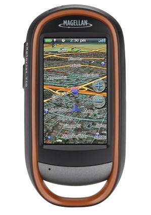
 Magellan has rolled out a new aerial imagery subscription program for their eXplorist and Triton lines. Like the DeLorme and Garmin services, this one will utilize DigitalGlobe imagery and runs $29.99 per year.
Compatible units are the eXplorist 310, eXplorist 510, eXplorist 610, and eXplorist 710, Triton 400, Triton 500, Triton 1500 and Triton 2000. Imagery will need to be downloaded and transferred via Magellan’s VantagePoint program. As far as I know, that is still a Windows only program.
Previously, Triton owners could use National Geographic’s TOPO Explorer application for aerial imagery, though I found the quality of that offering lacking; the DigitalGlobe imagery should be much better. For more information, there’s a discussion thread at the eXplorist forum on VantagePoint 2.17, which adds this capability.
Here’s the full news release.


That screenshot appears to show aerial imagery in 3d view – something that Garmin can’t do. I wonder how performance is? Glad to see Magellan is trying to keep up with Garmin and Delorme. I have a Triton 1500, but not really interested in investing in this since I hardly ever use it anymore.
Interesting. I wonder if they really do 3D.