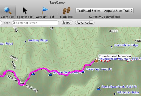
While prepping a review of the Garmin Trailhead Series Appalachian Trail map, I wanted to verify that it couldn’t be used in BaseCamp. Needless to say, I was pleasantly surprised to find that it did indeed work! The screenshot above shows a route on the AT in the Great Smoky Mountains National Park.
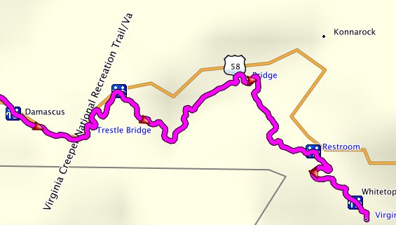
I had previously considered buying one of the Rails to Trails series maps, but hadn’t since it was my understanding that you couldn’t use it on your computer for trip planning. So in the interest of research, I ponied up my $9.99 yesterday and proceeded to download it. Lo and behold, it displayed in BaseCamp too. Here’s a screenshot for a portion of the Virginia Creeper Trail.
Garmin still notes the following on the Requirements tab of each product’s web page, but I’ve verified that they work in the latest version of BaseCamp on both Windows and Macs, while the GPS receiver with the maps is connected to the computer…
Note: The download is installed directly to a Garmin device or microSD/SD card and is not accessible on the computer.
I haven’t checked the US TrailMaps Whitewater and Equestrian maps, but I’m assuming these work the same way.
As far as I can tell, this is new, and you haven’t been able to access these maps in BaseCamp until one of the last couple of updates. Have any of you been able to access these maps on your computer in the past?


What exactly are these maps Rich? Are they transparent overlays that are used with another map, or are they complete topo maps of a small area? What was installed on your computer? If you are running Windows 7 or Vista, look in C:\ProgramData\GARMIN\Maps. Do you see a folder there for the map? If so, then they are using their new gmap format (also used for City Navigator).
How is the map installed on the GPS device? Directly from the downloader or do you use Mapinstall?
The AT map is a complete map, with contour lines. The Rails to Trails maps don’t have contour lines, so I’m not sure how you would classify them. But neither seem to be transparent overlays.
They do not reside on the computer; they are installed direct from download to the device (the AT map can also be purchased on a microSD card).
Ah, OK, now I understand. But is that really anything new? Basecamp should be able to access any Garmin map while the device or memory card is connected via USB. I think Basecamp got that ability a couple years ago, so maybe the info on their website is just out of date?
And if, for some reason, a map on the card or device isn’t visible in Basecamp then there are several utility programs that can fix this. The compiled map file (ie: gmapsupp.img) has a “flag” inside that tells Basecamp whether it can display. Just “flipping this switch” will make it visible. JaVaWa has recently released a user-friendly way to accomplish this, along with many other things: http://www.javawa.nl/jdm_en.html
I’m pretty sure it is new, but am trying to get independent confirmation. It wouldn’t work for me in BaseCamp 3.2.2 in Windows until I updated. IIRC, after they rolled out Basecamp’s ability to view maps on devices a couple years back, it still took awhile for them to allow it work with nuvis. So I suspect it’s tied to licensing agreements.
Thanks for the tip on JaVaWa.