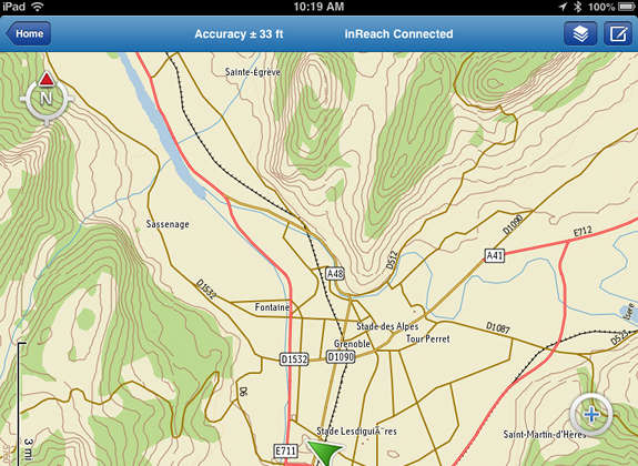
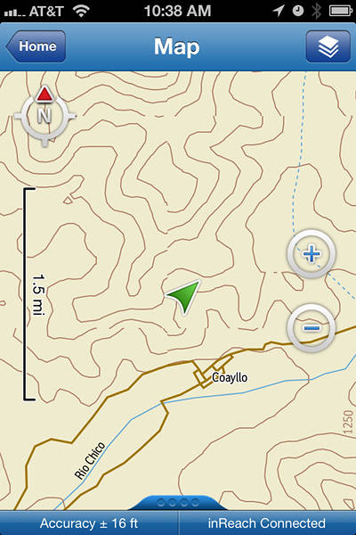
Globetrotters rejoice! One of the missing pieces of the GPS puzzle for jet-setting adventurers is the lack of detailed maps for their devices. Sure, there are decent maps for most of Europe, Australia, etc., but you don’t even need to be in a third-world country before your GPS is pretty much devoid of mapping options. Now smartphone-toting trekkers have a new option though.
Buried in a news release earlier this month was this tidbit about the Earthmate app for the DeLorme inReach:
The Earthmate app now enables downloading of seamless topographic maps of the world from DeLorme’s new Digital Atlas of the Earth (DAE). Users can download and store all the maps they need for travel all around the world. DAE detail includes elevation contours, land cover, place names, major roads as well as connectors and urban streets, railroads, transportation hubs and places of interest including museums, landmarks, dams, stadiums, ports and more. The extensive river and stream detail makes DAE one of the premier hydrography data sources in the world.
Features include:
- Major highways, urban streets and connector roads
- Railroads
- River and stream detail
- Over 300,000 place names
- Places of interest – museums, monuments, landmarks, dams, power plants, stadiums, ports, and more
- Transportation hubs including airports, runways, rail yards
While the app and maps aren’t going to provide you with the full complement of navigation tools, they will show your position and surrounding terrain. If tracking is enabled, your track history can be shown at 10 minute intervals depending upon your settings.
Contour intervals are 50′ at the tightest zoom level. There is no charge for the over the air map downloads to your phone (apart from data charges); folks following you via DeLorme’s MapShare web interface can also access the maps.
EDIT: I should add that with the latest firmware update, the inReach GPS signal can display your position on the maps, rather than using the phone’s GPS. This helps reduce phone battery usage and should improve position accuracy.


