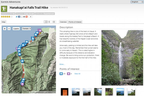
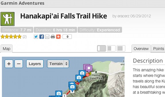
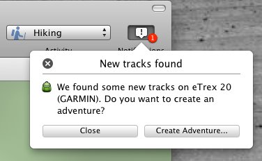
Garmin Adventures hasn’t been officially announced to the general public yet, but there’s enough information available to give you a good peek at what’s coming. Basically, it seems to be a social/outdoor adventure sharing website, that integrates with BaseCamp, allowing you to download “adventures” to your Garmin (see screenshots below).
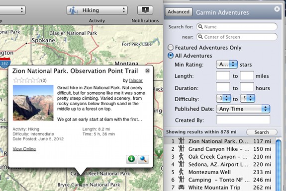
That’s my take on it anyway. Here’s a quote from the Garmin Forum post where they let the cat out of the bag:
“Garmin Adventures” is a new feature that allows you to easily share trips and photos and lets you find Adventures by other Garmin users. You can download a track from your GPS to BaseCamp, add some photos, videos and annotations; upload the trip as an Adventure and then share it via the Garmin Adventures web site with friends and family. BaseCamp allows you to author Adventures, and use a playback feature so you can re-live your trip. In the near future, Garmin devices will add support for Adventures as well.
It will be interesting to see how they implement Adventures on their handhelds. You can already transfer the waypoints, tracks, photos, etc., so clearly they have something different in mind.
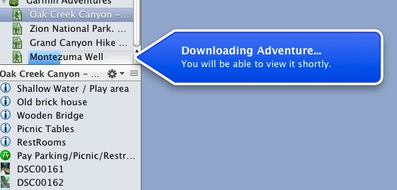
To get anything more than access to the Adventures website, for now you’ll have to risk the beta 4.0.0.4 version of BaseCamp (Mac/Windows – the latter is a webpage with a link to the .exe file).
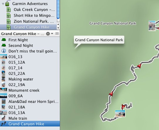
As you can see below, the typical adventure download includes a track, some waypoints or points of interest, and georeferenced photos.
If they don’t pull it, this unlisted YouTube video shows off the playback functionality.
Speculation
I have a couple of things to add here…
It will be interesting to see how this integrates with the forthcoming BaseCamp mobile app. For example, will we be able to download a track at the trailhead and transfer it to our Garmin? This just makes me more convinced that Bluetooth-enabled Garmin handhelds are right around the corner.
And now that there is a web interface for sharing trips, I have to believe that a Garmin-branded satellite communicator is also in our future.
A huge thanks to Allory for the tip.


Perhaps this is how Garmin plans to catch up with local maps, as well. It seems as though they could curate and average data to add the trails and paths their mapping products are sorely lacking. They could even have some sort of “advanced user” status where certain users could review and correct the data to ensure trailheads, trails, and junctions are properly located and labeled.
I hope, though, that Garmin Adventures doesn’t feel as smarmy as Backpacker Magazine’s Trails program and corresponding iPhone app. That app is difficult to use for anything but creating trips for others to use. A shame, too, because it offers the ability to change the datum, which nearly none of the other apps do.
If Garmin is able to build a database of local trips and trails, that could become their new sales model for maps. Instead of selling regional topos for $100, they could offer in-app purchases of specific parks and trails. I can see folks paying $1-$5 a park much more readily than $100 for six states (and not enough trails). Imagine if they had a really good GPS receiver app that offered you maps and trips based on your current location, downloadable instantaneously. Just dreaming out loud here
Garmin has a great trail database in Garmin Connect. Why they haven’t made an effort to really utilize that data more in their mapping products is beyond me.