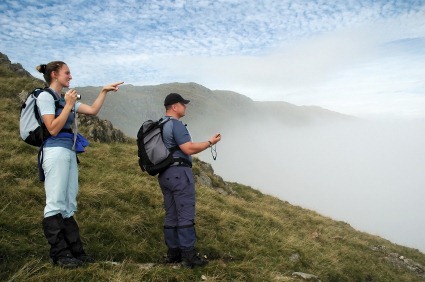
Part of the wonder of GPS is that you can go anywhere and never have to worry about getting back. But if getting there is the best part of the journey for you, then check out these GPS games you can play by yourself or with others. It’s a great excuse to get out and enjoy the beautiful summer weather and maybe discover something amazing!
 Geodashing is a game in which players use GPS receivers to find waypoints, or dashpoints that are randomly selected and scattered over the entire planet. One point is awarded for each dashpoint visited, and the person who finds the most wins. Each game has a new set of dashpoints, so completely random and unpredictable every time.
  Waymarking is like a worldwide scavenger hunt where users mark notable and interesting sites around the world with coordinates and a photo for other explorers to discover. The website lists more than 230,000 sites around the world that have been marked, with waymarks being added daily. Type in your zipcode and discover new places! Geocaching is probably the most well-known of the games listed. This game involves millions of hidden stashes containing trinkets and a logbook and the hunt to find them with only coordinates to guide you GeoVexilla is a GPS game that uses the globe as a playing field. At
  random times all across the globe, virtual flags will appear for a limited amount of time. The goal is to visit the waypoint before the time is up to collect the virtual flags. Each flag is worth points, and players can gather ‘collections’ of flags for additional bonuses, or trade with other players to increase their collections. The player with the most points when the game ends wins. Travel Bugs is a sub game of Geocaching. Each travel bug is a dogtag to which you assign a mission before placing inside a geocache. The next geocacher who finds the bug can take it, log their find and read the bug’s mission–which could be anything from staying by the ocean or traveling around the world. The travel bug finder’s job is to do their best to help the travel bug fulfill its mission by placing it in another geocache on its route. You can purchase Travel Bugs on Amazon or other websites.
  MinuteWar is a game of capture-the-flag very similar to GeoVexilla, without the different types of flags and multipliers. In this game, maps are divided into squares, each one minute of longitude wide and one minute of longitude long. Each square will have one virtual flag which players can capture by visiting.Visit the spot where the flag is located to capture the flag. There are lots of rules about teams and navigating the squares, and each game lasts for a predetermined amount of time. At the end, whoever has the most points will win.
  Shutterspot is basically the opposite of geocaching where, instead of using coordinates to find a hidden object, players are given a picture and challenged to find the exact coordinates where the picture was taken. Players can log their guesses on the website, and if the guess is within 100 meters of the shutterspot, it will be a success. GeoPoker combines GPS know-how with the popular card game. In this game, players try and gather the best poker hand by finding either a virtual or physical container and logging the find before rehiding or relocating the container. The container will be moved 52 times, and players can discard their cards in an attempt to get a better hand. And, as in poker, the best hand wins.
  GeoGolf or geodashing golf, is a game in which players navigate to 18 (or 9 for a shorter game) predetermined and randomly placed waypoints. Your score will be determined by how close to the waypoint you get and, just like golf, the lowest score wins. Degree Confluence Project is not really a game, but still can be a lot of fun. The idea behind this project is to visit the lines of confluence, where latitude and longitude both read an even number (such as 27°N 82°W) and take a photo of it and write a description of the journey to get there. There are roughly 64,442 intersections of latitude and longitude on the planet. While many of these confluences are discounted because of their unreachable location on the poles (or in the middle of the ocean) there are still 16,345 confluences that meet the goals of the project and roughly 14,029 of them are on land. There are currently 10,053 confluences that have not been visited, and the site encourages participants to revisit confluences to see how the area has changed and then log their journey. The project is designed to be a sampling of the world and to give participants a reason to explore the world around them and see it’s natural beauty. Rules and explanations for how to map a successful visit can be found on their website.
