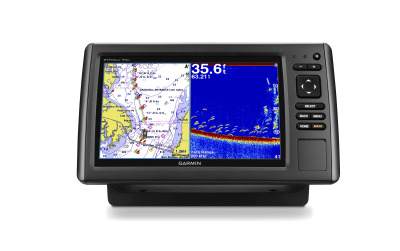
Garmin has finally released information on the next generation in the popular ecoMAP series for mariners of all types. The newest iteration of ecoMAP chartplotters will include scanning sonar capabilities without the need to purchase additional devices or mess with complicated hookups. The series will come in 4, 5, 7 and 9 inch color displays and is expected to be released in the first quarter of 2015.
Additional features for the new series include:
- intuitive, keyed interface
- High sensitivity 5Hz GPS antenna that updates location and heading five times per second
- HD-ID sonar
- DownVu scanning sonar
- preloaded maps
- Garmin Auto Guidance
- easy disconnect for storage
Certain units in the series will also have additional features such as SideVu, to view the sides of the boat as well as the bottom, and various different preloaded maps. LakeVu is an extensive database of more than 17,000 inland lakes, reservoirs and rivers, some of which include 1-foot contours shore-to-shore. BlueChart g2 coastal maps include comprehensive detail for all of the coastal Untied States and the Bahamas. When purchasing a unit, you may select which preloaded maps you prefer.
The new series is will retail for $300 – $1300, depending on which unit you purchase.

I own a new Garmin Striker7sv Combo. There are two addional wires on the GPS cable. One is blue
and the Brown. I understand the blue wire is for Tx (Transmit) and the Brown wire is for Rx (Receive). What device do I need to purchase to make use of these two wires. There must be a mapping capability I can add to my Striker, other wise, why Tx and Rx wires the involve EcoMap.