Sunday, March 18, 2012

Tracking Baby Jesus

nativity

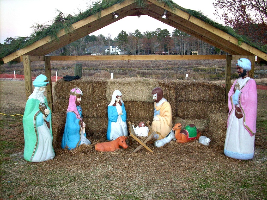
The Christmas season is upon us and it seems that everywhere you look, there are Christmas decorations. One of the staples of Christmas decorations here in the South are nativity sets. Whether they are plastic or cardboard or a real living nativity, these biblical scenes grace the fronts of churches across the country during the month of December.

However these churches across the country also share a common problem: the theft of Baby Jesus. Personally, I can’t imagine why someone would want to steal a plastic Baby Jesus, but it’s apparently a huge a problem this time of year. So much so, in fact, that several GPS companies have stepped forward during the last few years and offered free GPS trackers so that parishes and chapels can ensure their Baby Jesus stays with his flock. read more

FAA Grants Commercial Drone Flight Exceptions

DJI Phantom Quadcopter Drone

In yet another victory for drone enthusiasts, the Federal Aviation Administration (FAA) recently approved four companies to use commercial drones for various reasons including research, construction and data collection. The companies that gained approval include Trimble Navigation, VDOS Global, Clayco Inc and Woolpert Inc. In addition to the approvals granted earlier this year to six film and photography companies and two Alaskan oil projects, it is starting to look like commercial drone use might actually become a reality sooner than you’d think. read more

Amazon Best Selling GPS Lists

amazon

I admit it: I’m a nerd. I’m also kind of weird, and I find watching Bestselling trends on Amazon to be extremely interesting to watch over the course of time. While their bestselling lists update hourly I’m not a big enough nerd (with enough free time) to check it more than once every couple of days, but the trends are kind of neat. read more

NTSB Rules on FAA Appeal about Drones

GPS drone (UAS) with GoPro camera

GPS drone (UAS) with GoPro camera; Creative Commons image courtesy Don McCullough

I know we haven’t really covered drones all that much on here, but I saw a new ruling by the U.S. National Transportation Safety Board (NTSB) that clarifies the noncommercial use of drones a little further and wanted to share.

According to the GPS World article, the NTSB has ruled that the Federal Aviation Administration does have the authority take enforcement action against anyone operating an aircraft system a careless or reckless manner. They have defined aircraft as “any contrivance invented, used, or designed to navigate, or fly in, the air” which, of course, will include Unmanned Aircraft Systems (UAS) such as drones and larger model airplanes. This sort of muddies the drone regulatory water even further, as model airplanes were formerly not considered to be under the FAA regulatory rights (and are allowed to fly under 400 feet with no problems). read more

GPS Favored Over Navigational Beacon in Nome

NDB

I know this isn’t directly related to GPS, but thought I would pass along the word anyway…

According to a brief posted by Knom.org, the Federal Aviation Administration (FAA) is conducting a series of studies on the non-directional navigational beacon (NDB) in Nome, Alaska, and is looking for public comment on possibly disabling the beacon. read more

TomTom Brings Navigation to Acer Smartphones

tomtom-logo_1

TomTom has announced yet another deal this week, this time with Acer, Inc, a Chinese hardware and telematics corporation. This multi-year deal will bring TomTom navingation and maps to Acer’s newest smartphone. Referred to as “AcerNAV” this turn-by-turn navigation application is powered by TomTom’s navigation engine NavKit and will allow consumers to download any TomTom map completely free. read more

Testing Begins for GNSS-Enhanced Search & Rescue

Europe_search_and_rescue_cover

An example of the range of the Cospas-Sarsat coverage area and system. Photo from Inside GNSS

Inside GNSS reported earlier this week that the European Space Agency has completed the tests of their component of the GNSS satellite-aided search and rescue service known as Cospas-Sarsat. Now that the European portion of the system has been completed successfully, the whole system will be undergoing tests to determine accuracy and work out kinks before becoming available in 2016.

Created in 1979 as a collaboration between Canada, France, the USSR and the United States, Cospas-Sarsat is a global satellite system designed to detect distress signals and then send them to the nearest rescue stations for faster locating of those in need. It has helped rescue more than 35,000 people since its first launch.  read more

New Pet Tracker Debuts on Kickstarter

pip

It has been a while since we took a look at some upcoming GPS technology on Kickstarter, so I decided to take a peek and found a promising pet tracker called Pip. Created by PetSimpl, this tracker is advertised as having a GPS chip that is accurate to within five feet, but also uses cell data to inform you of geofence breaches, etc. And the coolest part? If your furry friend goes wandering, then the unit will work with your phone to give you GPS directions to your pet in real-time. The unit also has a really long battery life–an expected three months before needing a recharge–and is waterproof and rugged so your pal can romp and play without worry. read more

GPS Poppy in London Honors Soldiers

poppy GPS

I’ve written about GPS art a few times in the past, mostly because I find the marriage of art, technology and exercise both interesting and beautiful. So, while Veteran’s Day has already passed, when I read this story about a disabled war veteran creating a poppy on the streets of London to help raise money, awareness and support of war veterans around the country, I had to share it.

In the US, UK, Canada and several other countries around the world, red poppies have become to represent remembrance of the fallen soldiers and the sacrifices by those in the military service in defense of their country. These little red flowers are often handed out by military veterans and adorn windows around the middle of November, thanks to a poem written by John McCrae called “In Flander’s Fields.”

This year, 27-year-old British war veteran Ben McBean ran a total of 31 miles to draw the outline of a remembrance poppy on the streets of London. Then McBean, who was grievously injured in Afghanistan in 2008 and has a prosthetic leg, called to the public to run around the city and color in the flower. The public took up the call and ran more than 7,500 miles, coloring in the poppy almost completely as of yesterday and raising more than $23,000 (£ 15,000).

McBean told The Mirror in an interview that he wasn’t doing it to get press–the project was all about honoring veterans.

“I want people to do it, I think the main thing is remembering what happened 100 years ago… Even now [after Iraq and Afghanistan], the parents of soldiers who have died in battle are living with that, that’s why I did the run, it’s all about remembering,” McBean said.

UK Resurrects WWII Tech as GPS Backup

LORAN_AN-APN-4_receiver_set

WWII Loran recievers like this one used the Loran system, which recently got an upgrade and revamp to be used as a backup for GPS.

GPS is a wonderful tool, but as it becomes more and more prevalent in technology, it becomes harder and harder to navigate without it. The BBC reported last week that the General Lighthouse Authorities have installed a system called eLoran in seven ports across Britain to use as a backup in case of a GPS outage.

The eLoran system is a resurrected and revamped version of the Long Range Navigation system (Loran) used in WWII by the US Navy to guide warships. The eLoran system has, of course, been upgraded to make it more accurate and renamed and rebranded. Unlike GPS, the eLoran system is ground based and uses completely different kinds of signals to GPS, meaning that a blackout of both systems is highly unlikely. read more