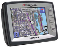
Earlier this week, Lowrance announced a new GPS receiver, the iWAY 600C. What makes this unit so special is that it can display satellite imagery. It looks like they will beat DeLorme, manufacturers of the fabled Earthmate PN-20, to the punch (though no release date has been set). Actually, Garmin already has marine units that can accommodate aerial photography.
This is a rare feature, and one reason is memory. The points and lines you see on your GPS screen come from data files, not images. It takes a lot more room to store the latter. 25 GB of the iWAYs’s 30 GB hard drive is devoted to maps and satellite imagery. But hey, if they can make an 80 GB iPod, this stuff can’t be to far away for GPS. Hopefully, the manufacturers will get it right, and not charge us extra for imagery that is available for free on line.
Get the Lowrance iWAY 600C at Amazon.

c46iby sdlfRnd6M2HvO4