 It was a little over a year ago when I learned about a new 10,000 acre public land acquisition located between Asheville, NC and Johnson City, TN. Described as remote, isolated and unmapped (as far as trails go), I knew right away where I’d be spending my play time for the foreseeable future. I’ve now completed most of the routes that can be mountain biked in Rocky Fork, and I’m happy to present my first trip report post since my son came into this world.
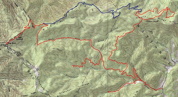
When I started out, there were no accurate trail maps of the Rocky Fork tract. Well no more. The clickable image below shows a fairly good trail map of the area (image captured from National Geographic TOPO software).
So for anyone interested, here are the details:
Rocky Fork Trailhead
The trailhead I used is located in the southeast corner of the map. It is near Flag Pond, TN, the last I-26 exit in Tennessee before entering North Carolina. Here are directions from an article in Blue Ridge Outdoors:
From I-26, take the Flag Pond exit. At the stop sign turn left onto Higgins Creek Road. Drive .5 mile, then turn right on route 23. Drive 2.25 miles through Flag Pond, then turn left on Rocky Fork Road. Drive .75 mile to a gravel pull-off to the left in front of a gate. From here, explore Rocky Fork on foot or bike.
There are other possible access points, including Higgins Creek and Squibb Creek, but the one listed above is likely to be the best for most people. Access is also possible via the Appalachian Trail (AT), but that would be a long hike.
Buzzard Rock, a southern Appalachian bald and the Appalachian Trail
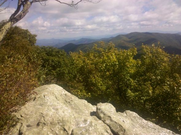
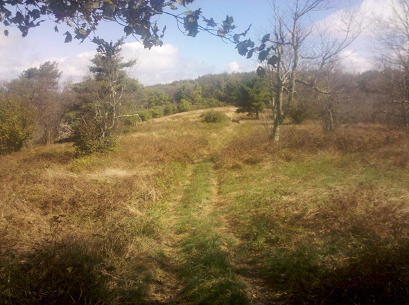
This is the crown jewel of the tract; getting there requires quite an effort. The out and back route I chose to mountain bike was 16 miles long with nearly 3,000’ of elevation gain. Five stream crossings each way (two that are knee deep) make it an unappealing route during winter. But the pay off is awesome, taking you by Buzzard Rock (pictured at the top of the post), Ball Ground (a southern Appalachian bald, pictured below), and the Appalachian trail. I apologize for the image quality in this post – I was using a camera phone to cut down on weight and bulk, and it was a very windy day to boot.
 This route basically cuts across the heart of the property, going up the main Rocky Fork drainage, reaching its peak at the left side of the map above.
Higgins Ridge / Lake
This is also an out and back — a seemingly endless climb that takes you up to a figure eight loop, that circumnavigates a seven acre man-made lake. This is the red trail that runs along the east side of the map. One advantage for winter riders/hikers – no stream crossings.
Flint Creek
Although the Carolina Mountain Club has done this as a hike from the AT as recently as the spring of 2008, I found it nearly impassable two years later, and certainly not to be attempted by bike. Theoretically, there are connections to Blockstand Creek and Flint Mountain, once you get out of the bottom. Lots of stream crossings; well, actually…the streambed is the trail in many places.
Blockstand Creek
I made it to a couple of splits worthy of further exploration, including one that looked rough, but promised to head up towards the AT. One stream crossing is required, but you may be able to keep your feet dry in low water periods.
Rich Mountain and Wilson Knob
I haven’t done this one (shown in blue on the map), but I have seen both ends of the ridge road and it appears to be wide open and in pretty good shape (once you get to the ridge!). The track is from a Garmin Connect user. Doing it as a loop means deep water stream crossings, but you can stay dry by approaching it as an out and back from the Higgins Ridge side.
A note about conditions
The Rocky Fork tract receives very little traffic, so be prepared for rough conditions and self-rescue! Most of the routes are old logging roads, and after the first few miles they tend to be overgrown or in otherwise rough condition in places.
Rocky Fork GPX files
The links below are for GPX files that you can download for the trails I’ve recorded:
- Rocky Fork waypoints
- Rocky Fork to AT
- Rocky Fork Higgins Ridge / Lake
- Rocky Fork Blockstand
- Rocky Fork Flint Creek
What’s left to explore? Waterfalls!
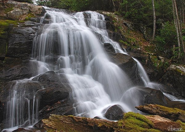
There’s still plenty left to explore in Rocky Fork, including waterfalls such as the one shown below on Higgins Creek in the northeast corner of the tract. This web page has a map showing the Higgins Creek trailhead location. Image courtesy Mark Peacock.

Related post:


Rich,
This is awesome! Any chance we can see that map any larger (the one form the National Geographic TOPO software)?
Thanks for posting this info. I look forward to getting out there myself. If you up for another journey, I can drive!
Best,
David Bourne
Doh! Clicking on it was supposed to go a full size map. Try this…
http://gpstracklog.com/wp-content/uploads/2010/10/Rocky-Fork-trail-map-lg.jpg
It’s a great place. I’ve been having tons of fun there.
I’ve been hiking up from Clarks Creek&across to Buzzard Rock since ’97.Also I have went up Squibb creek&Middle Spring Ridge trail many times.My next trip will be up Squibb creek ,on a day trip,to bring chainsaw to remove blowdowns at the last part where the trail ends and the old road cut starts.I think this is about 1.5 miles from Buzzard rock.I just loaded an app on my Iphone to help me know where I am on the USGS 7.5 Flag Pond quad.Anyone who wants to help contact me via this site or email.
I lived over in Unicoi County back in the late 90’s. There were only a handful of local mountain bikers in the area back then. I was given a hand drawn map by Creston Fowler (I think that was his name, it’s been many years since then) who grew up hiking, fishing, and hunting up in Rocky Fork. He had drawn the map from memory and it was amazing how close to actual scale it was given how long it had been since he was up there. We always ran the main loop which was the easiest to follow. I was just up there today for a day hike and it is as beautiful and unspoiled as ever with a light cover of snow on everything. I have seen a couple of stories about Rocky Fork in different papers in the last few years. Most have been about the remoteness of the area and its recent sale. Each time I see news about Rocky Fork I selfishly hope nobody reads the story! I like to think of Rocky Fork as a secret that very folks know about! I’m glad to see that the area isn’t in immediate threat of big development. Thanks for getting such a detailed map of the area.(Although I don’t really want anyone else to use it!) Perhaps I’ll run into someone next time I’m back in the deep of it (I secretly hope not, since it is one of the few places I can still go and not have to worry about running into a single person for the entire trip!) Seriously though good job.
Thanks! It’s an awesome area. I hope to get back and do the big loop sometime.
Hiked to the lake hoping to catch a fish or two. Nothing in there but tadpoles.
Yeah, it didn’t look very promising to me. Which way did you go in?
I started at the gate on Rocky Fork road. The hike is about 7.2 miles one way. I did see some incredible wild flowers. Pink Lady Slippers, Foam Flowers, Mayapples, etc. It was nice to revisit spring again at the higher elevations. Bear scat was prevelant up high also. I actually walked up on a 200+ lb bear last year, around this same time. When it finally noticed me he left in a hurry. The road was in really good shape considering the recent heavy rains. Thanks for posting the map. It’s the best one I have seen of the area. I know some Forest Service folks who have been working on mapping and boundary work on the new acquisitions. Their unofficial maps cover some of the side trails. Your map is on par with their results. In my opinion, the area is more suited to bikers than hikers. 15-20 miles for round trips are the norm to the highest elevations. I’m going to try to make it to the bald and White Rocks this weekend.
That’s a long hike! I think you can get to the lake from the Higgins Branch side, but I’m not sure it’s any closer. Glad you’re finding the map useful. I’ve seen several bears there too. Is White Rocks the same thing as Buzzard Rock? Or White House? I’ve got to get back over there — it’s been too long!
I think White Rocks is the same as Buzzard Rock. Local names vs. map names. There are two trails that lead off from the dam at the lake. One follows the contour of Higgins Ridge. There is a flat area not far from the lake where you can see I 26 through the trees. Probably will be blocked by the canopy soon. Not sure how far out it goes. Good cell signal there if you need it. The other trail drops straight down and follows the creek. From what I’ve heard it comes out on Lower Higgins Creek road. The “gentleman” who lives at the end of the pavement tends to be somewhat irritable, but I think he is more bark than bite. Both of these trails are obliviously made by a four wheeler ATV. The Tennessee Eastman Hiking & Canoeing Club also has an excellent map of the area. Send me an email if you’re in the area. I can at least provide you with a base to operate from or give you a lift back to your vehicle if you choose to explore the side trails to see where they come out. I have an old Forest Service map that shows connecting roads leading to Bumpass Cove. I’m planning for a through hike maybe this fall. Just need to do some more looking around to get my bearings so I’m not wandering around for a couple days. A lot of the side trails tend to have not been maintained in awhile. As it is now, the rules and regs about camping and usage are in flux. I’m sure they will be more defined & established as the State Park is developed. I personally stick with what has always been in place. Better safe than sorry. It just makes for some long day hikes.
Yeah, the Higgins Creek access is interesting. It was kind of weird the one time I went out there for hiking; I sure wouldn’t want to show up in mountain biker lycra! 🙂
Keep me posted on your explorations. One that I’d like to try sometime is a trail that accesses Flint Mountain via private property near the Rocky Fork Road trailhead. I’ve seen tracks posted for it on Garmin Connect.
The State Park development plans scare me. Campground, roads, etc. Folks should see it now before they screw it up!
Don’t be scared of the Development plans. I am a local GIS analyst and conservationist loosely associated with planning and development of the rocky fork tract. I’ve been told that the development will be done with extreme care and that the natural wonders won’t be harmed in any way. basically they are just gonna go in and improve and maintain all the existing trails/roads. The addition of a campground is not that big of a deal. it will be around the trailhead so that your backcountry experience will be preserved. I haven’t heard for sure but primitive campsites are in order for extended backpacking trips. Also, access from Bumpus Cove is something we are looking at right now. I think it’s awesome that it is being turned into a state park and that is coming from a conservationist point of view. i will post on here again once we have a map that encompasses everything in the area with all proposed additions.
Thanks Alex! Glad to hear it. Yes, please post a link to planning maps once those are available.