 Hands on Garmin Oregon 650t review
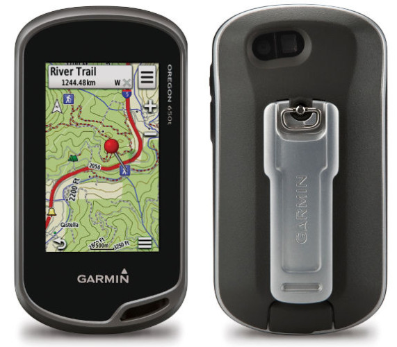
The Garmin Oregon 650t is the company’s top-of-the-line handheld GPS receiver. Offering an 8 MP geotagging camera and preloaded 1:100,000 scale US topos, the 650t also offers all the other goodies found on the 600 series, including a bright capacitive touchscreen and extensive customization options.
Since I’ve already posted a full review of the Oregon 600, I’m going to concentrate on the differences between it and the 650t (and for a perspective on the 650, check out this guest review).
Related models
- Drop down to the Oregon 650 from the 650t and you’ll give up the pre-loaded 1:100,000 scale US topo maps (see discussion below)
- Or choose the 600t to keep the preoaded topos, but you’ll lose the 8MP geotagging camera and internal rechargeable
li-ionNiMH battery pack - To see how the Oregon 650t stacks up against other models, check out our Garmin handheld GPS comparison chart

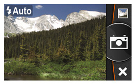
Sample photo taken with the Garmin Oregon 650t
Camera
I don’t claim to be a great photographer, but I’ve uploaded an album of photos taken with the 650t. Nor did I spend a lot of time on each shot, so this should give you an idea of the quality you can get from a quick snapshot.

Garmin Oregon 650t camera screen
Topo maps
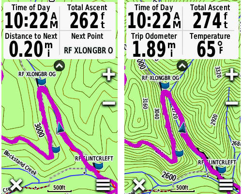
I’m not a big fan of the “t” units, since they only have 1:100,000 scale maps, and you can get free 1:24,000 scale maps from GPS File Depot. For most folks, buying the “t” models just doesn’t make sense. You can see the difference in the screenshots below.

The 650t comes with prelaoded 1:100,000 scale topos (seen at left), but you can get more detailed 1:24,000 scale topos (seen at right) for free
Battery pack
The other thing that sets the 650 series apart from the 600/600t is the included rechargeable li-ion NiMH battery pack (available as an accessory for the 600 series). The nice thing about this is that you can plug it in and recharge it without removing the batteries. And you can still swap out the li-ion NiMH pack for a couple of AAs in the field though.
For the rest of the story, see my Oregon 600 review.
More Garmin Oregon 650t reviews
- Consumer-authored Garmin Oregon 650t reviews
have been posted at Amazon
I’ll be posting more hands on GPS reviews as they appear, but in the meantime, here are some…
Other Garmin Oregon 650t resources
- The Garmin Oregon 650t owners manual
- An Oregon 650t FAQ
- Our Garmin handheld GPS comparison cart
- The Garmin Oregon 6xx series wiki
- The official Garmin Oregon 650t
web page
Compare prices on the Garmin Oregon 650t at these merchants:
- Check the current Garmin Oregon 650t 3-Inch Handheld GPS with 8MP Digital Camera (US Topographic Maps)
price at Amazon
- Check out the Garmin 650t
at REI.com, where satisfaction is guaranteed and members get 10% back on eligible purchases
- Get the Garmin Oregon 650t from GPS City
- Buy the Garmin Oregon 650t
direct from Garmin


It’s actually a NiMH battery pack, not a lithium-ion battery pack.
Doh! I think that’s the second time I’ve done that! I’ve fixed it, thanks.
Still says…. “Or choose the 600t to keep the preoaded topos, but you’ll lose the 8MP geotagging camera and internal rechargeable li-ion battery pack”
Also…. “And you can still swap out the li-ion pack for a couple of AAs in the field though.”
Crap! Thanks, I fixed it.
I noticed on my 650T, that the build in topos have more detail in terms of 4×4 dirt roads in the mountains, and hiking trails, that any of the free 24K topo maps for Utah. For that reason alone, I’m finding myself using the built in topos more often.
The 100K scale maps and the USGS topos they are based on often show a different 4WD road set than 24K maps, and you’re right, this is one place where they can be useful.
Rich, please submit original unedited photos using the provided link here:
http://garminoregon6xx.wikispaces.com/Photo+Album
Thank You!
Done!
I am new to BaseCamp software. Can I get my BaseCamp updated so I don’t have to have my Oregon 550T plugged in to see the topo map detail on BaseCamp?
Not that I know of, but you can download one of the free topo maps from http://gpsfiledepot.com and add it to BaseCamp.
Has anyone had any problems with navigation on the 650t? On a recent outing, when touching a spot on the screen the 650t said it was 7783.31 mi at 067 degrees while the correct distance was about 800 yards at approximately 40 degrees. It would show the correct distance an bearing when selecting a location nearby ( in the same lake).