GPS for biking!
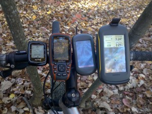
No, I’m not going to recommend a GPS for biking setup like the one at left. But suffice it to say, I do spend a lot of time biking with various GPS units. And whether you are a road biker or a mountain biker, there’s a GPS that will work well for you, and you only need one on your handlebars! Either type of cyclist will have special needs, so let’s take a look at the options for each:

GPS for road biking
GPS Cyclometers
The lower level Garmin Edge series is comprised of cyclometer-type GPS receivers. All of them have high-sensitivity chipsets for superior satellite reception in urban canyons and under canopy. While they are excellent cyclometers, they aren’t all that great as navigation devices (more on navigation options below). If you are primarily wanting to track your performance though, they can be an excellent choice.
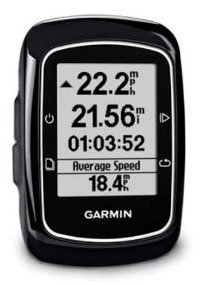
A new model is the Garmin Edge 200 (seen at right), which is a basic cyclometer, though you don’t have to calibrate wheel size or mess with wires (yay!), plus you can upload your tracks to online maps and see where you’ve been and get some basic stats.

The Edge 500 adds a barometric altimeter and lets you add a heart rate monitor.
Models with turn-by-turn routing
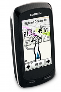
If you want something for navigating the roads you’re riding, you’ll probably want a GPS with turn-by-turn navigation. Several Edges offer this capability. The newest model is the Garmin Edge 800 (shown at left), which brings a touch screen interface and extensive mapping capabilities to the Edge series. The previous generation includes the Garmin Edge 605 and Edge 705, the first models with color screens and mapping capability (maps purchased separately).
GPS for mountain biking
If you want something that is primarily a training partner, the Edge series (described above) is a great choice. But most mountain bikers getting a GPS will want one that has better backcountry navigation features. Here are my top choices:
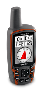
- The Garmin GPSMAP 62s (at right) has all the latest features, such as advanced track navigation, and the ability to add Garmin custom maps or BirdsEye aerial imagery. I prefer it to touch screen models such as the Garmin Oregon 450 simply because it’s easier to operate (and change screens) on the fly.
- Don’t want to spend as much? Consider the new Garmin eTrex 20, which brings a bevy of new features to a low-cost unit.
And no matter which unit you end up with, remember that there are plenty of free topo maps available for Garmin mapping units.
Related posts:


Hello,
I’m thinking the Garmin 800 is the be all end all for me. I road cycle and want to be able to have clear turn by turn instructions for upto 6hr routes around the English countryside. Having planned the route on my laptop/tablet then uploaded it onto the device. I only use the quiet roads which would mean having the trail map pack am I right or should I consider anything else?
I would need to know which map you are looking at to be able to verify that it is the right one, but as long as it has routable roads you should be fine. The best way to plan a route may be to create a course using Garmin Connect. And yes, this sounds like a good unit for you.
Well it will be all on road as I have a road race type bike. There are two similar priced bundles:
http://www.gooutdoors.co.uk/garmin-edge-800-trail-bundle-p207364?utm_source=google&utm_medium=SEO+product+search for £349
OR
http://www.amazon.co.uk/GARMIN-Cycle-Computer-Trail-Bundle/dp/B0049XTHE4/ref=wl_it_dp_o_pdT1_S_nC?ie=UTF8&colid=ZA466ITXU89X&coliid=IMZMJJLVABB3Z for £299
They seem to be the same thing as this…
http://gbr.garmin.com/on-the-trail/maps/recreational-maps.html and those maps have routable roads so I think you’re okay. The other option would be to get City Navigator maps.
We are going back to North and West India for three weeks cycling over the Christmas period after doing four weeks in South India last year. We are looking for a mounted GPS navigator (like the E Trex 20) which we will use to hopefully navigate our way around without using the main roads. The primary function is simply an Indian road map but I guess it will come with speed, direction, mapping etc. We don’t want to spend $NZ500 or $NZ600 for the expensive ones. What do you recommend?
The eTrex 20 would work fine, but you may want this map… https://buy.garmin.com/shop/shop.do?cID=253&pID=65217
Be sure to look at the coverage details.
Hi
Can somebody give me direction in regards to rechargeable device to work with my SON28dynamo hub, i have just finished my first bike touring in south west Australia and it is realy essential to be able to charge my I PAD and I PHONE during the ride.
I consider to buy the GPS Garmin 62s, is it possible to charge it as well ?
Thanks
Ishay
Perth
What kind of power output do you get? What sort of connection is available?
Hi,
I am searching for a christmas gift for my brother…he mountain bikes frequently and just moved to a new city where he uses he bike often as transportation…I would like to get him a gps to mount on his bike that will serve him use while he’s mountain biking and also one that will allow him to easily explore what the new city has to offer. any suggestions? Thank you
I like the Garmin GPSMAP 62s. I’ve got many units, but it is my fave for biking. Realize that it doesn’t come with maps, but there are plenty of free topos. The best city maps you need to pay for, but there is also Open Street Map which may work fine for him.
Thanks so much…something I’m definitely looking into!
Hi Rich,
My situation is similar to that of Julie’s brother. I do a lot of back road cycling, mostly gravel roads in Nebraska, including some competitive events. These events and be 100 – 150 miles in length and the routes are quite circuitous. It would be great to be able to load the course map into a gps device and get turn by turn directions.
I also do some touring in unfamiliar locales, and it would be great to know where I am at any given time and to get turn by turn directions.
I have some questions and concerns about maps. I would like to take a printed map with me in addition to the GPS. I already have Basecamp and have attempted to use it with my Garmin Nuvi. I find it difficult to use and I can print only a one page map–whether the route is 50 ft. or 50 miles, it will print a one page map, which is not very useful. Am I doing something wrong, or is this a limitation of Basecamp?
I see you like the Garmin GPSMAP 62s for mountain biking. That is a bit more than I really want to spend, but could if I need to. I’ve looked at the Etrex 20, but don’t know if it would do the job for me.
In summary, what GPS devise(s) do you recomment, and which maps and mapping software do I need?
Thank you,
Patrick
Want to add to my post abve:
1. Sorry for the typos and misspelled words.
2. I may have made it sound like I’ve already ruled out the Etrex 20. Not so. I just want your opinion whether that would be a good choice for me.
3. One thing I forgot to mention is that I also want to use this device for pedestrian navigation in the city. I’m going to Lisbon in June. I was in Bangkok last June and wished I had something. I don’t have a smart phone.
Thank you,
Patrick
BaseCamp isn’t the best for printing. I prefer National Geographic Topo, which is no longer being made (but still available). More info here… http://gpstracklog.com/2012/01/handheld-gps-201-mapping-software.html
The button placement on the 62s is much better for a biker than the eTrex 20 but otherwise the latter should meet your needs. Hope this helps.
I have a map62 that I would like to mount to my mountain bike. Garmin has a mount, but it looks kinda sketchy, a couple of zip ties and a clip. I’ve been looking for a sturdier mount and I swear I saw a cage style awhile back. Anyone have a clue?
Ned – I had the same concern, but am using the “sketchy mount” with my eTrex 20 and it seems to be OK. It holds the device very securely, and I’m sure the zip ties won’t break. There could be a problem with rotation, but I haven’t experienced that.
I like it as well. I use it w/ my eTrex 30 on my mountain bike on fast bumpy trails. I have crashed several times with no harm to my eTrex. I admit I was concerned about the wire ties at first, but they are actually quite workable. The rubber on the back of the mount where it engages the handlebar is very grippy and compressible. When you tightend down the wire ties, it is mounted securely while offering some minor shock absorption.
Not having any spare wire ties on hand, I have even used a knife tip to carefully open the latch on the wire ties to reuse them on another bike before returning the mount to my own.
The only hassle I’ve had so far with the mount is remembering how to remove the GPSr. Its actually easy to do if you remember the right direction to push and how much force to use on the release catch. Otherwise, I end up using too much force on the GPSr itself and then having it violently come loose, scrubbing my knuckles.
I like it… http://gpstracklog.com/2012/09/my-new-favorite-bike-mount.html
Before posting my query here, I read the reviews of the Garmin bracket at REI which seemed to bolster my suspicions of sketchyness. But if you guys are endorsing it, I’ll go for it. Thanks!
I also mounted an etrex20 using the Garmin bracket and it worked very well. I often struggled to remove the device from the bracket and used quite a lot of force getting the device off (I know – brains not brawn) but the bracket stayed firmly intact on the bike. My only comment is that the etrex20 screen is so small that I often found myself zooming in and out to try and get a feel for where we were (cycling in India), which necessarily involved stopping which my wife was none to pleased about. This was especially so navigating in cities. A much larger screen would make a big difference. We also found it amusing when the only time we entered coordinates for a hotel took us exactly to the right spot only to find a completely different hotel – of course the hotel had somehow provided the wrong co-ordinates – but hey its India!
You are sure the hotel just didn’t change hands? Multiple times in the US I arrived at a hotel or restaurant to find that it was a completely different hotel or restaurant than expected. Eventually I realized that the establishment has just changed names/owners. Sometimes the place has closed and there are weeds growing up through the parking lot. To me, it feels a little surreal… almost like I’ve done a little time travel into the future. Except it occurs to me that the overgrown parking lot in front of me is actually the present and it was my belief that the place would be open that is outdated. Similar feelings happen when you arrive at a spot where you are to exit from the freeway and you find no exit. Is it cloaked? In my case, the discrepancy has been due to outdated maps or Point of interest (POI) data.
I just found the cage style mount I was seeking….http://www.amazon.com/Mount-Garmin-GPSMAP-Series-System/dp/B004GVZEM8/ref=wl_it_dp_o_pdT1_nS_nC?ie=UTF8&colid=2CUN6E3YX2WCP&coliid=I395V1D12RBZS2
Good ol’ Amazon
I’ve used plenty of RAM mounts, but still prefer the new Garmin mount. I like the fact that it’s a little lower profile too.
I Mt bike and plan on riding dirt road trips and backwoods adventures mostly in North America.
I was considering an Oregon 600 or a etrex 30 till I read this page and you recommend a 62s.
So what would be the main reason you would pick the 62s over the Oregon 600.
Thank you
With a touchscreen, you have to look at the screen to switch pages. With a unit with buttons you can switch pages on the fly, without looking at the screen. The front button arrangement on the 62/64 series makes this even easier.
Dear customers:
This is housheng from Meilan, we are a professional manufacture provide Bike related LED Lighting, Power supply, Charging solution products.
We would highly recommend our hottest selling products and the newest ones to you.
Kindly please use a little bit time to find attached files with more information for your reference.
Or please forward to the right person in your company who handle of this. Thank you very much in advance!
Please contact me if you have any further questions. 🙂
I need a GPS for cycling as well as for GeoCaching. The cycling part needs to accept the ANT protocol so it can read data from my power meter such as cadence and power, and HR from a chest strap. Also needs to be able upload to Garmin Connect and then to a cycling specific website. For the geo-caching part I need to be able to load data direct from the Geo Caching website.
Ideas?
Thanks in advance
Jonathan
I’m in a similar situation. I’m looking for a do-all GPS unit for road and mt. Biking, hiking, and kayaking. I want the biking data and ANT and/or bluetooth connectivity. I’m leaning towards touchscreen, but due to lack of experience with other interfaces, I’m open to recommendations.
I bought the Garmin Edge 500 gps here and am very happy: http://tiny.cc/edge500gps
Hi
I need the garmin edge 705 3.1 firmware to downgrade my GPS …
I can’t manage to find it on the garmin site and french garmin support refuse to send it to me.
Does anyone CAN help me ?
Thanks
Regards
Gautier (France)
Try not to depend too much on GPS. You’ll lose track if you drop it one day. Memorize the road and all the way you go. Enjoy!
Nowadays GPS is very efficient tool used to track the location and time information in all weather conditions. My brother always like to ride on bikes specially at nights and evenings. So this article is really wonderful to track his locations. Thanks for sharing useful information about GPS for biking.
I am grabbing one of these for sure.