 Yesterday morning there was an announcement on the OziExplorer discussion board that a new version had been released which included support for .gpx and .kml files. The upgrade was a little buggy at first, or I would have reported it yesterday, but an updated version has been posted with a fix, and it works great.
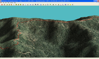
OziExplorer has long been one of my favorite mapping software programs. Even if you don’t use it everyday, there may be times when there is no substitute, unless you have access to a high-end GIS program. Ozi accepts shapefiles (.shp and .e00 formats) and allows you to import MrSID (.sid) imagery. The screenshot here shows a .gpx track, superimposed on a recent color aerial photo of my county (.sid format), re-generated in Ozi’s 3-D module.
OziExplorer allows you to download free USGS topo maps (DRGs) and aerial photos (DOQQs), providing a low cost way to get access to maps of much of the U.S. for free. There is a full chapter on Ozi in my book, GPS Mapping. No program is perfect, but this one comes close. If they could only implement a better method for seamless map printing…
