UPDATE: Read my hands-on Garmin Oregon 400t review.
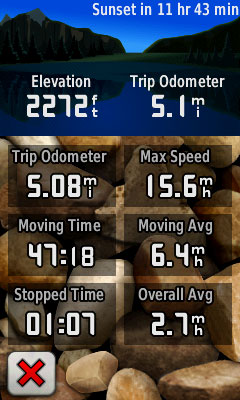
I received a Garmin Oregon 400t review unit yesterday, right before a scheduled bike ride with a friend. I scrambled to get Garmin’s Colorado mount on my bike, which works with the Oregon series, since the carabiner attachment is the same on both models. (The RAM mount will not work however, since the Oregon is smaller than the Colorado.) I had no time to set up waypoints or routes, or load tracks. Nevertheless, I do have some first impressions to share…
Screen visibility
The screen seems even dimmer than the Colorado in direct sunlight; the touch screen is very reflective, leading to glare problems. It was not easy to see on my bike unless I was in shade, where visibility was very good. Turning off shaded relief (shown below on and off) improves visibility, but the map loses a lot of visual appeal by doing this.
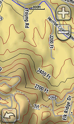
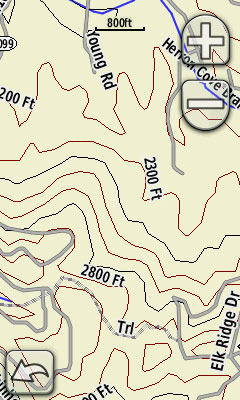
The excellent Garmin Oregon wiki has tackled the visibility issue in more detail. I’m going to try and focus some of this post on areas not covered there yet.
Touch screen
The touch screen is a joy to use. I had very wet, sweaty fingers yesterday and had no problem with touch screen operation.
You can select a location by tapping the map. My first attempt at tapping a nearby mountain peak got me close. Once I zoomed in I could see that I was about 200 feet off.
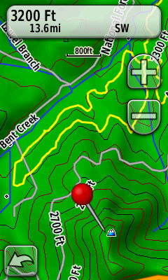
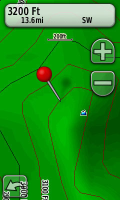
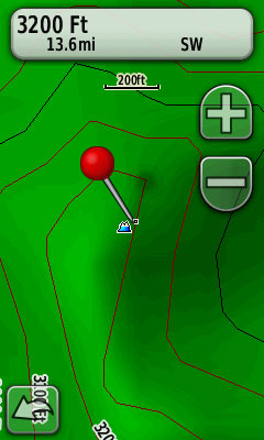
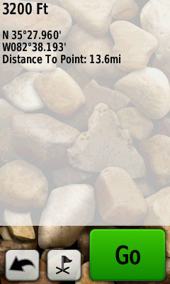
But then you can drag the map underneath the pushpin — the pushpin doesn’t move, but the map does, allowing you to fine tune the location of the selected point, as shown at left below. Now tap the information box at the top of the screen to display options to navigate to the location or save it as a waypoint.
Track management
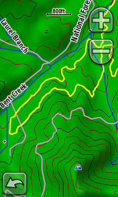
Updating to firmware version 2.2 means improved track management tools, including the ability to show saved tracks in a choice of 16 colors; I used yellow below. I am very happy to see this since I often download tracks from others ahead of backcountry adventures.
Text entry
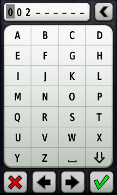
Text entry is much easier on the Oregon series than on the Colorado, eTrex or GPSMAP 60/76 series.
Accuracy
I ran my 60CSx side by side with the Oregon 400t yesterday on my bike ride. I did not change settings or check them till today, so the 60CSx was set to record every three seconds, while the Oregon was set to the default auto record. The 60CSx gathered about 3.5 times as many track points as the Oregon. So what follows is a very preliminary and decidedly unscientific test.
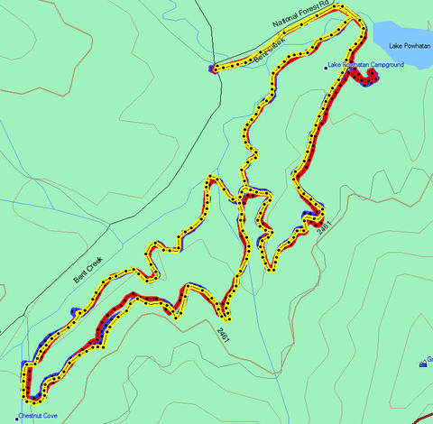
The image below (click the picture for a larger image; here is the .gdb MapSource file for download) shows the Oregon 400t track in red, the 60CSx in blue, and a previously collected track of an almost identical ride in yellow. The 60CSx track matches up so well with the previous ride that it rarely shows under the yellow. There were several locations where the Oregon track deviates by 80-100 feet, though I did not see the type of error sometimes reported on the Colorado, which is much more disconcerting.
That’s it for now. Time to work on a full review.
Related post:

Thanks for the report, Rich. I was especially interested in how to select a point accurantely via finger. You covered that very well.
I was hoping the reviews would make me want to buy the Oregon, but I’m concerned about the readability of the screen. I’ve never been very happy with the Colorado, and the Oregon is clearly not an improvement.
I love the shaded topography on these units, but it comes at too high a cost in non-backlit visibility and slow map panning for me.
The text entry looks great on the Oregon — the best Garmin has done yet in that respect.
I’ve given up on using the hand-helds on my bike (road bike). I got the Garmin Edge 705. I have both City Nav and Topo on it, and that has been working very well. (Except when I forget to charge it, anyway.)
Thanks again for the report.
Peter
where would we all be without GPS? i work as a courier and GPS makes my life so much easier, and its good too see the price of these coming down all the time, i bought mine for £169.99 from http://www.gadget-mania.co.uk which i think is a great price. and as time goes on im sure they will only get better and better, dont you just love technology 🙂
Is the readability of the Garmin Edge 705 screen in sunlight much better than the Oregon and Colorado? When the Oregon was announced, I thought that it would be perfect for bicycle touring, but the readability in bright sunlight seems like a major flaw.
Yes, I think the Edge screen is better, but the angle of the stem mount (recommended) impacts visibility greatly. I discussed it in my Edge 605 review…
http://gpstracklog.com/2008/04/garmin-edge-605.html
Unless you need the Edge’s features, you may want to consider one of the eTrex line like the Vista HCx.
Can you view multiple tracks at the same time on the map? Currently Garmin Colorado series can’t support this feature.
Yes, you can on the Oregon. Hopefully Garmin will include this in the next Colorado update.
Unit looks really great up from but if you have had another of Garmins upscale units like the 60csx it will leave you wanting more. Has several great features but is so far behind the 60csx in so many ways. I returned my Oregon and got another 60csx.