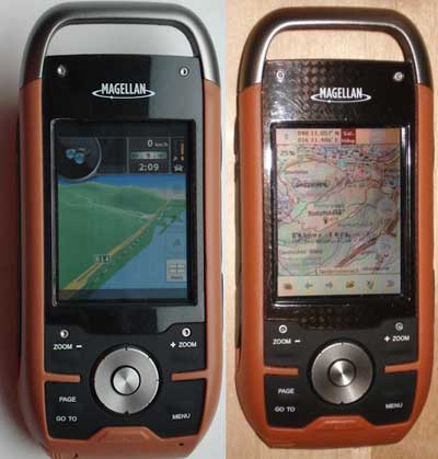
There’s been a lot of progress recently on making custom maps for the Magellan Triton series. For any of you with these handhelds, here are some resources to check out…
- Triton RMP allows you to calibrate raster map images for use in the Triton series
- The Yahoo Triton Group is the best place to find discussions about Triton RMP
- Meanwhile, over at TritonForum.com, at least one person has succeeded in getting Nav N Go iGO and OziExplorer CE to work on a Triton (see image above from the TritonForum)
- There’s so much progress being made that the Triton Forum has put up two new sections on custom maps and custom software
development; for now anyone can access these, but at some point in the
future you may need to become a registered member (free) to view them
These developments should make it possible to use nearly any scanned map or aerial photo on a Triton. Congratulations to all the folks who have been working on this!

