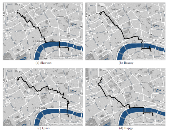
New route options, such as most beautiful, quiet or happy paths may be coming to online mapping programs.
When you search for a route using your GPS device or an application like Google Maps, you have several options for what kind of a path you want—walking, cycling, fastest, shortest—but what if you could plot the most beautiful route as well? Yahoo Researchers have conducted a study proposing methods for selecting the most scenic route to get from point A to B instead of just the fastest.
“We find that, on average, the recommended paths are only 12% longer,” the study states. In walking time, that would equal to about 7 minutes extra time in order to take the more scenic route.
In this study, researchers crowdsourced information about which London avenues and areas were considered the most beautiful, peaceful and happy and used that information to plot routes using GPS, then used volunteers to walk the paths and analyzed feedback.
The researchers acknowledged that crowdsourcing information for every major city would be not only time-consuming but also impossible and completed a second study in Boston utilizing metadata of pictures from Flikr to discover the most beautiful scenery. The second study was also met with success, but the research does acknowledge the troubles with this method. Certain parts of the city are more quiet during certain times of the day, week or year. Also, personal ideas of beauty and memories attached to an area can have an effect on the individual’s perception of the area.
“In our user study, some respondents were happy to visit streets full of shops, while others cringed at the idea of facing a human mob of shoppers,” the study said. Researchers proposed personalizing map routes tailored by the user’s past visits to help select the best route for each person.
Overall, it seems like quite a nice idea with a very complex goal of assessing what is considered “beautiful” for each person. Regardless, it seems like an excellent way to discover the more scenic locations in a city.
