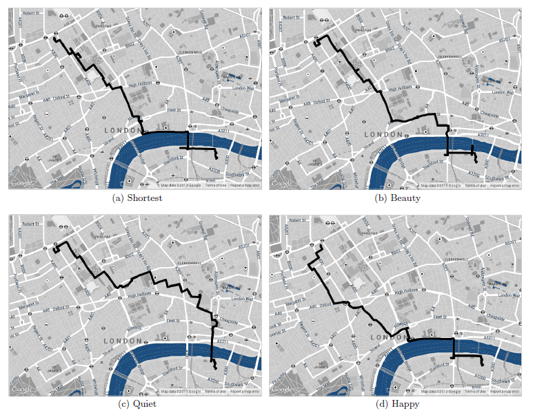
New route options, such as most beautiful, quiet or happy paths may be coming to online mapping programs.
When you search for a route using your GPS device or an application like Google Maps, you have several options for what kind of a path you want—walking, cycling, fastest, shortest—but what if you could plot the most beautiful route as well? Yahoo Researchers have conducted a study proposing methods for selecting the most scenic route to get from point A to B instead of just the fastest.
“We find that, on average, the recommended paths are only 12% longer,” the study states. In walking time, that would equal to about 7 minutes extra time in order to take the more scenic route.


 older than USGS aerial photos. In the image on the right below, I’ve drawn a track along a logging road. To the left below, you can see how I’ve been able to update a topo map with the hand-drawn track.
 particularly useful for people new to the world of GPS, who may not be ready to lay out money for mapping software and aren’t quite sure what all they can do with it. If you’ve never transferred your track to your computer, to view it on an aerial photo, you’ve got a treat coming. And now you don’t have any excuse not to!


