UPDATE: I’ve got a new page devoted to the Garmin Edge 800, complete with links to hands on reviews.
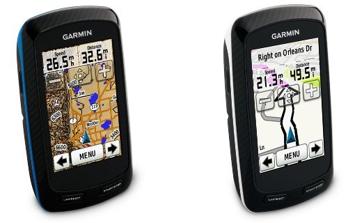
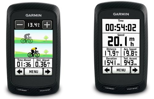
Garmin announced a new cycling GPS this morning, the Garmin Edge 800. The big news is that this is the first touchscreen model in the Edge series. It also brings BirdsEye aerial imagery and Garmin custom map capabilities to the Edge line. I’m curious about Garmin mentioning simplified route planning through BaseCamp; I’ve never been a fan of the Edge’s use of courses instead of tracks, although much of that may be due to my background as a longtime mountain biker and handheld GPS user. There’s nothing in the specs that leads me to believe the Edge brings more traditional backcountry navigation tools to the plate though.
DC Rainmaker, who is starting to be the go to blogger for Garmin fitness products, already has a detailed first looks review posted. I pinged him on Twitter and asked about visibility issues with the touchscreen and he said “It’s actually even more visible, I was pretty amazed. No glare issues.” Fred Zahradnik, who also posted an early review, concurs. This caused me to dig a bit deeper — I think we’ve seen this screen before. At 160 x 240 pixels, it is not a high-resolution screen. As a matter of fact, the resolution and screen size specs match up perfectly with the Dakota 20. It is of course possible that some more recent screen technology improvements have been introduced, ala the Oregon 450.

The Edge 800 will be available in various bundles, priced from $449.99 to $649.99 when it starts shipping in October.
Here’s the full news release.

Rich,
Could you elaborate on this? “I’ve never been a fan of the Edge’s use of courses instead of tracks, although much of that may be due to my background as a longtime mountain biker and handheld GPS user. There’s nothing in the specs that leads me to believe the Edge brings more traditional backcountry navigation tools to the plate though.” I also am a MTB Biker that is considering an 800 for biking in areas like western NC. I have friends that use handhelds (Garmin 60CSx) that think they perform better in backcountry, but I don’t see anything in the specs that indicate they would be any different. Thanks!
The Edge series is more for tracking fitness stats.
If you want to download a track or waypoints for Bent Creek or Tsali, and then use them for navigation, it’s going to be a pain with the Edge. They do not use traditional waypoints, routes and tracks. You would need to convert them to another format and you still wouldn’t have full navigation capabilities.
If you’re training and want to see your stats, and riding the same trails over and over again, the Edge may be a good choice.
Hope this helps.