Sunday, March 18, 2012

GPS Jamming Becomes Big Problem in Europe

gps-jammer.jpg

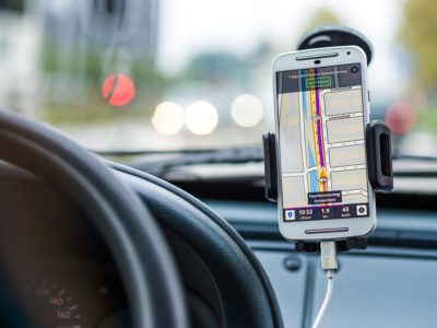
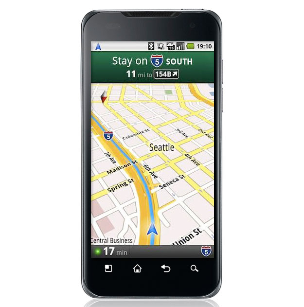
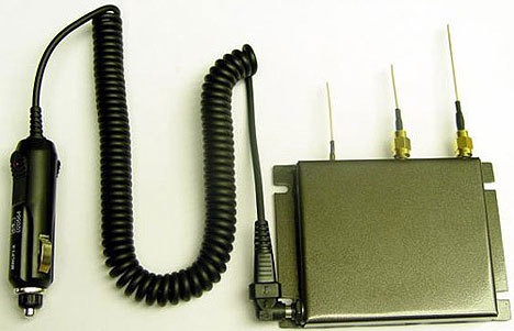
Although GPS is one of the most important technologies of our age, it is surprisingly susceptible to tampering and failure. GPS signals are actually surprisingly weak with leaves them vulnerable to not only spoofing, but jamming. While spoofing is the process of sending fake signals to a GPS device to make it think that it is in a different location, jamming completely scrambles the signals so that they become unusable.

In the United States, both jamming and spoofing are illegal, but other countries (which often use GPS as it was the first and arguably most reliable system) the laws vary and are sometimes nonexistent. This has led to many problems with GPS jamming and spoofing in other countries and here in the US.  read more

It is Illegal to Use Phone GPS While Driving in RI

attempting-to-text-on-cell-phone-while-driving-car-725x482

The Rhode Island Traffic Tribunal made a landmark decision recently that may have cemented the beginning of troubles for phone GPS apps. Recently, the ruling from the Tribunal’s Appeals Panel upheld a state fine for a man in Rhode Island who was given a ticket for looking at his phone while driving. The man claimed that he was checking his GPS, not texting.

“…Based on the plain language of the statute,” the judges wrote in their decision, “a reader may be looking at any visual display on the phone’s interface and be in violation of the statute. To hold otherwise would defeat the purpose of the statute: to prevent drivers from distractions caused by operation of a cell phone while driving.” read more

No Satellite Next-Gen Navigation System

uas

Credit: UCR

We all know that while GPS is great for getting us from point A to point B and about a million other things, but there are still flaws in the system. There are instances when GPS signals just can’t reach you, not to mention the signals put out from GPS are actually pretty weak, which leads to spoofing and jamming. Of course, GPS issues are no small problem for conventional cars, but with self-driving cars and unmanned aircraft systems (UAS) on the rise these issues could become a lot worse. We will need a much more accurate navigation system, or at least a back-up.

Currently, the only global navigation systems in place or developing operate by using satellites. This includes the United States’ GPS, Russia’s GLONASS, and Europe’s Galileo. Since all of these systems function primarily the same, they all have about the same accuracy. The University of California Riverside (UCR) has the Autonomous Systems Perception, Intelligence, and Navigation (ASPIN) team focusing on creating an alternative navigation system, and they’ve recently made some big discoveries.

read more

Built in GPS Disappoints Customers

rent1

Technology in the world today is advancing so fast that it is sometimes hard to keep up. With that being said, more and more cars are coming equipped with a built-in navigation systems so that consumers won’t need to use a stand alone model or their smartphone.

Unfortunately, while the technology is becoming available for the public, not many people are utilizing it. In a survey conducted by J.D. Power and Associates, it was revealed that about 1/3 of people who had built-in navigation gave up on it after less than 2 weeks, and more than half never used it at all. Additionally, almost 2/3 of people with the built-in navigation said that they continue to use their smartphone as a GPS at least some of the time. read more

GAGAN Redefines Navigation over India

300px-indian_space_research_organisation_logo-svg

India’s GPS-aided Geo Augmented Navigation System, also known as GAGAN, is trying to make big moves. The developers, Indian Space Research Organization (ISRO) and the Airport Authority of India (AAI) have nothing but pride for it, and the Indian government has announced plans to make GAGAN receivers mandatory for all aircraft that passes through Indian airspace by May of 2019.

For those of you who are confused, GAGAN is a satellite-based augmentation system (SBAS) specific to India. India is the 4th country to create an SBAS system (behind the USA, Japan, and Europe) and it will inter-operate with existing systems. GAGAN uses technology that relays data from GPS satellites, augmented satellites, and about 15 reference stations on the ground. read more

Why the Prime Meridian Isn’t Where You Think it Is

640px-Primemeridian

The Prime Meridian, as I am certain most of you probably know is located in the United Kingdom at the Greenwich Royal Observatory in Greenwich, England. This line represents the zero value on the longitude scale and separates the eastern and western hemispheres on the globes. It was set based on a vote which included 25 nations in 1884 and basically standardized mapping, set time zones and has been invaluable for any other number of important things. It’s a pretty big deal.

If you visit the Greenwich Royal Observatory, you’ll see a big fancy metal line set in the ground to represent the divide and millions of tourists every year take photos at the location, with one foot on either side of the world.

But there’s a problem. That line isn’t actually the Prime Meridian. read more

Top Smartphone GPS Navigation Apps

a

Smartphones might not always be the most ideal option for GPS navigation, but there are times when it makes more sense. After all, no matter where you are, you probably have your smartphone on you, right? Well, while there are literally dozens to choose from, if you’re only going to use it some times then you probably don’t want something you have to pay for, right?

So, here are my top three picks for the best free smartphone navigation apps for those little emergencies or even day-to-day use.

1. HERE – Google Play, iTunes

Nokia’s HERE, also known as Here Maps, was recently sold to BMW for quite a pretty sum. The maps themselves are hailed as being extremely accurate and BMW intends to use them for self-driving cars if that says anything. The routing isn’t half bad either and tends to mimic dedicated GPS units more than Google does, making it a little easier to use.

2. Google Maps – Google Play, iTunes

If you have an Android, then you already have Google Maps by default. Google Maps is the default go-to for most people and its maps are pretty excellent. It also offers voice guidance, although personally I don’t care for how complicated it can be to preview the route and it’s dangerous to do while driving I think. Regardless, this is still a pretty solid option and has great search functions.

3. Maps.Me – Google Play, iTunes

This little app is one that hardly anyone even knows about, and I actually found it on accident. Completely offline, Maps.Me is first and foremost an offline atlas. The company recent introduced routing and while you do have to download ahead of time, the fact that it requires zero data is worth the time. The routing is a little odd sometimes, but if you can read a map, then this is still a great option. Unlike the others, it does require a bit more planning ahead of time, as you probably won’t want to be routing on the fly.

How accurate are they?

location

With dedicated GPS devices, it’s easy to measure and compare how accurate each GPS device is, how well it tracks and routes and whether or not the signal is lost. However, with smartphones it doesn’t depend on the app as much as the actual device itself. Some smartphones are better at GPS than others, and I don’t have access to enough devices to really give any tips on that.

For example, my LG G4 gets fantastic signal most of the time and rarely loses or does anything weird like jumping a few blocks at a time. My old Samsung, on the other hand, didn’t even know what GPS was, I don’t think. So it’s really going to come down to your actual device and how often the company updates the maps on the apps. Most apps update at least a couple times a year and Google and Here both update more than that. So sadly, you’ll have to test it out for yourself to determine which works best with your device.

So, for those of you who use your smartphone for navigation, which apps do you prefer? Do you have a suggestion for one that ought to be included? Let me know in the comments!


GPS Celebrates 20th Birthday Friday

gps satellite IIF

From guiding our military service men and women to finding your way around downtown LA, tracking your afternoon jog, or even deciding how far the green is on a golf course in Scotland, GPS has become a part of everyday life in more ways than most people realize. And Friday July 17, GPS is officially celebrating the 20th anniversary of FOC or full operational capability. read more

Will the Department of Defense Replace GPS?

GPS is one of those technologies that has completely changed the way that people function, and I would argue completely for the better. While I talk a lot about how knowing how to use a paper map is a good skill, at the end of the day, GPS is incredibly useful and helpful. But, according to an article by the National Defense Magazine, Defense Secretary Ashton Carter is somewhat less of a fan, and would be all too happy to see GPS reliance gone completely.

“[GPS] is very expensive to launch and operate,” Carter said during a podcast in April. According to Carter, GPS makes the United States vulnerable and “is impossible to use in the valleys of Afghanistan or in a big city, or in places where the signal is poor.” read more

App Provides Navigation Inside Stores

gpsindoor

Imagine it: you walk into the store with a short grocery list in mind. You input the items in your phone and an app immediately maps out the most efficient route to each item on your list. You follow the flashing blue dot from one item to the next, and the phone vibrates on occasion, alerting you to coupons and advertisements for relevant products as you walk past. This might be the indoor GPS of the future, and it’s available now. read more