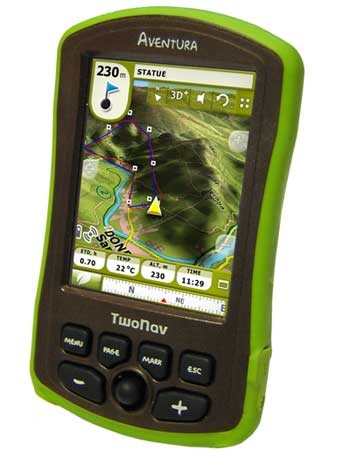
 I don’t often write about GPS receivers that aren’t available in the U.S., but I’m making an exception today with the TwoNav Aventura. For one thing, the company is on the lookout for a stateside distributor, so we may see it here yet. Another reason is it will accept just about any kind of map – more on that in a moment. The Aventura is a dual-use device, but it’s the handheld possibilities that excite me, so if you’re an outdoor type, I encourage you to read on.
TwoNav Aventura is a lust-worthy GPS
OnPar GPS

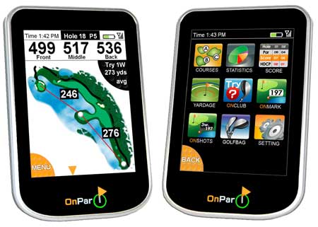
Looks like the Garmin Approach G5 may have some competition. Savant GPS has announced the OnPar GPS, which they claim is the “first hand held color touch screen GPS rangefinder,” and with availability slated for next month, it does indeed look like they’ll beat Garmin to market.
It looks quite attractive and perhaps even more robust than the Approach, but I have my doubts that they’ll be able to match Garmin’s skills when it comes to creating an intuitive interface. No word on price yet, but the screen is a wee bit bigger than that of the Garmin Approach (3.5″ vs. 3″).
GolfLogix GPS-8 review

UPDATE: Check out a new Garmin golf GPS in my Garmin Approach G5 review
The GolfLogix 2008 is the best-selling GPS for golfers. Why is it so popular? For one, it’s made by Garmin, the most popular GPS manufacturer in the world. It’s also built on the high-sensitivity eTrex platform, which translates into great accuracy (the GolfLogix 2007
used an older, less accurate GPS chipset).
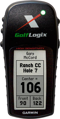
As you can see in the image above, the GolfLogix provides your distance to the front, center and back of the green. It also shows up to six hazards per hole, and identifies bunkers, water, lay-ups and carries.
Bushnell GPS to feature aerial photos and satellite imagery

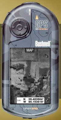
Bushnell has announced two new handheld GPS receivers that can accommodate aerial photos and satellite imagery (and apparently USGS topo maps). This comes hot on the heels of Lowrance announcing their iWAY 600C auto receiver. Assuming someone else doesn’t beat them to the punch, Bushnell will have the first non-PDA, consumer handheld GPS with this capability. Outdoor enthusiasts have been waiting a long time for a ruggedized GPS with this capability.
There are two models — the Onix200 and Onix200CR — the only apparent difference being that the CR has a color screen with higher resolution. Amazon says that the Bushnell Onix200 will be available sometime after December 22. The Onix200CR is due in February 2007.
Bushnell is hyping a screen layering feature, but it appears to only layer a navigation compass on the screen, rather than allow you to blend topos and aerial imagery. I’m a little disappointed that you can’t layer topo maps and aerial photos, but another concern is cost.
At first glance this doesn’t look too bad — $1 per map or photo, 25 for $20 or an unlimited annual subscription for $79. Which begs the question, after a year do I own the imagery or do I have to download it again every time I want to change images?
And consider this quote: "The ONIX200 series unit will store up to 12 photography (satellite or aerial) downloads at one time. Choose images of the same land at different levels of zoom, or broaden your coverage area by storing photos of separate areas."
With only 32 MB of user memory, the Onix200 series will accept only 12 images. And from that quote, and the layout of the download site, I assume that each time you change zoom level, it’s a different image and therefore another map or photo you are charged for.
Sounds a bit limited to me. Maybe Garmin will bring this capability to CES.
