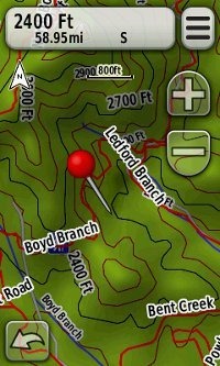
 Jim Bensman’s free MyTrails map for Garmin receivers now covers 37 states, including the entire eastern US. Pretty cool for a project that started with just St. Louis area trails! This goes to show what one person can do, and it makes it even harder for me to understand why Garmin hasn’t put out a better trail product, given the massive amount of trail data found at Garmin Connect.
This is a transparent trail map, so it won’t block other maps enabled on your device. In the image at left from Asheville, NC’s popular Bent Creek area, some trails (gray) are on the underlying Garmin Topo US 2008 product, while others (red) only appear on MyTrails.
To get the MyTrails map, simply follow the link above and download and run the .exe files. Once they run, the map will be available in MapSource or BaseCamp. While the trails aren’t routable, it is nice to have additional information available on your GPS while out in the field.
