Last updated December 3, 2009
When selecting a GPS for hiking, two key criteria come to mind. It’s likely that a hiker will want a unit that’s good for navigation, and will not want to have to hold it out at arm’s length for the entire hike, which means that…
Reception is important for hikers
I recommend a unit that will get great satellite reception, so I’m going to limit my recommendations to models with a high sensitivity chipset, such as the SiRFstar III or MediaTek chipset. With these receivers, you can stick them in your pocket, or a mesh pocket on a day pack, and you are still likely to have adequate reception. Some of this is dependent upon how the satellite constellation is configured for your location on any given day, but overall, I think you’ll be happy with the performance of these units.
Navigation and maps
The other important thing is getting a receiver that is set up to navigate. Not all GPS receivers can accommodate topo maps. If you’re content with a receiver that won’t let you add detailed maps, check out the Garmin eTrex H. Otherwise, stick with the ones below.
Be aware though — none of these units come with any kind of detailed map. Fortunately, there are free topo maps for most states for Garmin units.
Budget GPS for hiking
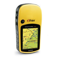
The eTrex Venture HC (pictured) has a sunlight-readable color screen, and the ability to accept detailed topo maps. The retail price is $200, but I typically see the Venture HC discounted to the $115 to $130 range.
Mid-range GPS for hiking
I’m going to recommend the Garmin eTrex Legend HCx as a mid-range unit. Stepping up to the Legend HCx you get expandable map memory, plus it supports turn-by-turn routing, making it useful for city navigation in your car as well. You’ll need a mount, City Navigator software, and preferably a power cord, but then you’re set up for turn-by-turn routing. The retail price is $269.99, but as of this posting the Legend HCx can be found for around $180.
The top of the line GPS for hikers

There are several units to consider here; each has a barometric altimeter and tri-axial electronic compass:
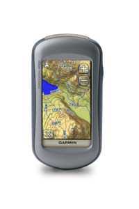
One of the newest Garmins, the Oregon 550t, combines a high resolution, touch screen interface with pre-loaded topo maps of the entire U.S. It also has a built-in 3.2 MP geotagging camera. As a new unit, the price is still right around the MSRP of $599.99. I have a review unit in hand and should have a review posted by the end of November. In the meantime, you can read my hands on Oregon 400t review for a closer look at the Oregon series.
Another recent introduction, the Delorme PN-40 can accommodate aerial imagery and real USGS topos. It has a smaller screen than the Oregon (albeit more legible in most daylight conditions) and comes with powerful but complex software. At the time of this posting, it was available for around $300.
Finally, the brand new Garmin Dakota 20 is a smaller version of the Oregon. Once its been on the market for awhile, it should start to show up at a discounted and very attractive price.
Finding the best deal
You should find some good deals on the review pages for these units. Also, be sure to check out our GPS Deals site for current offers to reduce your cost even further.
Related posts

They will work fine elsewhere, but it may take a while to get the initial satellite lock after moving that far. You can buy maps from Garmin for many other countries, but the are also lots of free ones at http://downloads.cloudmade.com and http://mapcenter2.cgpsmapper.com
Typically these won’t give turn-by-turn directions though. The paid Garmin maps will (though their coverage may not be as good).
Hi:
I do canine wilderness search & rescue with my GPS. I have an old Garmin Etrex (legend?) that is about 8 years old & is finally going out on me, so I am in the market for a new one.
I have narrowed it down to the Garmin 60csx, the Garmin Colorado 400t/i, and importing the 24K topos/lakes, and the DeLorme PN-40. My concerns are as follows:
-the 60csx is supposed to be the “gold standard” for SAR & hunting for the last several years, with great accuracy with the SiRF chip
-Some places say the Pn-40 has the same SiRF chip; other places say it has a 32 channel reciever; which is it?
-All say that the Colorado has the least quality reception of the 3.
-The PN-40 has a tri-axial compass & doesn’t need to be perfectly flat or moving in order to read; both Garmins do. I also read 1 revew (from a mountain climber) that said that even after calibration the Garmins don’t take into effect atmospheric pressure??? I did not see this complaint re: the PN-40.
-Several complaints on the PN-40 were that battery life was terrible and that the software interface was horrible. RE: software interface, could this just be operator error/inexperience?
-Durability: many people say the PN-40 is far more durable than the Garmin units, and can actually be submerged without damage. Several people have complained that the battery compartment in the Colorado is not watertight, and hence, not waterproof to IPX7 standards. No data on the 60csx. I do not plan on submerging my GPS, but it is not uncommon for it to literally fall in / lay in the snow, or to be exposed to pouring rain for hours, without protection, or for me to beat it against rocks, trees, other equipment in my pockets or pack.
-Both have utm datum, forest trails available, (extra cost in Garmin). For continual $29.95 /yr, you get 1/24:000 USGS for whole country with DeLorme, with updated data, and areals w/ updated data (stripmining, new buildings, etc).
-I’ve had a Garmin; I’m more familiar with its ui; its ui is supposed to be more friendly for the average user. DeLorme is supposedly less “intuitive”.
-The new Colorados will supposedly let you import a jpeg file to superimpose onto your existing map; but the DeLormes will suposedly let you superimpose a competitor’s software, if you feel the need, but supposedly, their own software is good enough w/ trails, topos, areals, etc. that you don’t need garmin’s software. 60scx will not allow the ability to superimpose, oh, say, a DEM trail map.
-Finally, as a marketing / PR device, I read something about DeLorme offering the Haiti maps to relief workers deploying to Haiti for free. Theoretically, that would include SAR workers. I didn’t see Garmin doing anything like that.
-I saw pro’s and cons for customer service on both sides for both Garmin and DeLorme, so that was a wash.
-Overall, it seems like the biggest drawback to the PN-40 is the battery life, but the 60csx has been the “gold standard” for years. However, why would they improve other things, and change a chip that worked so well?
So now I’m totally confused. How bad IS the battery life on the PN-40 really, and how much better is this device over the Garmins, that “eating the batteries” is worth it? Am I just better going with tried and true 60 csx, or taking a chance on the colorado, buying the protection case to improve ruggedness and waterproofing capabilities, and knowing that the compass is useless and the altimiter will only be roughly accurate?
HELP!!!
Thanks so much.
The 60CSx used the SiRFstar III chipset, but no longer does. The DeLorme PN-40 never did. Manufacturers have been shying away from SiRF due to patent issues.
All these units suffer somewhat when a new chipset is integrated. Over time, with adequate firmware updates, they improve.
There are some new Garmins with the tri-axial compass (Dakota 20s and Oregon x50’s).
The PN-40 unit software is okay (not great), but the desktop program is hideous, as is battery life. The forthcoming PN-60 should be better in terms of the latter.
There were reported waterproofing issues with the early Colorados. Regardless of which model you get, I suggest adding a screen protector.
Garmin now allows custom maps and aerial imagery to be added to the Colorado, Dakota and Oregon series. The 60CSx does not support any form of raster imagery.
Hope that helps. Unless you are highly opposed to the touch screens, you might want to check out the Dakota 20.
this helps tremendously. thank you!
How does the Lowrance Endura Sierra compare to the Garmin Oregon 400T?
In my testing, not very well, though there have been some improvements lately in the Lowrance’s firmware and map offerings.
What would be the best unit for backpacking/kayaking/biking not worried about cost, I really do not want 2 or 3 different units to lean to run, thanks for your time
I’m not sure there is a best unit for all three. For backpacking, I’d look at battery life and weight. The eTrex Legend HCx is rated at 25 hours. For kayaking, well, a Garmin 76C(S)x floats. For biking, either would work.
But if it were me, I’d take a strong look at the Garmin Dakota 20. It can accept aerial imagery and USGS raster topos, unlike either of the units mentioned above. It’s the only touch screen Garmin I would recommend for a bike, as their screens aren’t as bright as non-touch / low resolution units. Battery life is rated at 20 hours, not bad, but it doesn’t float.
Hope this helps. Feel free to follow up with more questions.
It looked like there was a software problem with the Dakota 20 on several issues, loosing lock, compass not working do you know if Garmin has fixed the problems?
I have not seen or heard of those problems. Can you provide a link where they are being discussed?
The problems might of been when it first came out, here are the links
http://forums.groundspeak.com/GC/index.php?showtopic=228663
http://www.rei.com/product/790318
Thanks for that. Firmware version 2.2 “improved compass responsiveness.” You might want to ask at http://garmindakota.wikispaces.com/message/list/home
Will Mapsource version 3.02 work in the Oregon 450
Are you talking about Topo version 3.02? If so, yes, it should work fine.
Yes the topo version, thanks a lot for your help