As promised in last week’s review of MotionBased software, I’m going to show you how to use their site to download tracks for trip planning. Recently, I was trying to find a good map for Annadel State Park, a little slice of mountain biking heaven in Santa Rosa, California. My wife and I used to ride there all the time before we were married, when she lived within a stone’s throw of the park. About the time I lured her away, there was a massive reconfiguration of the trail system.
An opportunity came up to ride Annadel again recently, and I really wanted a detailed map so I could plan to ride as much single-track as possible. I turned to MotionBased and searched their extensive trail network for MotionBased users who had mountain biked Annadel, which turned up nearly a dozen tracks.
I was able to download .gpx files for each one. This feature is a bit hidden, so let’s look at how to go about it. Go to MotionBased.com and click the Trail Network tab. Use the Quick and Advanced Filters to narrow your search. In my case I chose Cycling (Mountain Biking),  Recreation for event type and California for location. I then narrowed the location to Santa Rosa using the advanced filters. This brought up 11 records for Annadel, which I selected using the check boxes. The next step is to click on the left side of the screen to select Map View instead of Table View. Your screen should now look something like the thumbnail to the right.
As you can see, there is a Google Map image on the left and a list of selected tracks on the right. Click the Info link next to one of the tracks and a balloon will appear on the map, providing an option to export as a Google Earth (.kml) or .gpx file. I downloaded the 11 tracks as .gpx files.
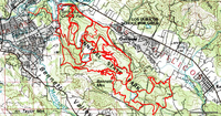
 There are other ways to do this, but I chose to open the saved .gpx files in TopoFusion and used its Cut Track feature to remove stray track segments. The result is shown in the screenshot to the left. I then transferred the tracks to my GPS.
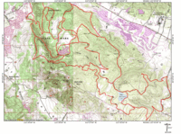
I was getting close to my goal, but I also wanted a good quality printed map. As much as I like TopoFusion, it and other TerraServer based programs have very limited printing capabilities, and TerraServer topo maps are fairly low-resolution scans. So I transferred  the tracks to National Geographic TOPO!
, and printed the map shown to the right.
The folks at MotionBased have plans to incorporate waypoint management, so in the future you may be able to download those too. For the time being though, it’s a great resource for grabbing tracks placed online by other outdoor adventurers.

Thanks for another great MB post.
Your right, the GPX export feature is a bit hidden. With a majority of our users on Forerunners, we don’t want to highlight a feature they can’t use. All this will change with the new Garmin Edge and MotionBased’s support of courses and more export options.
Browse by Google Map is another way to find trails/tracks for an area. Once in the Google Map view, pan and zoom to the area of interests and ‘Apply’ the Map Filter in the top right. Now you will only see activities within the red boundary and filter parameters you have set.
Both paths lead to the same results, but for MB Lite customers that don’t have access to Advanced Filters this is the better path.