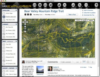
National Geographic TOPO!, a long-standing favorite mapping application, has announced that they will soon be debuting a new Internet-based application. New features will include aerial photos and hybrid imagery that blends aerial photos with contour lines (screen shot above).
The new site, TOPO! Explorer, will be found at www.topo.com, beginning in May. Beyond the new map database, which will be freely browsable, it will incorporate a large trails database filled with content from government agencies, partner organizations, National Geographic, and everyday outdoor enthusiasts. At the time of the public launch, they are expecting to have close to 10,000 unique file sets for free download.
Mike Dyer, digital and web product manager for National Geographic Maps, comments…
“Since 1995 when we first launched TOPO!, one of the most common questions we received was do the maps contain updated trails? We experimented with a program known as the MapXchange for years which offered free USGS quad updates to our users and user generated trails – it was a great success, but lacked the web 2.0 technology that people craved (easy publishing, photos, videos, ratings, and self-promotion capabilities.) TOPO! Explorer raises the bar to unparalleled levels with the creation of a platform that launches a national trails database that any trail, outing club, or enthusiast can give and get from. As a small example of the content to be had at launch, we’ve digitized every Trails Illustrated map in our collection and will provide the POI and resulting trails database as a free download.”
Outdoor enthusiasts will be able to download a "SuperQuad," the size
of a standard USGS 7.5 minute quadrangle. Each SuperQuad will include:
- 1:24,000 scale USGS map
- 1:100,000 scale USGS map
- 1:250,000 scale USGS map
- Aerial photography from i-cubed (3-10 meters/pixel)
- Tele Atlas roads
- Geographic names
- Elevation models
- A HybridQuad layer that adds contour lines and place names to aerial photos
The SuperQuads will be priced at $1.00 each, way cheaper than DeLorme’s average cost of nearly $40 per quad!
UPDATE: Looks like this caught someone’s attention on the DeLorme forum, where they point out that you can buy an entire state of USGS quads for $49.95.
There will still be an incentive to purchase other TOPO! products such as the state series, since you can get so many quads at a very reasonable price. But now, travelers venturing to other states will have the option of downloading individual quads for a few specific outings.
Two retail packages will be available, TOPO! Explorer ($24.95) and a Deluxe edition ($49.95). Both will contain $25 worth of download credits and identical functionality. The Deluxe Edition will contain 2 DVDs that have the complete set of seamless USGS 100k maps.
TOPO! State Series and Weekend Explorer products will continue to be supported, and will have access to the new database through a free application upgrade.
“We’ve worked hard to build great relationships with our retailers. We feel that the release of this massive content database will do nothing but improve the value of our existing retail products. Our State Series and Weekend Explorer packages will continue to offer the most maps for the best price, and the new TOPO! Explorer retail products create new sales opportunities,” stated Dyer.
The tech staff at National Geographic Maps is currently working on the new site and will be demonstrating it at the Outdoor Retailer and SHOT show over the next two weeks. Based upon my initial conversations with the team at NG it sounds as if we may soon be able to view aerial photos on Magellan Triton handhelds as well!
A few more details from the folks at National Geographic Maps:
- Enables you to search for street addresses
- KML import and full GPX support (import/export)
- GPS Auto-Connect – enables you to browse the contents of a GPS unit much like an IPOD and then move what you want to your “library” versus having to import everything. This is a pretty slick feature. Will support this as far back as we can and any existing GPS will be supported as much as they are currently. We will also add interface support for new Garmin and Magellan models, and will continue to reach out to any manufacturer to offer map loading capability.
I hope to have a full review posted soon after the site goes public later this spring.
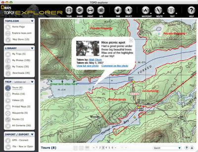
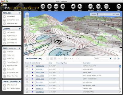
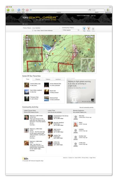
More screen shots follow…


nice