Sunday, March 18, 2012

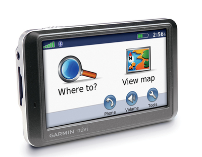
Consumer Reports rates Garmin nuvi 760 tops

Garmin_nuvi_760

Consumer Reports has released the results of their latest GPS tests, and I’ve got the full press release after the jump. I’ve added links to my reviews of the units they mention and recommend.

Overall, I think they did a pretty good job here, much better than in the past when they have rated units introduced years before.
read more

GPS, daylight savings time and Mini-Y2K

Have you heard about the fears of a mini-Y2K event when the U.S. goes to daylight savings time (DST) earlier than in past years? The law making this change wasn’t passed until 2005, which means that software created before then could miss the date for advancing the time (making you late for appointments from March 11 to April 1).

read more

Bushnell GPS to feature aerial photos and satellite imagery

Bushnell_gps_with_aerial_photo

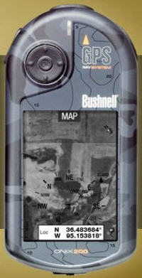
Bushnell has announced two new handheld GPS receivers that can accommodate aerial photos and satellite imagery (and apparently USGS topo maps). This comes hot on the heels of Lowrance announcing their iWAY 600C auto receiver. Assuming someone else doesn’t beat them to the punch, Bushnell will have the first non-PDA, consumer handheld GPS with this capability. Outdoor enthusiasts have been waiting a long time for a ruggedized GPS with this capability.

There are two models — the Onix200 and Onix200CR — the only apparent difference being that the CR has a color screen with higher resolution. Amazon says that the Bushnell Onix200 will be available sometime after December 22. The Onix200CR is due in February 2007.

Bushnell is hyping a screen layering feature, but it appears to only layer a navigation compass on the screen, rather than allow you to blend topos and aerial imagery. I’m a little disappointed that you can’t layer topo maps and aerial photos, but another concern is cost.

At first glance this doesn’t look too bad — $1 per map or photo, 25 for $20 or an unlimited annual subscription for $79. Which begs the question, after a year do I own the imagery or do I have to download it again every time I want to change images?

And consider this quote: "The ONIX200 series unit will store up to 12 photography (satellite or aerial) downloads at one time. Choose images of the same land at different levels of zoom, or broaden your coverage area by storing photos of separate areas."

With only 32 MB of user memory, the Onix200 series will accept only 12 images. And from that quote, and the layout of the download site, I assume that each time you change zoom level, it’s a different image and therefore another map or photo you are charged for.

Sounds a bit limited to me. Maybe Garmin will bring this capability to CES.

read more