Hands on review of the Garmin eTrex 10
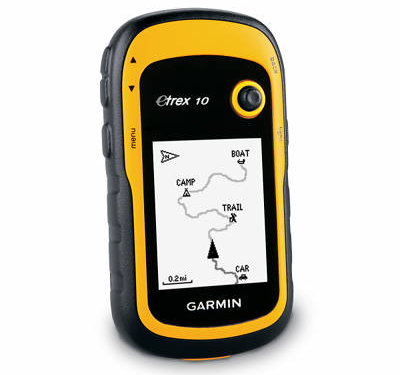
The Garmin eTrex 10 is Garmin’s new entry-level unit in the recently updated eTrex series. It offers paperless geocaching, GPS+GLONASS and advanced track navigation, but has a monochrome screen, limited memory and cannot accept detailed maps (although you can see your track and waypoints, as pictured above).
Related units
- Step up to the eTrex 20 to get a color screen, expandable memory, mapping and BirdsEye topo/aerial image capability
- Going the other direction, the older eTrex H uses a serial interface instead of the eTrex 10’s USB port, and drops paperless geocaching and advanced track navigation
- To see how the eTrex 10 stacks up against other models, check out my Garmin handheld GPS comparison chart
A big improvement
As noted above, the eTrex 10 represents a huge improvement over the older eTrex H. One of the biggest changes is the USB connection instead of the old serial port, which caused a lot of people a great deal of pain. The eTrex 10 also adds paperless geocaching capabilities, so you can have cache descriptions, logs, hints, etc., in the field as you cache. I was also happy to see advanced track navigation on the new model. I’ll go into details on all of those features shortly.
Garmin eTrex 10 hardware
Buttons
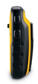
There are six buttons on the eTrex, three on the left, two on the right and one on the front (see image at top of page):
- Zoom in and zoom out buttons – These are on the left and can also be used to navigate menu lists a page at a time
- Menu button – (Also on the left side) Brings up a context sensitive menu; double-tap to access the main menu
- Back – On the right side; moves you back a step in the menu structure
- Power/Light – (Also on the right side) A short tap brings brings up a screen with date/time, battery and GPS status; additional short taps toggle between 0, 50 and 100% backlight; press and hold to power down
- Thumb stick – Located on the front of the device, you can toggle it side to side or up and down to navigate menus and pan the map; press down to enter a menu command or select a map point; press and hold to mark a waypoint
Display
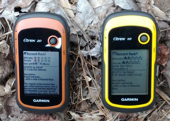
The eTrex 10 has a monochrome and lower resolution display than its color cousins. Generally speaking, I find monochrome displays harder to read in certain conditions, although it definitely isn’t a deal breaker. The device is still quite usable in a wide range of situations and I never really struggled with making out anything on the screen. Here it is compared to the eTrex 20.
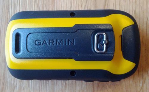
The image below of the rear of the unit shows the mounting spine for a bike mount or carabiner clip (not included with the purchase of the eTrex 10, sad to say). Unlike the Oregon and 62 series, the spine is plastic, which could lead to some wear, and definitely makes it harder to slide in and out of those accessories.
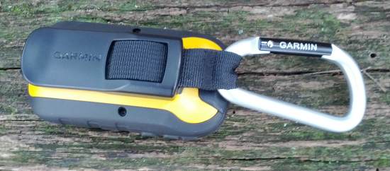
And here it is with the carabiner clip attached…
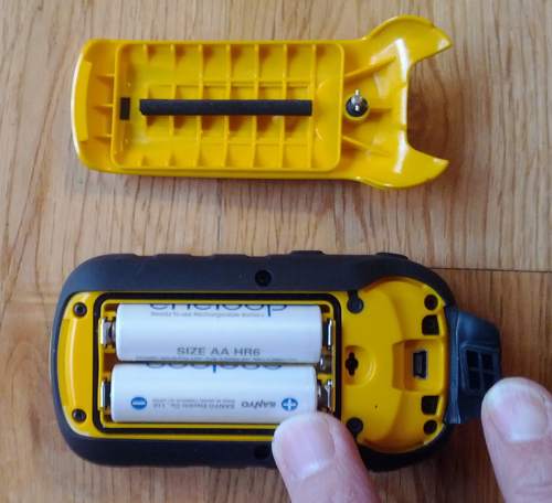
Here’s the battery compartment showing the mini-USB connector under the top rear flap…
Memory
There is no memory expansion slot in the eTrex 10 and Garmin doesn’t publicize the amount of internal memory available for geocaches, etc. My test unit, stripped of any .gpx files, had 2.3 MB available. I can tell you that even a single pocket query of 500 caches can generate a low memory warning.
Garmin eTrex 10 interface
The eTrex 10 utilizes the same interface as the other models in this series. The main menu items are pictured below.
Garmin eTrex 10 features
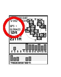
Even though the eTrex 10 is an entry level device, it offers several nice features:
GPS+GLONASS
Theoretically, this will give you better reception, especially in northerly latitudes and (natural and urban) canyons.
Advanced track navigation
On the eTrex 10, you can select a track to navigate and a route will be created. Waypoints are automatically generated for major high and low elevation points, and start and finish; these and any user waypoints along the track are added to the route. I’m a heavy user of track navigation. If I head out for a trail I’ve never traveled before, I do an online search for tracks to load to the device. One advantage of this new track navigation feature is that, unlike typical backcountry route navigation, you’ll get an estimate of actual trail distance rather than “as the crow flies” mileage.
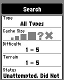
Paperless geocaching
The eTrex 10 is set up for full paperless geocaching support, including cache filtering (shown at right), so you can see the description, logs, and hint, and you can log your attempt (find, DNF, etc.) for later transfer back to geocaching.com. Speaking of which, full access to these features requires a premium membership at geocaching.com. Garmin has an opencaching.com site that is free, but the number of caches is far less than what is found on geocaching.com. Shown below: closest geocaches, geocache description, individual geocache menu, recent logs.
Customizing the Garmin eTrex 10
Main menu item order – You can customize the main menu item order by pressing the Menu button while viewing the Main Menu.
Accessing pages via the back button – Use Setup > Page Sequence for this, but be aware that these pages will disappear from the main menu.
Data fields – You can change data fields on just about any screen that has these; usually you just press Menu > Change Data Fields.
Profiles – The eTrex 10 comes with recreational, geocaching, marine and fitness profiles. You can switch profiles by selecting Profile Change from the Main Menu. Or create a new one by going to Main Menu > Setup > Profiles > Create Profile. Select the new profile to edit the name. Any changes you make in menus or other settings will be retained in that profile. So start changing things! Want track up when geocaching and north up when biking? No problem.
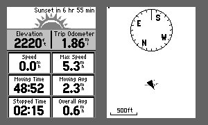
Dashboards – Instead of data fields (and in some cases in addition to), you can select a dashboard for the map, compass and trip computer screens. Choices (depending upon page) may include automotive, stopwatch, small or large data field, recreational, compass, and geocaching. I’ve included screenshots showing a couple below. For the trip computer and compass pages, you access this via Menu > Change Dashboard. For the map screen, choose Menu > Setup Map > Data Fields > Dashboard. The one downside here is the small screen on the eTrex series; using a dashboard can significantly reduce screen real estate.
Garmin eTrex 10 performance
Tracking
The eTrex 10 performed very well in terms of tracking accuracy. For example, in one test I placed the eTrex 10 and Garmin 62s on my pack shoulder straps for an out and back hike. The 62s had tracklog separation errors of up to 28′ when comparing the out and back tracks, whereas the eTrex had errors of up to 45′. This isn’t bad and I wouldn’t expect it to be quite as good as the 62s yet, which has more mature firmware. In my experience, such tests generally improve over time with subsequent updates.
Geocaching
Caveat: I’ve yet to come up with a good way to test geocaching accuracy. There are just too many variables – accuracy of the cache coordinates, satellite constellation variability, terrain, multipath effects, etc.
So having said that, here’s a very unscientific test. After becoming familiar with the unit, towards the end of my testing, I made some cache runs. I set the units down on top of the cache one at a time and recorded the reported distance to cache in feet. The results are shown below.
| eTrex 10 | eTrex 20 | GPSMAP 62s | Oregon 450 | |
| Cache 1 | 10′ | 11′ | 13′ | 15′ |
| Cache 2 | 15′ | 10′ | 24′ | 27′ |
| Cache 3 | 10′ | 10′ | 14′ | 15′ |
| Average | 11.67′ | 10.33′ | 17′ | 19′ |
Battery life
I tested battery life using freshly charged 2000 mAh Eneloop NiMH batteries. The unit was left stationary, under light canopy, with the tracklog interval set to record once every 5 seconds. Testing was done with the backlight off. The rated battery life is 25 hours but in my tests the unit ran for 30 hours and 36 minutes!
Garmin eTrex 10 pros
- Full paperless geocaching support
- GPS + GLONASS support
- Excellent battery life
- Uses mini-USB cable (included) rather than eTrex H’s serial connection
- Advanced track navigation
Garmin eTrex 10 cons
- Monochrome screen
- Cannot display maps
- Limited memory
Conclusion and recommendation
Highly recommended. The eTrex 10 is the best starter GPS for geocachers on the market. You can find this model for just over $110 and that gets you the full set of paperless geocaching features. This combined with the fact that it offers GPS + GLONASS support makes it an incredible deal. The eTrex 10 is a huge improvement over Garmin’s previous entry-level handheld unit, the eTrex H. Backcountry users on a tight budget might want to stick with the older Venture HC, which allows you to load topo maps, but you won’t get paperless geocaching, advanced track navigation or the newer, easier to navigate interface.
More Garmin eTrex 10 reviews
- Consumer-authored Garmin eTrex 10 reviews
have been posted at Amazon
- A video review of the eTrex 10:
I’ll be posting more hands on GPS reviews as they appear, but in the meantime, here are some…
Other Garmin eTrex 10 resources
- The Garmin eTrex 10 owners manual
- Want to see how the eTrex 10 stacks up against other models? Check out our Garmin handheld GPS comparison chart
- An eTrex 10 FAQ
- The official Garmin eTrex 10 web page
- Our handheld GPS FAQs
- New to GPS? If so check out our handheld GPS 101 series; otherwise, here is handheld GPS 201
Compare prices on the Garmin eTrex 10 at these merchants:
- Check the current Garmin eTrex 10
price at Amazon
- Get the Garmin eTrex 10 for a low price at GPS City
- Check out the deal on the Garmin eTrex 10 GPS
at REI.com, where satisfaction is guaranteed and members get 10% back on eligible purchases
- Buy the eTrex 10
direct from Garmin




Can the Etrex 10 display MGRS rather than lat long