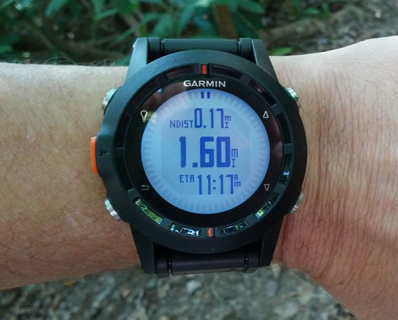
Hands on Garmin fenix review
The Garmin Fenix is a new backcountry sportswatch, Garmin’s first to use their popular Forerunner form factor. With an up to 50 hour battery life, this wrist-top GPS is most likely to appeal to two classes of users: (1) those who want both hands free (rock climbers, off trail hikers, and even some hunters and fishermen) and (2) those who demand a long battery life, such as backpackers.
Hardware
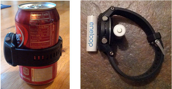
The fenix feels a little large on my (admittedly skinny) wrist, as you can see above. You probably don’t want to use it when you’re out stylin’ on the town, or even in your office unless you’re surrounding by geeks, but it isn’t too big for the outdoors. I’d rather have this on my wrist than carry a Montana.
I’ve included a couple of pictures below to try to give you an idea of the size of it. First with a 12 ounce soda can, then with a couple of AA batteries…
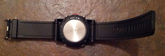
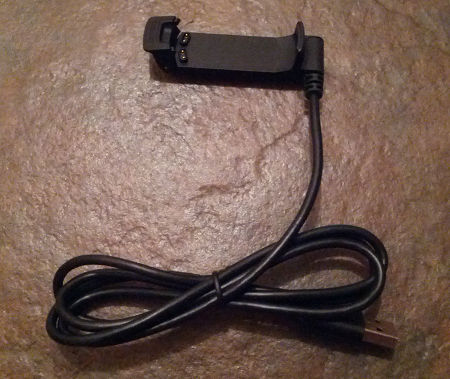
Here you can see the back of the watch and the USB charger. An AC charger is also included.
I found it awkward to connect the charger, but only the first few times. Now it’s second nature. Charging takes about 2-1/2 hours with the li-ion battery fully drained.
Notable specs
The fenix will hold 1000 waypoints, 50 routes, 10,000 trackpoints, 100 saved tracks and 2,000 geocaches. It is rated as waterproof to 50 meters.
Interface
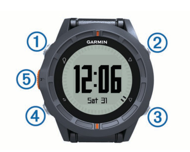
The fenix has five buttons, shown in the image below.
They function as follows:
- Turns the backlight on and off; hold down to power on or off
- Scrolls up through menus, pages and options
- Scrolls down through menus, pages and options
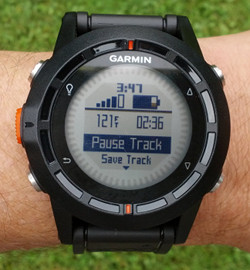
- Returns to the previous screen; hold down for status (see screenshot below)
- Acts as enter button; used to select an option or go to the menu for the current screen; hold to mark a waypoint
The functions are about as intuitive as you could wish for on a device like this, and you’re not likely to forget what they do after using it a time or two. The up and down buttons on the right can be customized for what happens when you hold them down. Unfortunately those options are pretty limited (e.g., Start/Stop, Lap, Man Overboard, Flashlight).
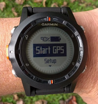 Starting up the fenix
Once you power on the fenix, you’ll be greeted with the first screen, which is typically a clock screen, depending upon the profile you are using (more on profiles shortly). Press the orange button and you’ll see the screen at right. It’s very important to realize that the watch doesn’t start receiving satellites upon powering on; you have to select start GPS first. It took me a couple of times to realize this, which left me cooling my heels at the trailhead while I waited a minute or two for it to acquire satellites.
Customizing the Garmin fenix
Between profile options, multiple screens and a wealth of data fields, the fenix can be heavily customized.
Profiles
You can select your activity type by choosing a pre-loaded profile. These include hiking, running, cycling, geocaching, fishing, sailing, aviation, and mountaineering, but you can also create your own. Changes made to data pages and selection of data fields within a profile are saved, so you’ll have the same setup the next time you return to that profile.
Data pages
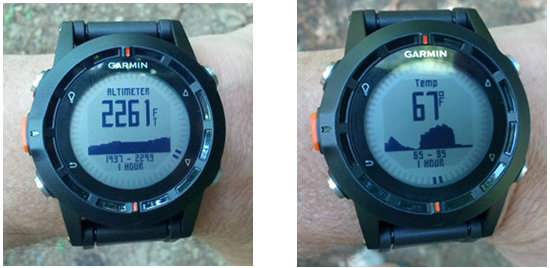
These are the pages within a profile that the up and down buttons scroll though. Under Setup > Data Pages, you’ll get separate options for setting up screens while Tracking or Navigating. Typically, depending upon which profile you are modifying, 7 or 8 pages are available, but more can be added. Standard pages can include one to three data fields, and there are also barometer, compass, map, heart rate, cadence, time, dual grid screens, altimeter, and temperature screens (the last two are shown below).
Data fields galore
I won’t go into all the menu options, but I did have a request to list the available data fields. They are: accuracy, ambient pressure, ascent, average ascent, average cadence, average descent, average heart rate, average lap, average pace, average speed, barometer, battery, bearing, cadence, calories, compass heading, compass, course, date, descent, distance, elevation, final destination, final distance, final ETA, final ETE, final location, final vertical distance, final vertical speed, glide ratio, GPS, GPS elevation, GPS heading, glide ratio destination destination, grade, heading, heart rate, heart rate zone, lap ascent, lap cadence, last descent, lap distance, lap heart rate, lap pace, lap speed, lap time, lap total, laps, lat/lon, last lap ascent, last lap cadence, last lap descent, last lap distance, last lap heart rate, last lap pace, last lap speed, last lap time, location, max ascent, max descent, max elevation, max speed, max temperature, minimum elevation, minimum temperature, moving average, moving time, next destination, next distance, next ETA, next ETE, next vertical distance, none, odometer,off course, pace, speed, stop time, stop watch, sunrise, sunset, temperature, time, timer, to course, time of day, track distance, turn, vertical speed and velocity made good. Whew!
ABC
You’ll see the fenix referred to as an ABC watch, meaning that it has an altimeter, barometer and compass. Basically this means it has a barometric altimeter and a tri-axial, tilt-compensated compass. The compass auto-calibrates and worked well for me. Like any compass, standing near large metal objects (like your car at a trailhead) can throw it off. The manual says it can be calibrated “if you experience irregular compass behavior, for example, after moving long distances or after extreme temperature changes.”
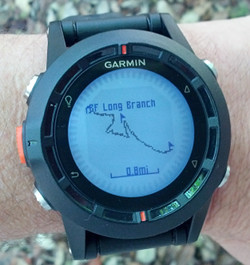 Navigating with the Garmin fenix
The fenix works as well for navigation as any GPS without a map. It does have a rudimentary map, shown at right, but if you want a GPS with a map, this isn’t the model for you.
And while I am definitely into maps, I didn’t have any trouble navigating to a destination or along a route with the fenix, While doing the latter, the fenix advanced to the next waypoint promptly.
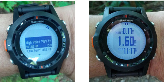
In the images below, you can see two pointer marks on the perimeter of the screen. These act as a bearing pointer anytime you are actively navigating.
I was very pleased to see that the fenix includes advanced track navigation, which automatically creates a route with any of your waypoints along a track, as well as key high and low elevation points (shown at left below), whenever you navigate a track or use trackback. At right below you can see the distance to next waypoint along the track in the top data field.
POIs
The only points of interest (POI) data on the device is a list of cities; there is no geographic POI dataset, which would be nice for navigation purposes. I was able to upload a custom POI (.gpi) file using Garmin POI Loader though, so that is another way to get the data in there.
There’s a map for that
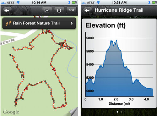
A couple of weeks ago, Garmin released their BaseCamp Mobile app for iOS (screenshots below). So you can carry your iPhone 4s or 5, link it to your fenix and view your position on a map. If you have a cell connection. Hopefully Garmin will soon bring Android compatibility, and add onboard map storage and other features. When I asked Garmin about this, I was told…
“Correct, the BaseCamp app doesn’t include onboard maps. In general, I’d like to point out though that this is only the first version of the BaseCamp app and we plan to add many additional features down the line.”
I’m an Android guy, so I wasn’t able to test the app.
Bluetooth and ANT+
The fenix has built-in Bluetooth SMART/4.0 and ANT+ functionality. The former is how it communicates with iOS devices. ANT+ gives the fenix the ability to pair with sensors such as compatible heart rate monitors, tempe temperature sensor (review forthcoming) and the chirp geocaching sensor.
Geocaching with the Garmin fenix
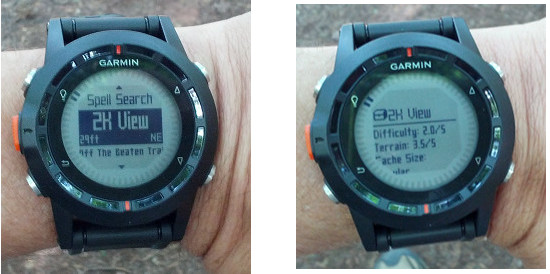
The fenix has paperless geocaching capabilities, although it does not have a built-in filter function. But you can still view logs, hints, etc., and it can hold 2,000 caches. You can see a couple of screenshots below.
Performance
Interface performance
I did see some sluggishness with the unit on occasion but it was pretty rare. I noticed it more loading and viewing geocache information than any other time. Since it was so spotty, I’m assuming the processor is adequate and they just need to tweak the firmware some. Hopefully that will happen.
I also saw some other random bugs that I can no longer replicate and I’m assuming they were fixed in the 2.60 or 2.70 firmware updates.
Tracklog accuracy test
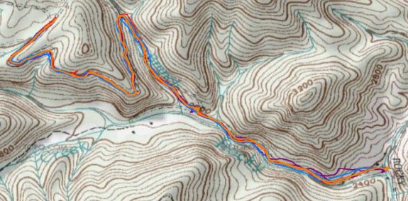
To test tracklog accuracy, I wore the fenix on my wrist and mounted several other units on the handlebars of my mountain bike. I rode an out and back section of logging road that has at least one challenging section for GPS reception, where the trail is pinched by rock walls in a canyon-like setting. All units were set to record one trackpoint per second. The main things I try to look for in this sort of test are stray track points and track separation, i.e., how far apart the track collected by each unit was on the out and back sections. You can click the image below for a larger view.
The fenix is in red, 62s in orange, eTrex 20 in blue and Oregon 450 in purple. The fenix did very well, especially for a new unit (firmware updates tend to improve things). The peak track separation was only 65′, though one stray track point where I stopped to chat with a couple of mushroom hunters was 100′ off. At a couple of other stops though, the fenix show no significant stray points, even though other units did.
The GPSMAP 62s performed best, with track separation errors up to about 45′ and one stray point at a rest stop about 70′ off the road. My Oregon 450 was the worst, with track separation errors up to 180′. Coming in better than that but worst than the 62s and fenix was the eTrex 20, with tracklog separation errors of up to 100′.
Altimeter test
I’ve seen a great deal of variation within a single unit in terms of accurately tracking elevation. So I put a fair amount of effort into eliminating as many variables as possible for this test.
All units were tested using the most recent firmware update, and set to collect one trackpoint per second. They were then reset, clearing the tracklog and trip data, and calibrated at a USGS benchmark (2384′). All units except the wrist-mounted fenix were on the handlebars of my mountain bike.
I then proceeded to climb a hill that, according to USGS maps, should have been about a 430′ climb, with perhaps 10′ of descent at one culvert crossing. All units were equipped with a barometric altimeter. I’ll also note that I picked a calm day when little change in barometric pressure was anticipated. You can see the results below. I recorded reported elevation, total ascent and total descent, both at the top of the ride and at the bottom.
| Garmin fenix | Garmin GPSMAP 62s | Garmin Montana 600 | Garmin Oregon 450 | |
|---|---|---|---|---|
| Total ascent at top | 441′ | 345′ | 356′ | 308′ |
| Elevation at top | 2807′ | 2816′ | 2803′ | 2828′ |
| Total descent at top | 17′ | 0′ | 0′ | 1′ |
| Total ascent at bottom | 467′ | 345′ | 359′ | 308′ |
| Elevation at bottom | 2390′ | 2411′ | 2393′ | 2429′ |
| Total descent at bottom | 460′ | 408′ | 438′ | 433′ |
In terms of reported ascent, the fenix outperformed the other models. Nevertheless, I would take this with a grain of salt, since altimeter performance is highly variable in handheld GPS receivers.
Geocaching test
I’ve yet to come up with a good test for geocaching, but I did take the fenix and a few other models to three geocaches and recorded the reported distance to cache with each unit on top of the cache. Remember that the units aren’t showing distance to the cache location necessarily, but distance to the coordinates posted by the cache owner, which are likely off to some extent. Regardless, the fenix came out in the middle of the pack, behind the eTrex 20 and Oregon 450, but ahead of the 62s. I’d take these results with a big grain of salt too.
| Garmin eTrex 20 | Garmin fenix | Garmin GPSMAP 62s | Garmin Oregon 450 | |
|---|---|---|---|---|
| Cache 1 | 23′ | 40′ | 58′ | 31′ |
| Cache 2 | 45′ | 54′ | 58′ | 32′ |
| Cache 3 | 19′ | 32′ | 39′ | 26′ |
| AVERAGE | 29′ | 42′ | 52′ | 30′ |
Battery test
I tested the battery, leaving the device stationary until the battery went from 100% to 0% and shut down. The fenix ran for 18 hours and 4 minutes with the tracklog set to auto, and 18 hours with it set to once per second. I did not test Ultratrac mode which claims a battery life of 50 hours.
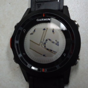 UPDATE: Maps on the fenix
I’ve been told by a couple of folks now that you can add small detailed map (.img) files to the fenix. To the right is one sent to me by Brent, showing a residential street and a trail.
Pros
- Excellent for hands free tracking and navigation
- Works as well as any non-mapping GPS for navigation
- 50 hour reported battery life in Ultratrac mode
- Extensive customization options
- Fairly intuitive interface
- Pause track function (I sure would like to see this across Garmin’s handheld line)
- Paperless geocaching
- Advanced track navigation features
- Impressive accuracy for a newly introduced unit
Cons
- BaseCamp Mobile app requires cellular connection to view map
- BaseCamp Mobile app not available for Android at this time
- No geographic POI database
- No geocache filter function
- Sluggish when loading and viewing geocache logs
Conclusion
More Garmin fenix reviews
- Consumer-authored Garmin fenix reviews
have been posted at Amazon
- A long, ongoing fenix review on a forum
- Outside Magazine likes the fenix
- Sam Penrod reviews the fenix
- A first looks review from Outdoors Magic
- Ultra 168 compares it to the Suunto Ambit
- The Clever Training blog has also posted a Garmin fenix review
- A technical review of the fenix
- Military Times reviews this backcountry sportwatch; and then again to complain about UltraTrac mode for runners
- Digital Trends reviews it too
- A brief review by Gear Junkie
- This review compares it to the Suunto Ambit 2
I’ll be posting more hands on GPS reviews as they appear, but in the meantime, here are some…
Other Garmin fenix resources
- The Garmin fenix owners manual
- To see how the fenix stacks up against other backcountry models, check out our Garmin handheld GPS comparison chart
- The official Garmin fenix web page
Compare prices on the Garmin fenix at these merchants:
- Check the current Garmin Fenix Hiking GPS Watch with Exclusive Tracback Feature
price at Amazon
- Check out the Garmin fenix
at REI.com, where satisfaction is guaranteed and members get 10% back on eligible purchases
- Get a great deal on the Garmin fenix at GPS City, one of our favorite small vendors
- Buy the Garmin fenix
direct from Garmin


Having a mapping unit such as the Garmin Oregon and using the unit to unit transfer feature is an option to review previously recorded tracks on the fenix on a bigger screen, over , I have not checked if transfered tracks keep the original HR and temperature readings from the watch
You can also load a small detailed mapset to this unit via Mapsource.
I saw someone else say that. Wish I had tried it. Got pics?
I can try to get some, but I don’t know how to upload them here.
You would have to upload them to a third party service like http://imageshack.us/. Or you can email them to me at richowings+uploads at gmail dot com. I might append them to the review if that’s okay with you.
I emailed them to you. Let me know if that works.
Thanks! I posted it: http://gpstracklog.com/2012/10/garmin-fenix-review.html#maps
my device don’t working and stop display in time mode.
Explanation the situation.
GPS : stop
Display : time
Action : push the Red Button once
message : low memory.Delete data to continue.
a Fact : Nothing without 3 Waypoints
how do I make try my Device for normalization?
Have you tried updating the firmware?
No I didn’t.
Let me make it please.