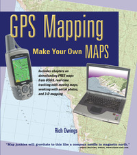
 Because I compared so many different software packages in my book, GPS Mapping – Make Your Own Maps (cover at right), I’m often asked what programs I like. In the book, I shied away from recommendations, focusing instead upon the pros and cons of each program, because no software is perfect. People who really get into this will often use multiple packages (a number of them are free or have extensive demo modes). Today, I’m going to take a different approach and share my favorites in each of several major categories.
CD-based maps
Here we’re talking about programs that package all the USGS topo quads for an entire state or region onto a DVD or set of CD’s, products like DeLorme 3-D TopoQuads and Maptech Terrain Navigator. These packages are ideal for producing printed maps. No other category can beat them for this. My current favorite though, is National Geographic TOPO! It’s not perfect, but in my mind, it has fewer drawbacks than the other two. One caveat though–these programs are constantly being upgraded. For example, I haven’t had a chance to check out the recently released Terrain Navigator 7.0, but I’m expecting a copy soon and will report back here with a full review.
Internet-based maps
The programs discussed here all utilize TerraServer maps and aerial photos, but they offer a much better interface. If you’re looking for a freebie, check out USAPhotoMaps. Other entries here include ExpertGPS and, my personal favorite, TopoFusion. I like TopoFusion for its ease of use and exceptional features.
Comprehensive programs
I always struggle with what to call these. They utilize scanned map images, allowing you to do things like use USGS quads available for free downloading online. No more paying $100 per state for CD-based packages! They don’t print seamless maps very easily, but that’s one of the few downsides. Entries here include Fugawi Global Navigator and OziExplorer or Ozi for short. My favorite here is Ozi, primarily because it will allow me to load GIS files and MrSID files. If you want this level program, those features may be important to you.
Maps for your GPS
Maps that go on the screen of your GPS are proprietary. In other words, if you have a Garmin receiver, you need Garmin maps, unless you make your own. Ditto for Magellan and Lowrance. Because of this, personal preference is more about the receiver than the maps.
The book
There is a mini-manual on each of these software programs in GPS Mapping – Make Your Own Maps. Of course, there is much more too. See for yourself in the table of contents. My book is available from Amazon or direct from the publisher, who is throwing in free priority mail shipping.
Happy mapping!

I’m looking for and update map program for my garmin nuvi. what do you think is the best one to buy? Free is best 🙂