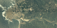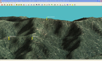
The Map Room recently covered the National Agricultural Imagery Program (NAIP). Now don’t be confused by the Agriculture part of the name, because the NAIP is of value to a much broader audience. NAIP offers very recent, natural-color aerial imagery of almost the entire U.S., at a relatively high resolution. Full county mosaics are $50. For my county, there is a 2006 image with a resolution of 2 meters/pixel, and a 2005 image at 1 meter/pixel. The image at left, of the Big River estuary and Mendocino, CA, is supposed to be 2 meter resolution. The resolution doesn’t look quite that sharp to me, but nevertheless, I can make out recent changes in logging roads in the area I frequent for mountain bike rides. The image to the right below, shows a 3-D view with waypoints, that I created using OziExplorer.

The color county mosaics are in MrSID format. You can use OziExplorer to work with these files, and the NAIP website lists several viewers. Quarter quadrangles are available in GeoTIFF format. Here’s the latest (2005) aerial photo coverage map for color county mosaics.
Unfortunately, we’re dealing with the feds here, so ordering is a pain and delivery is slow.
