I just can’t say enough good things about OziExplorer. When you hit a wall with other software, OziExplorer can usually get the job done. Before we get into the feature list, let me point out that while OziExplorer costs $85, there are two free trial versions that will allow you to check out nearly all its features. But unless you have one-time needs, I’m betting you’ll pony up the bucks after trying it out. It’s that good.
Here are a few highlights:
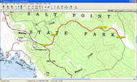
Free maps. Sure, the program may cost $85 but, after that, you can use  many sources of free maps. Often these are USGS maps in digital form, known as digital raster
graphics (DRG). One example is shown at right. This can come in quite handy. I own National Geographic TOPO! for California, but on a recent vacation to Tahoe, I was contemplating a side-trip into Nevada to ride the Pine Nut Mountain loop. I was able to download free maps from a Nevada site and use them in OziExplorer.
- Extensive track controls. I wrote recently about how to extract individual tracks from a TOPO! file that had many, many tracks. OziExplorer was the tool that let me easily isolate individual tracks.
- MrSID. Don’t think who here, but what. MrSID stands for Multi-resolution Seamless Image Database and Ozi is one of the few consumer-level (i.e., reasonably priced) mapping programs that can utilize it. I was able to get a very current color image (in MrSID format) of most of the county in which I live from USDA, for only $50. It was used to produce the rest of the images on this page.
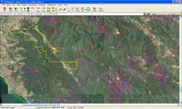
- Geographic Information System (GIS) files. Ozi can handle these as well — both shapefile

(.shp) format and .e00 files. I used this type of vector data to construct the image at right, overlaying boundary lines of public land and private timberlands. - Traveling internationally? I got to go to Ecuador a couple of years ago, and I was able to download quite a bit of vector data that allowed me to produce maps with contour lines, major cities, major highways, provincial boundaries and volcanoes. Having Ozi Explorer was a big help.
- Frequently updated. Des Newman, the creator, updates Ozi frequently, to ensure that it stays current.
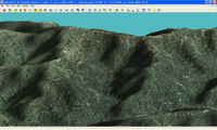
- 3-D. A 3-D module costs $30, though again, there is a very nice free demo with few limitations. It was used to create the image below, at right. The only drawback here is that you have to import your own height data (Digital Elevation Models or DEM), which is easy enough to do.
 PDA version. There is also a PDA version,OziExplorerCE, which is designed to work with
PocketPC devices. I’m not a huge fan of PDA’s for GPS use, but I have to say that it’s very cool to be able to see your position on raster maps.- Making maps for your GPS. While you can’t do this directly with Ozi, it is a very helpful tool that can be used in the process. This is because it can convert tracks, shapefiles, and MIF files.
And remember, those are just a few of this software’s many, rich features.
OziExplorer does have a bit of a learning curve; my book, GPS Mapping – Make Your Own Maps, has a full chapter on OziExplorer to walk you through most of its features.
Finally, if things get so complicated that even OziExplorer won’t handle it, I suggest you try Global Mapper.
Other posts in this series:

Hi All,
I’m the author of the thread and the Mobile XT vs. nüvi comparison document that’s being talked about over on GpsPasSion’s nüvi forum. Unfortunately, I had to pull the document from my site as the sheer number of folks downloading it was killing my bandwidth. If anyone has the ability to host the document publicly (it’s about 5 MB in size in it’s compressed format), I’ll be more than happy to provide it.
Other than that… I’d be more than happy to answer any questions you may have.
Lastly, note that while the comparison document specifically references the nüvi, it can be applied to the C550 as well since the nüvi and the C550 have nearly the exact same (feature limited) user interface.
Let’s hope that Garmin gives us more of what we want in the nüvi 610/660 when they come out. The zumo also looks promising as well.
— MIKE
Wall Accessories
10-1. File Format: PDF/Adobe Acrobat Design of Lock Wall Accessories . Protect your car door