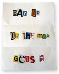
Late this past summer, Jared Benedict posted a ransom note for maps. But he wasn’t holding them hostage; on the contrary, his goal was map liberation. And now he has succeeded. The Libre Map Project has posted over 50,000 free USGS topo maps.
I’ve been following this for awhile, and last weekend, all the maps were finally made available. These are 1:24,000 scale, 7.5′ digital raster graphic (DRG) quadrangles. I’ve posted before about free USGS topographic quad maps, and about OziExplorer, my favorite mapping software that allows you to use DRG’s with (but not on) your GPS. Here is a good resource on importing DRG’s into OziExplorer.
Related post:

Comments