UPDATE: The Oregon 200 has been discontinued. For current recommendations, check out our handheld GPS buyers guide or our Garmin handheld GPS comparison chart.
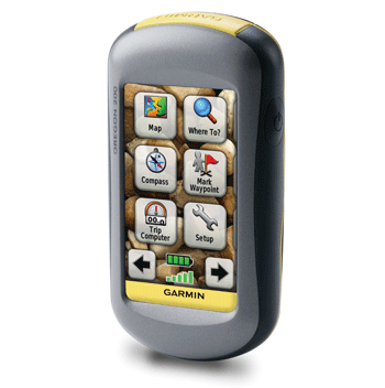
The Garmin Oregon 200 is the entry level model in Garmin’s touch screen Oregon line, offering a great backcountry navigation and/or paperless geocaching solution at a reasonable price. It doesn’t have a barometric altimeter or electronic compass, nor does it come with pre-loaded detailed maps. The latter is not a huge issue, given all the free maps available for it. You’ll want a micro-SD card for the maps though, as the 200 only has 24 MB of internal memory. The 200 also leaves out the ability to transfer data wirelessly between units.
Here’s how it compares to other models in the Oregon series:
- Oregon 300 (GPS Tracklog) – Worldwide basemap with shaded relief, no pre-loaded detailed maps
- Oregon 400t (GPS Tracklog) – Built-in topo maps of the United States and a worldwide basemap with shaded relief
- Oregon 400c (Garmin) – Built-in BlueChart® g2 coastal charts and a worldwide basemap with imagery
- Oregon 400i (Garmin) – Built-in U.S. Inland Lakes and a worldwide basemap with imagery
- Oregon 450 (GPS Tracklog) – Worldwide basemap with shaded relief, no pre-loaded detailed maps, triaxial compass, brighter screen than previous models
- Oregon 450t (GPS Tracklog) – Built-in topo maps of the United States and a worldwide basemap with shaded relief, triaxial compass, brighter screen than previous models
- Oregon 550 (GPS Tracklog) – Worldwide basemap with shaded relief, no pre-loaded detailed maps, triaxial compass, geotagging camera
- Oregon 550t (GPS Tracklog) – Built-in topo maps of the United States and a worldwide basemap with shaded relief, triaxial compass, geotagging camera
To see how the Oregon 200 stands up against other Garmin models, check out my Garmin handheld GPS comparison chart.
Compare prices on the Garmin Oregon 200
Much of the following is adapted from my hands on review of the Oregon 400t.
Garmin Oregon touch screen
I really like the Oregon’s touch screen interface. There’s room for improvements but generally speaking, you can navigate menus faster than on other Garmin handhelds. The place where this really shines is when it comes to naming waypoints or entering other text; it is SO much easier.
One of the concerns people have about the touch screen interface is how well it will work with gloves on or when wet, especially when doing detailed work like picking a point on the map. For those of you who missed my first impressions post, let me go over how easy it is to select a point, then we’ll talk about gloves and conditions.
You can select a location by tapping the map. My first attempt at tapping a nearby mountain peak got me close. Once I zoomed in I could see that I was about 200 feet off.
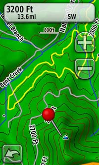
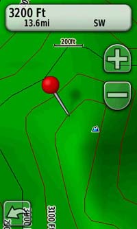
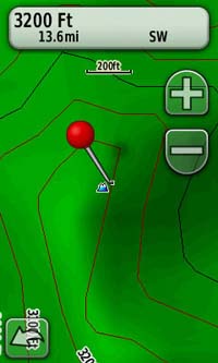
Now you can drag the map underneath the pushpin — the pushpin doesn’t move, but the map does, allowing you to fine tune the location of the selected point, as shown at left below. Now tap the information box at the top of the screen to display options to navigate to the location or save it as a waypoint.
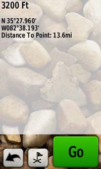
I’ve tried using the touch screen with (very) sweaty fingers, fleece gloves and ski gloves. I had no problem with the first two, and only minimal problems with bulky ski gloves on.
Garmin Oregon display
Unfortunately, the touch screen comes with a significant drawback — visibility. I written about visibility problems on high resolution handhelds before, and it’s all true for the Oregon too. The Oregon may actually be a little worse than the Garmin Colorado.
You can turn off shaded relief (shown below on and off) to help, but the map loses a lot of visual appeal by doing this.
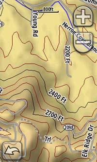
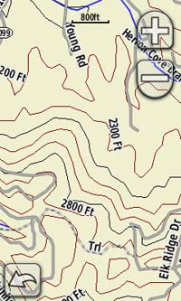
How problematic this is depends upon your use. If you use the Oregon as a handheld, for hiking for example, you will intuitively adjust the viewing angle for maximum visibility. I don’t see it as a major problem in this situation.
It’s more difficult for cyclists though, where the unit is at a fixed angle on your handlebars. Still, with shaded relief disabled, it is usable on a bike. You won’t have the bright screen of a 60CSx, but the touch screen may make it a worthwhile trade off.
Garmin Oregon interface
The touch screen interface is a joy to use. One handed operation is very easy; the buttons are large and I usually press them with my thumb.
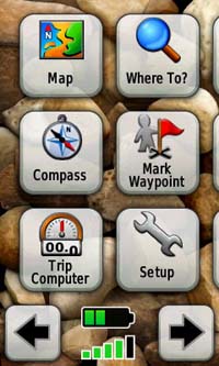
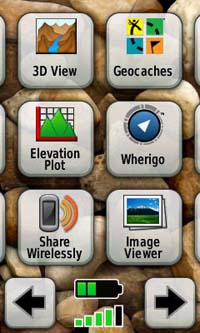
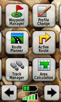
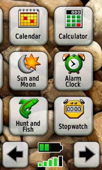
The main menu is spread across four screens, pictured below. The button order can be customized within different profiles. The creator of the Garmin Oregon Wiki has posted the bright idea (pardon the pun) of having a bright sun profile with shaded relief turned off.
Garmin Oregon 200 track management
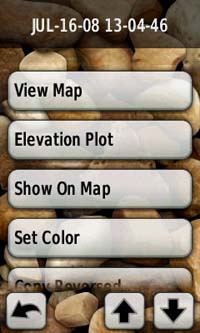
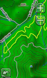
Track management tools allow you to load tracks, view them, show or hide them on the map, and display them using one of 16 colors. This is very helpful for those of us who like to load tracks showing trails onto our units to aid in navigation. Some track options are shown below, along with a sample yellow track loaded to the unit.
Geocaching with the Oregon 200
The Oregon series allows for paperless geocaching, displaying the full description, cache size, difficulty and terrain ratings, and recent logs. It does not however, have all the specialized geocaching screens of the Colorado. The images below show the Oregon’s geocaching mode.
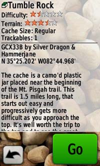
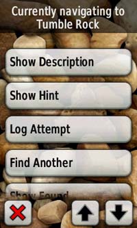
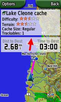 The Colorado screenshot, at left, gives you an example of the type of overlay screen you won’t get with the Oregon series.
There is an excellent and detailed geocaching tutorial on the Garmin Oregon Wiki.
Garmin Oregon 200 accuracy
It has been reported that the Oregon series may not be as accurate as the 60CSx, but that it doesn’t suffer as much from the wild swings of the Colorado series. Yet the Oregon is new, and it sometimes takes a while to figure out the accuracy of these new units, so I would take the initial reports with a grain of salt. Here’s what I’ve found in my own use…
In one test of the Oregon, I saw it deviate from previous tracks of the same trail by up to 100′. You can see details at the end of this post. Other times, it’s been spot on with my 60CSx. My initial take is that the unit’s accuracy is not quite as good as some units with a quad helix antenna, but that it’s probably fine for most people. If you’re mapping trails professionally however, stick with the 60CSx.
You can read someone else’s take on Oregon accuracy here.
UPDATE: Since writing this, several firmware releases have seen steady improvements in the Oregon’s accuracy, to the point where it is nearly as good as the venerable 60CSx.
Differences between the Oregon and Colorado series
- The big difference is the Oregon’s touch screen interface, whereas the Colorado relies on the "Rock N Roller"
- The battery cover is much easier to remove on the Oregon than it is on the Colorado
- The Oregon has a better waterproof seal and an improved location for the data storage card
- The Oregon uses a micro-SD card, while the Colorado uses a full size SD card
- The Oregon powers on faster than the Colorado
- The Oregon automatically sets your time zone; the Colorado does not
- It is easier to mark a waypoint on the Colorado, but the ability to custom name it much faster on the Oregon helps make up for this
- The Colorado has some geocaching mode screens not found on the Oregon
Garmin Oregon 200 tips
- Customize your profiles, and place the main menu items in the order most likely to be used
- Consider disabling shaded relief
- Consider setting the map screen to show data fields only when navigating
- Hold down scroll buttons to continue advancing through multi-page menus
- After selecting a point on the map, zoom and drag the map to increase the accuracy of the selected location
- You can search from a waypoint or a recent find by going to Where To? and tapping the "target" icon at the bottom of the screen (shown below at left).
![]() What’s hot
What’s hot
- The touch screen rocks and performs well under a wide range of conditions; the interface is very easy to navigate
- Text entry is easier than on any handheld GPS to date
- Strong track management tools
- Option to show data fields only when navigating
- Paperless geocaching
What’s not
- Screen visibility is poor in direct sunlight, unless you adjust the viewing angle
- There is no direct access to settings from key pages
; for example, you can’t calibrate the compass from the compass screen; you must go to Setup > Heading > Prepare to Begin Compass CalibrationUPDATE: You can do this, by pressing and holding on the compass screen for a few seconds (thanks Miraslav!) - You cannot mark a waypoint from any screen; going to the main menu to do this slows entry (but giving it a custom name is much faster than on other GPS devices)
- The current tracklog is difficult to see; it is a thin black line and you cannot change its width or color
There is no waypoint averaging functionWaypoint projection is difficult, as you have to manually enter a bearing (to project a waypoint, go to Mark Waypoint > Save and Edit > Project Waypoint > Enter Bearing); there is no sight n’ go function- These last two items were added with the v 2.96 firmware release
Recommendation
Garmin nailed the touch screen interface on the Oregon. It is so nice to use that it far offsets the drawback of the dim display.
The Oregon 200 is well suited for those who will truly use it as a handheld, such as hikers and geocachers.
For bikers and others using it on the move, a lot depends on how you use it. If you like to do things with a GPS while you bike, or if you need to view the screen for navigation while on the move, you will likely be frustrated by the display. If, on the other hand, you only tend to use the GPS when stopped, it might work out fine for you.
The accuracy seems good enough for most people, geocachers included. As I said earlier, if you’re mapping trails professionally though, stick to a 60CSx, at least until further testing determines if the Oregon is as accurate as this time-tested model.
One other point — if you are wondering whether to get the Colorado or the Oregon, get the Oregon. It has almost all of the Colorado’s advantages, with a superior interface to boot.
The Oregon series is so good that, after sending my review unit back, I plunked down my hard-earned cash on an Oregon 400t of my own. I *try* to limit myself to one new handheld and one new auto GPS a year, but I broke the rule for the Oregon series.
More Garmin Oregon 200 reviews
- Consumer-authored Garmin Oregon 200 reviews
have been posted at Amazon
I’ll be posting more hands on GPS reviews as they appear, but in the meantime, here are some…
Other Garmin Oregon 200 resources
- The Garmin Oregon 200 owners manual, in the language of your choice
- GPS Fix is a blog that focuses on the Garmin Oregon and Colorado series
- A Garmin Oregon message forum
- This tool will show you how the Oregon 200 compares to other mapping units
- The Garmin Oregon wiki has an Oregon FAQ
- A comparison of the Garmin Oregon and Colorado series
- And another Oregon / Colorado comparison
- Garmin Oregon training videos
- The official Garmin Oregon 200 web page
Compare prices on the Garmin Oregon 200 at these merchants:
- Find the low price on a Garmin Oregon 200 at GPS Now, where shipping is free on orders over $99 (and the upgrade to overnight shipping is dirt cheap!). Order by 5 p.m. Central Time for same day shipment
- Check the current Garmin Oregon 200
price at Amazon
- Get the Garmin Oregon 200
for an amazing price on eBay


I’ve found what seems like a great price on an Oregon 200 (less than a Dakota 10). But I have a couple of questions: What size microSD cards can be used in the Oregon 200? 1GB? 2GB 4GB? Is there a recommended size or manufacturer?
Is there any difference in loading maps or anything else when using a GPS with a microSD v. one with internal memory (like the Dakota 10)?
Thanks for your help.
Up to 4 GB. The main advantage of expandable memory is that you can load many more maps. I try to go with a name brand manufacturer, but have seen no empirical evidence that this makes a difference. Hope that helps!
“The Oregon has a better waterproof seal and an improved location for the data storage card ”
I’m not finding this to be accurate at all. The Oregon 200 has a micro SD sleeve that is located under the batteries powering the unit. Meaning that you have to actually remove the batteries anytime you want to slide a new card in or out. The Colorado has the slot at the bottom that is accessible any time you remove the battery cover.
True, but this location is more waterproof, which is why many users consider it better.
I’ve seen two reviews that said the Or200 lacks relief shading. Is this only because of the included basemap? In other words, if I load a map with DEM will I be able to see relief shading?
Yes, this is due to lack of a DEM basemap. My understanding is that you can gain this functionality by adding a product such as Topo 2008.
I have a question. I would like to buy a handheld GPS system for my boyfriend. He is going on a tropical ecology extended study in Costa Rica and I didn’t know if the Oregon 200 would be suitable for this trip. He will also be traveling throughout the US so I’d like a GPS that would help him navigate cities as well. Is the Oregon 200 a good choice? If not, do you have any suggestions?
It’s hard to find a unit that does both road and trail well. You might want to read this…
http://gpstracklog.com/2009/04/dual-use-gps-for-road-and-trail.html
Having said that, handhelds such as the Oregon can do a better job on the road, than road units can do on the trail. Of course he’d have to add City Navigator maps and a car kit to have it function well on the road.
Definitely go with a Garmin, whatever you do. There are a ton of domestic and international free maps available for them. If you can swing it, the Oregon 450 is MUCH easier to read in bright sunlight than the Oregon 200 BTW.
Hope this helps. Feel free to follow up with more questions.
I have a Garmin Oregon 200 and recently it stopped running up. After pressing the power on button it starts and shows it is it is loading waypoints etc but then shuts off. Any ideas how to resolve this issue?
Will it go into mass storage mode if connected to a computer? Have you tried updating the firmware?