 Ever had the itch to make your own maps? Wished that you had access to the same cartography tools used by Garmin? Well, your dreams may be coming true. A new MapSource Product Creator page on Garmin’s developer site offers you the opportunity to…
Create custom maps that can be easily loaded into Garmin devices with the MapSource Product Creator (MPC). The MPC can create everything from full country topographic maps to maps for specific industry, military or research applications.
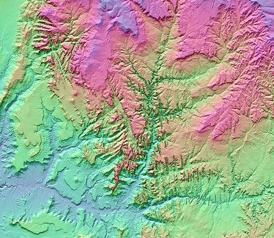
MPC supports digital elevation model data (a DEM-derived image of Zion National Park is used above), routing and restrictions, FM traffic support, speed limit display and more. Of course the devil is in the details…
Contact us to see if you qualify* for a free 90-day trial of MapSource Product Creator. You’ll receive a fully functional version of the MPC software and a three-month license. After your trial period, simply pay the first $5,000 of license fees to continue using the program.
*Evaluation and licensing of Garmin’s MapSource Creator Product is subject to approval.
Could this be a way for Garmin to reclaim the commercial development territory siphoned off by cGPSmapper? Will high licensing fees eliminate the possibility of trail maps? Okay digital cartographers, spill the beans; what do you think about all this?

Garmin has offered SDKs for map creation before; don’t remember the exact price, but it wasn’t too far away from what they’re asking for this one. For professionals and people with money to burn, this might be a good option, especially for those features that free Garmin map programs don’t support (like DEMs and traffic). I also understand that recent Garmin updates broke the data locking capabilities of cgpsmapper, so this is the only option for locked data for now.
But the price is way too steep for everybody else, even if it winds up being easier to use. Be nice if Garmin could introduce a limited version for non-commercial use.
Yeah, I wasn’t sure what third-party map providers used before, so thanks for filling in with the SDK tidbit. Here’s some third-party maps on their site, in case anyone is interested…
http://www.garmin.com/garmin/cms/site/us/maps/mpcpage/
I know that some Garmin international units were selling maps created with cgpsmapper and other tools, but I don’t know how many of the ones on your link (if any) were created that way.
BTW, major props to Garmin to not trying to suppress custom Garmin maps by making them incompatible with newer units (unlike Magellan, which worked hard to suppress compatibility and make it difficult to create custom maps for their units). Ten years ago, Garmin and Magellan were neck-and-neck, and today Magellan is an also-ran. Custom maps may not have been the deciding factor, but they probably helped (and certainly didn’t hurt).
I think its probably way too expensive especially since most of the maps are free maps. I would have to sell a lot of maps at a rather high price to make the money back esp since its not a one time $5k fee
Sure does seem like a high entry point, that’s for sure. Good to see you here Dan. Love your site (as do many people).
I recently had a computer crash so bad (fried motherboard) that I had to purchased a new computer for my digital darkroom. I had a free, very user friendly, simple computer based program that allowed me to do straight line point to point track which would be converted into a real track that could then be loaded into my Garmin nivu 1300. Well that was lost with the old computer, couldn’t recover from hard drives. I can’t remember the name of the program or the site I got it from. Any help would much appreciated.
Pete
Mmm, could it be http://www.mapwel.eu/ or http://mobac.dnsalias.org/?
Nope not those. I think I may have gotten the link to the program from an article about Geo-Caching. I have looked at all the biggies MSM, Google, Yahoo and none of those look like what I had. Thanks for your help.
Pete
I just downloaded the 90-day trial. I am really new to creating maps and have difficult understanding all the map files needed to create the final map that i can upload to my Garmin ( I am using Garmin Nuvi 1370). I live a small island in the middle of the pacific ocean and there are not accurate maps that i can navigate with. I want to create a navigation map and let other residents and tourist have the opportunity to get to their destination with the most POI’s on the device. However, i am having trouble even creating a shapefile and understanding how to make this possible, i checked the help section on the MPC and still trying to figure out what all the files like BIL (building DEM data) needed to create the map means and other files as well? Can someone guide me through the process? I will be so grateful. I noticed last post was in 2010 as now it’s 2013 but hoping and looking forward to a reply.
Sincerely,
Lirone Veksler
I’d suggest asking on the forums at http://gpsfiledepot.com.