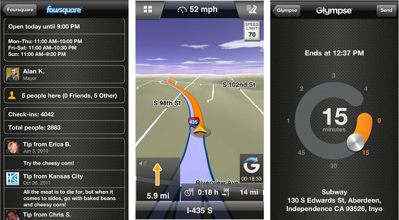
Waypoints is a weekly link roundup of (mostly) GPS related odds and ends. To get a few of the biggest stories as they break, follow me on Twitter. This week’s lead image is from an updated version of one of the Garmin navigation apps that now offer Glympse and Foursquare integration.
Tracking Santa
- Google Santa Tracker
- And a Google Santa Tracker Android app
- Santa GPS 2.0 for iPad
- Santa tracking as a proxy battle for Google v Microsoft
Garmin
- Garmin co-founder Min Kao steps down from CEO role
- GPS City calls the Garmin Montana the all-in-one GPS of 2012
- OSM maps for fenix watch
- Garmin Tempe Sensor low temperature limit a battery limitation; stores data on board?
- Fighting crime with the Garmin Astro
- Video: Garmin Topo Canada vs. Backroad GPS Maps
My GPS made me do it
- Wrong way leads to fatal crash; via Pocket GPS World
- And another driving the wrong way incident, thankfully without a fatality
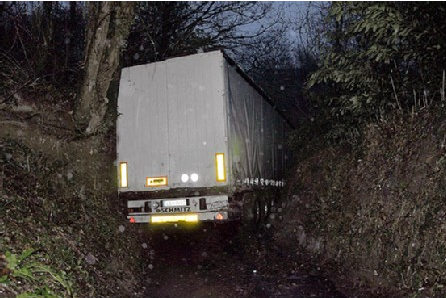
- Trucker edition (picture below); via Pocket GPS World
GPS Maps
- Ontario trails map for your GPS
- This article says the Michigan DNR has made their snowmobile maps “downloadable right onto your GPS” but I can’t find anything but PDFs on their site
GPS in the news
- Latest Skill Required for Municipal GIS Managers: Reporting GPS map errors
Going mobile
- Google Maps iPhone power user tips
- Facebook Nearby for iOS and Android
- Coming to soon to Garmin US? iPhone 5 Designer Car Kit
- Google Maps for iPhone App Review
- An Android voice command app for navigation
- Trapster for Android and iOS updated; traffic jam reporting added
- Twist for Android uses GPS to tell your friends you’ll be late
- ViewRanger Outdoors Android app review
The business of GPS
Updates
- ExpertGPS v 4.67
- c:geo v 2012.12.18 for Android
- Magellan Switch series
- More updates this week: Garmin dezl 560, nuvi 30, 40, 50, 24xx, Magellan VantagePoint
Geocaching
- Could Groundspeak incorporate these into their geocaching app as an alternative to Garmin’s Chirp? Via @cachemania
- Geocaching license tags
- Geocaching.com Face Lift
- Geocaching cop uses hobby to rescue hiker:
GPS tracking
- Senator Wants to Keep Women’s GPS Data Away From Stalkers
- After losing GPS-tracking case at high court, FBI goes after warrantless cell-site location data
- Life of Trash (tracking map); via Fast Company
- Frackers Use GPS to Save on Compliance
- GPS assists organ transplant
- GPS Helps Police Arrest Suspect in Cab Driver Stabbing
- Family Location Tracker Life360 Set to Reach 25 Million Users
- SPOT provider Globalstar to launch six satellites
Just geo
- Mount Everest, in two billion pixels; via @stefangeens
- Average Incomes on Google Maps; via Google Maps Mania
- Pinterest: Mapping 19th Century America
- Atlantic Cities 2012 – The year in maps
- Google Maps of the Year parts one and two
- Pronounce Wisconsin Map; via All Points Blog
- Mapping Drug Use in Minnesota
- The Basement Geographer: English Exonyms vs. Native Endonyms
All the news that doesn’t fit
- New Hampshire proposes rescue fees, regardless of negligence; via Meanderthals
- Cellphone, GPS data suggest new strategy for alleviating traffic tie-ups (some people just shouldn’t drive)
- Reverse geocache based on STM32 and busted GPS wristwatch
- How to fix heart rate strap dropouts/spikes
- The Biggest, Baddest Swiss Army Knife Ever
; via Adventure Journal
GPS deals
- Through 12/24: Free SPOT 2 satellite messenger (with activation)
These are some bargains we’re currently tracking in our GPS deals section:
- TomTom VIA 1505TM for $105.99 with free shipping
- Garmin Oregon 450 for $199.95 with free shipping
- UPDATED: Last holiday GPS deal roundup
- Deals from Garmin’s own eBay store
- SPOT Connect Satellite Communicator for $99.95 after rebate
- DeLorme inReach for $174.95 after $75 rebate
Updated GPS reviews
I’ve updated these review and resource pages with the following links:


The MI DNR has text file links embedded in their PDF files that you can then convert to tracklogs and load into your GPS. I would describe it as not an easy process.
Note I sell commercial GPS Maps, including MI Snowmobile GPS Maps, based on trail data I make while riding, so I may be a bit biased.
Wow! Thanks for letting us know.